
The following is a list of major roads in Montreal , Quebec, Canada.
The following is a list of major roads in Montreal , Quebec, Canada.

Nuns' Island is an island located in the Saint Lawrence River that forms a part of the city of Montreal, Quebec. It is part of the borough of Verdun.

Langelier station is a Montreal Metro station in the borough of Mercier–Hochelaga-Maisonneuve in Montreal, Quebec, Canada. It is operated by the Société de transport de Montréal (STM) and serves the Green Line. It is in the district of Mercier-Ouest. The station opened on June 6, 1976, as part of the extension of the Green Line to Honoré-Beaugrand station.

Mercier–Hochelaga-Maisonneuve is a borough of Montreal, Quebec, Canada located in the southeastern end of the island.

Le Sud-Ouest is a borough (arrondissement) of the city of Montreal, Quebec, Canada.
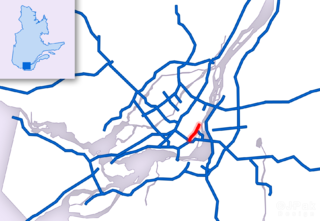
Route 136 (R-136), formerly Autoroute 720, known as the Ville-Marie Expressway (English) or Autoroute Ville-Marie (French) is an Autoroute highway in the Canadian province of Quebec that is a spur route of Autoroute 20 in Montreal. Its western terminus is located at the Turcot Interchange, a junction with Autoroute 15 and Autoroute 20, and its eastern terminus is near the Jacques Cartier Bridge, where the highway merges with Notre-Dame Street. The Autoroute Ville-Marie designation is named after the downtown borough of Ville-Marie, through which the expressway is routed. It was designated Autoroute 720 until 2021 when it was renamed to Route 136.

Sainte-Catherine Street is the primary commercial artery of Downtown Montreal, Quebec, Canada. It crosses the central business district from west to east; beginning at the corner of Claremont Avenue and de Maisonneuve Boulevard in Westmount, and ending at the Grace Dart Extended Care Centre by Cadillac metro station. It also traverses Ville-Marie, passing just east of Viau in Mercier–Hochelaga-Maisonneuve. The street is 11.2 km long, and considered the backbone of Downtown Montreal.

Saint Denis Street is a major north–south thoroughfare in Montreal, Quebec.
Rue Saint-Louis is a main street in Gatineau, Quebec, Canada, that runs mostly along the north and east side of the Gatineau River in the old city of Gatineau. It starts at the boundaries of the city of Gatineau and the suburban town of Cantley, Quebec and ends at Boulevard Maloney. On its northern end until Autoroute 50, it runs parallel to the Gatineau River, while it briefly runs parallel to the Ottawa River on its eastern end.

Mascouche is a commuter railway line in Greater Montreal, Quebec, Canada. It is operated by Exo, the organization that operates public transport services across this region.

Mile End is a neighbourhood and municipal electoral district in the city of Montreal, Quebec, Canada. It is part of the Plateau-Mont-Royal borough in terms of Montreal's municipal politics.
The Montreal Public Libraries Network is the public library system on the Island of Montreal in Quebec, Canada. It is the largest French language public library system in North America, and also has items in English and other languages. Its central branch closed in March 2005 and its collections incorporated into the collections of the Grande Bibliothèque.

The Service de sécurité incendie de Montréal is responsible for fire and rescue operations in Montreal, Quebec, Canada. EMS first-response has been available in limited areas since 1976 and to the entire service area since 2009. The SIM is the 7th largest fire department in North America. The department offers high-angle rescue, collapse rescue, hazmat response, ice rescue and nautical rescue.

Mercier denotes the eastern portion of the Mercier–Hochelaga-Maisonneuve borough of the city of Montreal, Quebec. It consists of two neighbourhoods Mercier-Ouest (Longue-Pointe) and Mercier-Est (Tétreaultville).

The Centre-Sud is a neighbourhood located in the easternmost edge of the Ville-Marie borough of the city of Montreal.
Jean Talon Street is one of the longest streets on the Island of Montreal. It runs from Decarie Boulevard in the west through Anjou in the east to Galeries d'Anjou. Jean Talon was the first Intendant of New France. In the Town of Mount Royal, it is called Dresden Avenue. In the Montreal Borough of Saint Leonard, it is colloquially known as Via Italia.

Côte-Saint-Paul is a neighbourhood located in the Southwest Borough of Montreal, Quebec, Canada.

La Petite-Patrie is a neighbourhood of Montreal, Quebec, Canada. It is located in the borough of Rosemont–La Petite-Patrie.
Langelier Boulevard is a north-south artery of Montreal.
Lacordaire Boulevard is a north-south thoroughfare located in Montreal.
