Listed buildings in Aspull

Last updated

Aspull is a village in the Metropolitan Borough of Wigan, Greater Manchester, England. The village and the surrounding countryside contain 21 listed buildings that are recorded in the National Heritage List for England. Of these, one is listed at Grade II*, the middle of the three grades, and the others are at Grade II, the lowest grade.

Aspull village in United Kingdom

Aspull is a village in the Metropolitan Borough of Wigan, in Greater Manchester, England. Historically in Lancashire, Aspull, along with Haigh, is surrounded by greenbelt and agricultural land, separated from Westhoughton, on its southeast side, by a brook running through Borsdane Wood. The ground rises from south to north, reaching 400 feet (122 m), and has views towards Winter Hill and the West Pennine Moors. It has a population of 4,977.

Metropolitan Borough of Wigan Metropolitan borough in England

The Metropolitan Borough of Wigan is a metropolitan borough of Greater Manchester, in North West England. It is named after its largest component town and former county borough, Wigan and includes the towns and villages of Leigh, part of Ashton-in-Makerfield, Ince-in-Makerfield, Hindley, Orrell, Standish, Atherton, Tyldesley, Golborne, Lowton, Billinge, Astley, Haigh and Aspull. The borough was formed in 1974 and is an amalgamation of several former local government districts and parishes. The borough has three civil parishes and lies directly to the west of the City of Salford and southwest of the Metropolitan Borough of Bolton. The local authority is Wigan Metropolitan Borough Council.

Greater Manchester County of England

Greater Manchester is a metropolitan county in North West England, with a population of 2.8 million. It encompasses one of the largest metropolitan areas in the United Kingdom and comprises ten metropolitan boroughs: Bolton, Bury, Oldham, Rochdale, Stockport, Tameside, Trafford, Wigan, and the cities of Manchester and Salford. Greater Manchester was created on 1 April 1974 as a result of the Local Government Act 1972; and designated a functional city region on 1 April 2011.

Contents

There has been coal mining in the area from the 16th century, but that has ceased and the area is now rural and residential. [1] The oldest listed buildings are houses, farmhouses and farm buildings. The only surviving listed buildings from the coal mining era are a row of miners' cottages and a ventilation chimney. The Leeds and Liverpool Canal passes through the area, and the listed buildings associated with this are bridges and a flight of locks, and a lock keeper's cottage. Also listed is a church.

Leeds and Liverpool Canal

The Leeds and Liverpool Canal is a canal in Northern England, linking the cities of Leeds and Liverpool.

Key

Map all coordinates using: OpenStreetMap  ·  Google Maps
Download coordinates as: KML  ·  GPX
GradeCriteria [2]
II*Particularly important buildings of more than special interest
IIBuildings of national importance and special interest


Buildings

Name and locationPhotographDateNotesGrade
Kirkless Hall and Kirkless Hall Farmhouse
53°33′09″N2°36′00″W / 53.55239°N 2.60008°W / 53.55239; -2.60008 (Kirkless Hall and Farmhouse)
Kirkless Hall, Ince, Wigan.JPG
Late 15th centuryOriginally one house, later divided into two, it is basically cruck and timber framed, with later alterations and extensions. The house is in brick with stone dressings and a slate roof. There are two storeys with attics, and seven bays, the second and fifth bays projecting and gabled. The first four bays have a stone plinth, the first bay has quoins, the fifth bay is rendered and painted to resemble timber framing. The windows are sashes, some with wedge lintels, and others with brick cambered arches. [3] [4] II*
Barn, Gidlow Hall
53°33′30″N2°34′07″W / 53.55838°N 2.56853°W / 53.55838; -2.56853 (Barn, Gidlow Hall)
16th century (possible)The barn has been converted for residential use. It is in brick on a stone plinth, and has a roof of slate at the front and stone-slate at the rear. It has five bays, with a later adjoining outbuilding. [5] [6] II
Gidlow Hall
53°33′32″N2°34′04″W / 53.55883°N 2.56780°W / 53.55883; -2.56780 (Gidlow Hall)
1574A farmhouse on a moated site that was reduced in size and partly rebuilt in 1840. It is in stone with quoins, and has two storeys, two bays, and a later brick outshut at the rear. The windows on the front are small-paned casements, and elsewhere are mullioned windows. Above the doorway is a fanlight and a lintel with an armorial crest. At the rear is a bay with a coped gable. [7] [8] II
Ainscow's Farmhouse
53°33′47″N2°34′25″W / 53.56293°N 2.57367°W / 53.56293; -2.57367 (Ainscow's Farmhouse)
Ainscow's Farmhouse, Aspull.jpg
17th centuryThe farmhouse, which was later extended, is in brick on a stone plinth with stone dressings, quoins, and a stone-slate roof. There are two storeys and four bays, the later first bay is recessed and lower, the others bays are gabled, and the third bay projects. The windows are casements, and some are mullioned. [9] II
Barn, Pennington Hall
53°33′16″N2°34′22″W / 53.55437°N 2.57284°W / 53.55437; -2.57284 (Barn, Pennington Hall)
17th century (probable)The upper part of the barn was rebuilt in the 18th century. It is in brick with buttresses, some quoins, and a stone-slate roof. The barn contains elliptical-headed openings and ventilation holes in diamond patterns. There are lean-tos on the right and at the rear. [5] [10] II
Wall, Pennington Hall
53°33′15″N2°34′23″W / 53.55422°N 2.57316°W / 53.55422; -2.57316 (Wall, Pennington Hall)
17th centuryThe wall encloses the garden in front of the hall. It is in brick with stone coping, moulded on the top. [11] II
Pennington Hall
53°33′16″N2°34′23″W / 53.55438°N 2.57317°W / 53.55438; -2.57317 (Pennington Hall)
Pennington Hall Farmhouse (geograph 5693332).jpg
1653The house was later extended. It is in brick with diapering and a stone-slate roof. There are two storeys and four bays, the first and third bays projecting and gabled. The windows are mullioned with hood moulds, and the date is spelt out in brick in the first bay. [5] [12] II
Bark Hill Farmhouse and barn
53°33′40″N2°35′56″W / 53.56119°N 2.59900°W / 53.56119; -2.59900 (Bark Hill Farmhouse)
Bark Hill Farmhouse, Aspull - geograph.org.uk - 1045340.jpg
1700The farmhouse and barn are in stone with roofs of slate and stone-slate. The farmhouse has two storeys and two bays, the right bay higher and projecting, and the windows are casements. The barn to the left has four bays, and contains windows, doorways and pitching holes. In the fourth bay is an elliptical hole, and in the left return are two owl holes. [13] [14] II
Colliers Arms Public House
53°33′40″N2°35′55″W / 53.56124°N 2.59868°W / 53.56124; -2.59868 (Colliers Arms Public House)
The Colliers Arms, Wigan Road, Aspull - geograph.org.uk - 1045330.jpg
1700The public house is stuccoed and has applied timber framing and a slate roof. There are three storeys and two bays, and above the central doorway is a datestone. On the front, the windows in the lower two floors are 20th century casements, and in the top floor they are mullioned. At the rear is a stair window that is sashed, and the other windows are mullioned. [13] [15] II
Higher Highfield
53°34′29″N2°35′33″W / 53.57461°N 2.59253°W / 53.57461; -2.59253 (Higher Highfield)
Higher Highfield, Aspull.jpg
1714A brick farmhouse, partly rendered, on a stone plinth, with a band and a stone-slate roof. There are two storeys and three bays, the first bay projecting and gabled. The windows are casements with plain lintels, and there is a datestone in the third bay. [16] II
Hilton's Farm and outbuildings
53°34′05″N2°35′34″W / 53.56818°N 2.59279°W / 53.56818; -2.59279 (Hilton's Farm)
Hilton's Farm, Aspull.jpg
c. 1730The outbuildings originated as workers' cottages in about 1830. They and the farmhouse are in sandstone and brick, and all are rendered with roofs of stone slabs. The farmhouse has three bays and a doorway with a moulded surround and a shaped keystone. Most of the windows are casements, some of which have keystones, and there is one small horizontally-sliding sash window. The cottages have been converted for other uses. [17] II
Marsh Farmhouse
53°33′16″N2°34′59″W / 53.55445°N 2.58308°W / 53.55445; -2.58308 (Marsh Farmhouse)
Mid 18th centuryA brick farmhouse on a chamfered stone plinth with bands and a stone-slate roof. There are two storeys and two bays. The windows and doorway have cambered brick arches; the windows are 20th-century casements. To the right is a barn extension with ventilation holes. [18] II
Barn, Marsh Farm
53°33′17″N2°34′58″W / 53.55461°N 2.58281°W / 53.55461; -2.58281 (Barn, Marsh Farm)
18th century (probable)The barn is in stone with a stone-slate roof, and has three bays. It contains large entrance doors, ventilation holes, and a pitching hole. [19] II
Walker's Higher Farmhouse
53°34′18″N2°34′48″W / 53.57165°N 2.58004°W / 53.57165; -2.58004 (Walker's Higher Farmhouse)
Walker's Higher Farmhouse.jpg
1755A brick farmhouse on a stone plinth, with quoins and a stone-slate roof. There are three storeys and a symmetrical front of three bays. The windows are small-pane casements with wedge lintels and keystones. The central doorway has a fanlight and a wedge lintel, and above the middle window in the first floor is a round datestone in the form of a rococo cartouche. [20] [21] II
Hindley Hall
53°32′54″N2°34′46″W / 53.54833°N 2.57954°W / 53.54833; -2.57954 (Hindley Hall)
Hindley Hall.jpg
1767 (Possible)The house was largely rebuilt in 1811, and has since been used as a golf clubhouse. It is in brick on a stone plinth, with stone dressings, quoins, bands, a top cornice and a parapet. The house is in Georgian style, with three storeys and seven bays, a later extension of two storeys and two bays, and a small service wing at the rear. The doorway has pilasters and an entablature, and the windows are sashes with wedge lintels. [5] [22] II
Dukes Row
53°33′59″N2°35′34″W / 53.56630°N 2.59281°W / 53.56630; -2.59281 (Dukes Row)
Duke's Row, Aspull.jpg
Late 18th centuryA terrace of 16 workers' houses in stone that have a tiled roof with coped gables. They have two storeys, and most houses have one bay. The doorways and windows have plain surrounds, and the windows are 20th century two-light casements. [23] [24] II
Lock Keeper's Cottage and wall
53°33′22″N2°35′36″W / 53.55615°N 2.59330°W / 53.55615; -2.59330 (Lock Keeper's Cottage)
Top Lock Cottage, Aspull.jpg
Late 18th or early 19th centuryThe cottage is adjacent to the top lock of the Wigan Flight on the Leeds and Liverpool Canal. It is in stone with a slate roof, two storeys, two bays, and a lean-to extension to the right. The windows and doorways have plain surrounds, and the windows are sashes. In front of the cottage is a garden wall with coping. [13] [25] II
Two bridges and flight of 13 locks
53°33′05″N2°36′04″W / 53.55128°N 2.60098°W / 53.55128; -2.60098 (Two bridges and flight of 13 locks)
Down the Wigan Flight-04 - geograph.org.uk - 852597.jpg
1816The bridges and locks are on the Leeds and Liverpool Canal. Bridge No. 57 is in stone with an elliptical arch, rusticated voussoirs and keystones, bands, parapets, and end piers. The arch of bridge No. 58 has been replaced by concrete beams. The locks are numbers 1 to 13 on the Wigan flight of locks. They are in stone and have gates in timber or iron. [26] [27] II
Monk Hall Bridge
53°33′21″N2°35′30″W / 53.55588°N 2.59174°W / 53.55588; -2.59174 (Monk Hall Bridge)
Monk Hall Bridge, Aspull.jpg
Early to mid 19th centuryBridge No. 59, carrying Withington Lane over an arm of the Leeds and Liverpool Canal. It is in stone, and consists of a single semi-elliptical arch. The bridge has rusticated voussoirs and keystones, a string course along the base of the parapet, and swept wings ending in piers. [28] II
Wall Hey Pit Furnace Ventilation Chimney
53°34′27″N2°35′25″W / 53.57406°N 2.59036°W / 53.57406; -2.59036 (Wall Hey Pit Furnace Ventilation Chimney)
Pit vent tower, Aspull - geograph.org.uk - 924703.jpg
1840The chimney is in brick and is square, with clasping pilasters at the corners. At the apex is a drip mould and a staggered cornice. The cap is missing, and the openings have been blocked. [1] [29] II
St Elizabeth's Church
53°33′48″N2°34′30″W / 53.56338°N 2.57492°W / 53.56338; -2.57492 (St Elizabeth's Church)
St Elizabeth, Aspull.jpg
1876The church was designed by J. Medland and Henry Taylor, and is built in common brick with dressings in red brick and stone, and has a slate roof. It consists of a nave and chancel win a single vessel with a clerestory, a west baptistry, a south aisles, and a south organ loft. At the junction of the nave and the chancel is a small octagonal bellcote with a spirelet. Most of the windows are lancets, and in the west end is a wheel window. [30] [31] II

Related Research Articles

Gidlow Hall is a scheduled ancient monument dating from 1574 in Aspull village, in Wigan, Greater Manchester. The great hall was the residence of the Gidlow family, whose members included Robert de Gidlow, freeholder of Aspull in 1291. Members of the family were recorded in the village until the 17th century. The hall, now situated amongst more modern farmhouses, is no longer surrounded by a moat. Although the building dates from 1574, the eastern extent and a porch was demolished in 1840. Parts of the hall which date from its original construction include masonry on the south front and east wall, a fireplace and a stair-tower at the rear. There is evidence of a previous screens passage.

Liverpool is a city and port in Merseyside, England, which contains many listed buildings. A listed building is a structure designated by English Heritage of being of architectural and/or of historical importance and, as such, is included in the National Heritage List for England. There are three grades of listing, according to the degree of importance of the structure. Grade I includes those buildings that are of "exceptional interest, sometimes considered to be internationally important"; the buildings in Grade II* are "particularly important buildings of more than special interest"; and those in Grade II are "nationally important and of special interest". Very few buildings are included in Grade I — only 2.5% of the total. Grade II* buildings represent 5.5% of the total, while the great majority, 92%, are included in Grade II.

Grappenhall and Thelwall is a civil parish in the borough of Warrington and the ceremonial county of Cheshire, England, and includes the villages of Grappenhall and Thelwall. The Bridgewater Canal and the A56 road pass through Grappenhall and to the south of Thelwall in an east-west direction, and the A50 road runs in a north-south direction between them. Within the parish are 30 buildings that are recorded in the National Heritage List for England as designated listed buildings. Of these, one is listed at Grade I, the highest of the three grades, and the other 28 at Grade II, the lowest grade. The Grade I listed building is a church dating back to the 12th century. The Grade II listed buildings comprise a variety of structures, including another church, houses, aqueducts, bridges, a public house, farm buildings, stocks, a sundial, a milepost, a mounting block, a war memorial, and a telephone kiosk.

Billinge Chapel End is a civil parish in St Helens, Merseyside, England. It contains 13 buildings that are recorded in the National Heritage List for England as designated listed buildings. Of these, two are listed at Grade II*, the middle of the three grades, and the others are at Grade II, the lowest grade. The parish contains the village of Billinge and surrounding countryside. The listed buildings consist of houses, farmhouses, farm buildings, and two churches with associated structures.

Lydiate is a civil parish and a village in Sefton, Merseyside, England. It contains 14 buildings that are recorded in the National Heritage List for England as designated listed buildings. Of these, two are listed at Grade II*, the middle of the three grades, and the others are at Grade II, the lowest grade.

Aughton is a civil parish in the West Lancashire district of Lancashire, England. It contains 15 buildings that are recorded in the National Heritage List for England as designated listed buildings. Of these, one is listed at Grade I, the highest of the three grades, one is at Grade II*, the middle grade, and the others are at Grade II, the lowest grade. The parish is partly residential, and partly rural. The listed buildings consist of churches, houses, farmhouses and farm buildings, two cross bases, boundary stones, and a war memorial.

Burscough is a civil parish in the West Lancashire district of Lancashire, England. It contains 38 buildings that are recorded in the National Heritage List for England as designated listed buildings. Of these, two are at Grade II*, the middle grade, and the others are at Grade II, the lowest grade. The parish contains the large village of Burscough, the rural hamlet of Tarlscough, and the surrounding countryside. Passing through the parish is the Leeds and Liverpool Canal, and the junction between the canal and its Rufford Branch is in the parish. Also passing through the parish are the railways of the Ormskirk - Preston and the Manchester-Southport Lines, which cross in the parish. The oldest listed buildings are farmhouses and farm buildings, and houses and cottages. Associated with the canal are the structures at the junction, bridges and a lock. Associated with the railways are station buildings and a bridge. The other listed buildings include churches, a war memorial, and a former mill and its offices.

Dalton is a civil parish in the West Lancashire district of Lancashire, England. It contains ten buildings that are recorded in the National Heritage List for England as designated listed buildings. Of these, one is at Grade II*, the middle grade, and the others are at Grade II, the lowest grade. The parish contains the village of Dalton, and is otherwise rural. Most of the listed buildings are farmhouses, or houses and associated structures, the others being a church, and a landmark in the form of a beacon.

Lathom is a civil parish in the West Lancashire district of Lancashire, England. It contains 49 buildings that are recorded in the National Heritage List for England as designated listed buildings. Of these, one is at Grade II*, the middle grade, and the others are at Grade II, the lowest grade. The parish contains the village of Lathom, and is otherwise rural. The most important building in the parish is Latham House, but most of this has been demolished, leaving only part of one wing. This is listed, together with structures associated with it. The Leeds and Liverpool Canal and its Rufford branch run through the parish, and the associated listed structures include culverts, locks and bridges. There are also three former railway level crossing keeper's cottages built for the Manchester and Southport Railway. Because of its rural nature, many of the listed buildings are farmhouses and farm buildings. The other listed buildings include a chapel, almshouses, other bridges, houses and associated structures, lodges, a war memorial, and a school.

Newburgh is a civil parish in the West Lancashire district of Lancashire, England. It contains 37 buildings that are recorded in the National Heritage List for England as designated listed buildings. Of these, one is at Grade II*, the middle grade, and the others are at Grade II, the lowest grade. The parish contains the village of Newburgh and surrounding countryside. Most of the listed buildings are houses, farmhouses and farm buildings. The Leeds and Liverpool Canal and the River Douglas run through the parish, and associated with these are aqueducts and a culvert. The other listed buildings include a village cross, a public house, a post office, a war memorial, and a telephone kiosk.

Skelmersdale is a town in the West Lancashire district of Lancashire, England. It contains 21 listed buildings that are recorded in the National Heritage List for England. All the listed buildings are designated at Grade II, the lowest of the three grades, which is applied to "buildings of national importance and special interest". Originally it was an agricultural community, and later was associated with coal mining. Sine the 1960s most of the area has been occupied by a New Town. Almost all the listed buildings are, or originated as, farmhouses or farm buildings. The other listed buildings are a cottage, a church, and a war memorial.

Up Holland is a civil parish in the West Lancashire district of Lancashire, England. It contains 97 buildings that are recorded in the National Heritage List for England as designated listed buildings. Of these, one is listed at Grade I, the highest of the three grades, four are at Grade II*, the middle grade, and the others are at Grade II, the lowest grade. The parish contains the village of Up Holland and surrounding countryside. The oldest surviving structure in the parish is Up Holland Priory, the chancel of which was converted into the nave of the Church of St Thomas the Martyr; both of these are listed. Most of the other listed buildings are houses, cottages and associated structures, and buildings that are farmhouses and farm buildings. The Liverpool and Bury Railway Company built a railway through the parish and, associated with this and listed, are two bridges and two tunnel portals. The other listed buildings include public houses, more churches, a former windmill, schools and colleges, a war memorial and a telephone kiosk.

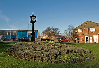
Shevington is a civil parish in the Metropolitan Borough of Wigan, Greater Manchester, England. The parish contains eight listed buildings that are recorded in the National Heritage List for England. All the listed buildings are designated at Grade II, the lowest of the three grades, which is applied to "buildings of national importance and special interest". The parish contains the villages of Shevington and Gathurst and the surrounding countryside. The Leeds and Liverpool Canal passes through the parish, and the listed buildings associated with is are a bridge, locks, and a lock-keeper's cottage. The other listed buildings are a farmhouse, farm buildings, a public house with a mounting block, and a school and master's house.

Worthington is a civil parish in the Metropolitan Borough of Wigan, Greater Manchester, England. It contains three listed buildings that are recorded in the National Heritage List for England. Of these, two are listed at Grade II*, the middle grade, and the other is at Grade II, the lowest grade. The parish is rural with no significant settlement, and the listed buildings are all houses.

Ashton-in-Makerfield is a town in the Metropolitan Borough of Wigan, Greater Manchester, England. It contains ten listed buildings that are recorded in the National Heritage List for England. All the listed buildings are designated at Grade II, the lowest of the three grades, which is applied to "buildings of national importance and special interest". Industry, including coal mining, came to the town in the 19th century, but it is now mainly residential. The older listed buildings consist of farmhouses, a farm building, a chapel and a milestone, and the later ones are churches and associated structures, and a library.

Atherton is a town in the Metropolitan Borough of Wigan, Greater Manchester, England. The town and its suburbs of Howe Bridge and Hindsford contain 17 listed buildings that are recorded in the National Heritage List for England. Of these, four are listed at Grade II*, the middle of the three grades, and the others are at Grade II, the lowest grade.

Billinge and Winstanley is an area in the Metropolitan Borough of Wigan, Greater Manchester, England. The area, which consists of small settlements and surrounding countryside, includes eleven listed buildings that are recorded in the National Heritage List for England. Of these, three are listed at Grade II*, the middle of the three grades, and the others are at Grade II, the lowest grade. Most of the listed buildings are houses and associated structures, the others being monuments and a set of stocks.

Ince-in-Makerfield is a town in the Metropolitan Borough of Wigan, Greater Manchester, England. The town and the surrounding area contains eight listed buildings that are recorded in the National Heritage List for England. All the listed buildings are designated at Grade II, the lowest of the three grades, which is applied to "buildings of national importance and special interest".

Orrell is an area in the Metropolitan Borough of Wigan, Greater Manchester, England. It contains 14 listed buildings that are recorded in the National Heritage List for England. Of these, one is listed at Grade II*, the middle of the three grades, and the others are at Grade II, the lowest grade. The area is largely rural, and most of the listed buildings are houses and associated structures. The other listed buildings include a stone post, a farmhouse, a church and a public house.

Standish is a town in the Metropolitan Borough of Wigan, Greater Manchester, England. It contains 22 listed buildings that are recorded in the National Heritage List for England. Of these, one is listed at Grade I, the highest of the three grades, two are at Grade II*, the middle grade, and the others are at Grade II, the lowest grade. The town and the surrounding countryside contain a variety of listed buildings, including three medieval cross bases, a village cross and stocks, houses, a church and associated structures, farmhouses, three mileposts, a drinking fountain, and two war memorials.

References

Citations

Sources

Historic England Executive non-departmental public body of the British Government, tasked with protecting the historical environment of England

Historic England is an executive non-departmental public body of the British Government sponsored by the Department for Culture, Media and Sport (DCMS). It is tasked with protecting the historical environment of England by preserving and listing historic buildings, ancient monuments and advising central and local government.

The National Heritage List for England (NHLE) is England’s official list of buildings, monuments, parks and gardens, wrecks, battlefields and World Heritage Sites. It is maintained by Historic England and brings together these different designations as a single resource even though they vary in the type of legal protection afforded to each. Conservation areas do not appear on the NHLE since they are designated by the relevant local planning authority.

Nikolaus Pevsner German-born British scholar

Sir Nikolaus Bernhard Leon Pevsner was a German, later British scholar of the history of art, especially of architecture.