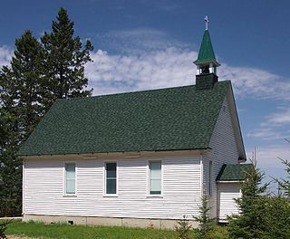
Loerch | |
---|---|
Coordinates: 46°24′12″N94°04′21″W / 46.40333°N 94.07250°W Coordinates: 46°24′12″N94°04′21″W / 46.40333°N 94.07250°W | |
Country | United States |
State | Minnesota |
County | Crow Wing |
Township | Oak Lawn Township |
Elevation | 1,240 ft (380 m) |
Time zone | UTC-6 (Central (CST)) |
• Summer (DST) | UTC-5 (CDT) |
ZIP code | 56401 |
Area code(s) | 218 |
GNIS feature ID | 654803 [1] |
Loerch is an unincorporated community in Oak Lawn Township, Crow Wing County, Minnesota, United States, near Brainerd. It is along Loerch Road near Dullum Road.
In law, an unincorporated area is a region of land that is not governed by a local municipal corporation; similarly an unincorporated community is a settlement that is not governed by its own local municipal corporation, but rather is administered as part of larger administrative divisions, such as a township, parish, borough, county, city, canton, state, province or country. Occasionally, municipalities dissolve or disincorporate, which may happen if they become fiscally insolvent, and services become the responsibility of a higher administration. Widespread unincorporated communities and areas are a distinguishing feature of the United States and Canada. In most other countries of the world, there are either no unincorporated areas at all, or these are very rare; typically remote, outlying, sparsely populated or uninhabited areas.
Oak Lawn Township is a township in Crow Wing County, Minnesota, United States. The population was 1,793 at the 2000 census.
Crow Wing County is a county in the U.S. state of Minnesota. As of the 2010 United States Census, the population was 62,500. Its county seat is Brainerd. The county was formed in 1857, and was organized in 1870.
Collegeville is an unincorporated community in St. Wendel Township, Stearns County, Minnesota, United States, near St. Joseph. The community is located near the junction of Collegeville Road and Old Collegeville Road. Nearby is Saint John's Abbey, a large Benedictine monastery. Stearns County Road 159 serves as a main route for the community. Interstate 94 is nearby.
Markham is an unincorporated community in Colvin Township, Saint Louis County, Minnesota, United States.
Kelsey is an unincorporated community in Kelsey Township, Saint Louis County, Minnesota, United States.
Bassett is an unincorporated community in Bassett Township, Saint Louis County, Minnesota, United States located within the Superior National Forest.
Shaw is an unincorporated community in Saint Louis County, Minnesota, United States; located on Saint Louis County Road 15, near Saint Louis County Road 49.
Toivola is an unincorporated community in Toivola Township, Saint Louis County, Minnesota, United States.
Wolf is an unincorporated community in Clinton Township, Saint Louis County, Minnesota, United States.
Elmer is an unincorporated community in Elmer Township, Saint Louis County, Minnesota, United States. The community is located near Meadowlands at the intersection of County Road 199 and County Road 193.
Vermilion Dam is an unincorporated community in Saint Louis County, Minnesota, United States.
Florenton is an unincorporated community in Wuori Township, Saint Louis County, Minnesota, United States; located near Britt.
Keenan is an unincorporated community in Clinton Township, Saint Louis County, Minnesota, United States.
Four Corners is an unincorporated community in Saint Louis County, Minnesota, United States; located 10 miles northwest of the city of Duluth at the junction of U.S. Highway 53 and Saint Louis County Road 13.
Fermoy is an abandoned townsite in McDavitt Township, Saint Louis County, Minnesota, United States. It was located near the communities of Sax and Kelsey. Fermoy was near the intersection of Kolu Road, Cranberry Lane, and Admiral Road South. Saint Louis County Highway 7 is nearby.
Petrel is an unincorporated community in Fairbanks Township, Saint Louis County, Minnesota, United States; located within the Superior National Forest.
Merrifield is an unincorporated community and census-designated place (CDP) in Lake Edward Township, Crow Wing County, Minnesota, United States, near Brainerd. It is along Crow Wing County Road 3 near County Road 127. Its population was 140 as of the 2010 census.
Clover Valley is an unincorporated community in Duluth Township, Saint Louis County, Minnesota, United States.
Ellis is an unincorporated community in Byron Township, Cass County, Minnesota, United States, near Motley. It is along 79th Avenue SW near 80th Street SW.
Woodrow is an unincorporated community in Oak Lawn Township, Crow Wing County, Minnesota, United States, near Brainerd. It is along Woodrow Road near Dullum Road.
Wolford is an unincorporated community in Wolford Township, Crow Wing County, Minnesota, United States, near Crosby. It is along Crow Wing County Road 30 near River Road. State Highway 6 and County Road 11 are both nearby. Perry Lake Township is also in the immediate area.
This article about a location in Crow Wing County, Minnesota is a stub. You can help Wikipedia by expanding it. |