The Red Deer River is a river in Alberta and a small portion of Saskatchewan, Canada. It is a major tributary of the South Saskatchewan River and is part of the larger Saskatchewan-Nelson system that empties into Hudson Bay.

Evansburg is a hamlet in west-central Alberta, Canada, within Yellowhead County. It is located on Highway 16A, approximately 88 kilometres (55 mi) west of Edmonton and 96 kilometres (60 mi) east of Edson. The hamlet is adjacent to the Pembina River and the Pembina River Provincial Park.

Entwistle is a hamlet in Alberta, Canada within Parkland County. It is located at the Yellowhead Highway's intersection with Highway 22/Highway 16A, approximately 95 kilometres (59 mi) west of Edmonton on the Yellowhead Highway. Entwistle sits on the east banks of the Pembina River near the halfway point between Edmonton and Edson.

Nordegg is a hamlet in west-central Alberta, Canada within Clearwater County. It is located in the North Saskatchewan River valley in the foothills of the Canadian Rockies, just east of the intersection of the David Thompson Highway and the Highway 734 spur of the Bighorn Highway. A former coal-mining town, it was named after Martin Nordegg and the name probably means "North Corner" in a German dialect.
Alexo is a ghost town in Alberta, Canada. Built as a coal mining town, it lies in the foothills of the Canadian Rockies at an elevation of about 1,260 metres (4,130 ft), near the David Thompson Highway between the towns of Nordegg and Rocky Mountain House. Shunda Creek and the North Saskatchewan River run to the south of it.

The Pembina River is a tributary of the Athabasca River in central Alberta, Canada.

The Smoky River is a river in western Alberta, Canada. It is a major tributary of the Peace River. The descriptive name refers to the presence of "smouldering beds of coal in the riverbank" noted by the Cree Indians.
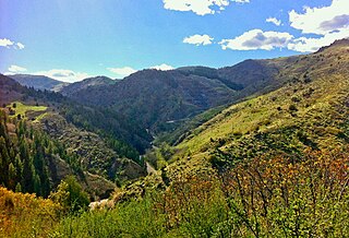
Mercoal, a former coal mining town, is located in the Yellowhead County of western Alberta, Canada. It was one of several communities along the historic Coal Branch segment of the Grand Trunk Pacific Railway, which included Embarras, Robb, Coalspur, Coal Valley, Cadomin, Luscar, and Mountain Park. At its peak in the late 1940s and early 1950s the town had over 800 residents. Mercoal declined after the mines closed in 1959, and it is now essentially a ghost town with only a small number of summer residences remaining. It is situated on Highway 40, 70 km southwest of Edson, 8 km (5 mi) west of Coalspur.
Cadomin is a hamlet in the west-central Alberta, Canada within Yellowhead County. It is located along the McLeod River in the foothills of the Rocky Mountains, approximately 50 kilometres (31 mi) south of Hinton near the Bighorn Highway. It is served by a spur of the Canadian National Railway.
Luscar was at one time a coal mining town in western Alberta, Canada, although nothing remains of the town today. It was situated in the foothills of the Northern Rockies about 12 kilometres (7.5 mi) northwest of Cadomin along the Bighorn Highway, at the end of the CN Railway line.
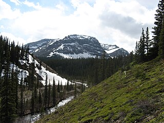
Cardinal River is a short river in western Alberta, Canada. It flows from the Canadian Rockies, and empties into the Brazeau River, itself a major tributary of the North Saskatchewan River.

The Embarras River is a short river in west-central Alberta, Canada. The river likely derived its name from the French word for obstruction, because it is often obstructed by driftwood.

Embarras is a locality in Yellowhead County, Alberta, Canada. It takes its name from the Embarras River. 'Embarrass' is French for 'barrier', probably in reference to the piles of driftwood that often clog the shallow, winding river.
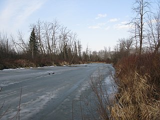
The Paddle River is a short river in northern Alberta, Canada. The river is named because of its slow speed. During the fur trade era, a canoe could be easily paddled up the river, in contrast to the more arduous task of ascending a swifter river like the Pembina River that required poling or tracking.

The Paskapoo Formation is a stratigraphic unit of Middle to Late Paleocene age in the Western Canada Sedimentary Basin. The Paskapoo underlies much of southwestern Alberta, and takes the name from the Blindman River. It was first described from outcrops along that river, near its confluence with the Red Deer River north of the city of Red Deer, by J.B. Tyrrell in 1887. It is important for its freshwater aquifers, its coal resources, and its fossil record, as well as having been the source of sandstone for the construction of fire-resistant buildings in Calgary during the early 1900s.

The Alberta Coal Branch is the name given to a segment of the Canadian National Railway and the region through which it passes. It is located within Yellowhead County in west-central Alberta, Canada.
The Luscar Group is a geologic unit of Early Cretaceous age in the Western Canada Sedimentary Basin that is present in the foothills of southwestern Alberta. It is subdivided into a series of formations, some of which contain economically significant coal deposits that have been mined near Cadomin and Luscar. Coal mining in those areas began in the early 1900s and continues near Luscar as of 2016.

Saunders Creek is a ghost town in west-central Alberta, Canada. Built as a coal mining community, the town existed from 1913 to 1954. It is located in the foothills of the Canadian Rockies near the David Thompson Highway, about 55 km west of the town of Rocky Mountain House. It was named for Saunders Creek, a small stream that runs immediately west of the townsite. The North Saskatchewan River flows nearby to the south.