Belle Glade Camp was a census-designated place (CDP) in Palm Beach County, Florida, United States. The population was 1,141 at the 2000 census.

Redan is a census-designated place (CDP) in DeKalb County, Georgia, United States. As of the 2010 census, the CDP had a total population of 33,015. It is a predominantly African American community in eastern DeKalb County, and is a suburb of Atlanta.

Mount Lena is a census-designated place (CDP) in Washington County, Maryland, United States. The population was 501 at the 2000 census.

Herrings is a hamlet and village in Jefferson County, New York, United States. The population was 90 at the 2010 census, down from 129 at the 2000 census. The hamlet is named after two brothers who owned a paper mill in the area.

Mulberry is a census-designated place (CDP) in Wilkes County, North Carolina. The population was 2,332 at the 2010 U.S. Census. The community was given its name by the first European pioneers to settle the area in the 1750s. They called the region "Mulberry Fields", after the many mulberry trees in the area. Mulberry Creek, one of the largest streams in Wilkes County, takes its name from the community of Mulberry, and flows through the area.

Cherry Grove is a census-designated place (CDP) in Anderson Township, Hamilton County, Ohio, United States. The population was 4,378 at the 2010 census.

Covedale is a census-designated place (CDP) in Green Township, Hamilton County, Ohio, United States. The population was 6,447 at the 2010 census. The CDP represents the part of the former village of Covedale that was not annexed by the city of Cincinnati in the 1890s.

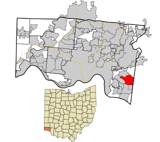
Dillonvale is a census-designated place (CDP) in Sycamore Township, Hamilton County, Ohio, United States. The population was 3,474 at the 2010 census.
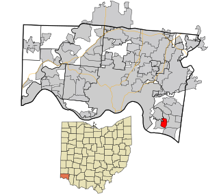
Dry Run is a census-designated place (CDP) in Hamilton County, Ohio, United States. The population was 7,281 at the 2010 census.
Fruit Hill is a census-designated place (CDP) in Hamilton County, Ohio, United States. The population was 3,755 at the 2010 census.
Mack South was a census-designated place (CDP) in Hamilton County, Ohio, United States. The population was 5,837 at the 2000 census. For the 2010 census it was merged into the Mack CDP.

Mount Healthy Heights is a census-designated place (CDP) in Hamilton County, Ohio, United States. The population was 3,264 at the 2010 census.

Northgate is a census-designated place (CDP) in Hamilton County, Ohio, United States. The population was 7,377 at the 2010 census.

Sherwood is a census-designated place (CDP) in Hamilton County, Ohio, United States. The population was 3,719 at the 2010 census.

Turpin Hills is a census-designated place (CDP) outside of Anderson Township, Hamilton County, Ohio, United States. The population was 5,099 at the 2010 census.

White Oak is a census-designated place (CDP) in Hamilton County, Ohio, United States. It is seven miles northwest of Cincinnati. The population was 19,167 at the 2010 census.

Drexel is a census-designated place (CDP) in Jefferson Township, Montgomery County, Ohio, United States. The population was 2,076 at the 2010 census, an increase from 2,057 in 2000. Informally, the Drexel designation also applies to the neighboring portion of Trotwood.
Fort McKinley is an unincorporated community in Harrison Township in Montgomery County, Ohio, United States. It was delineated as a census-designated place (CDP) at the 2000 census, when its population was 3,989. It was not delineated as a CDP for the 2010 census.
Chehalis Village is a former census-designated place (CDP) in Grays Harbor County, Washington, United States. The population was 346 at the 2000 census. The area was no longer listed as a CDP for the 2010 census.

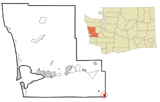
Ocean City is a census-designated place (CDP) in Grays Harbor County, Washington, United States. The population was 200 at the 2010 census.