Madison Township, Jefferson County, Indiana

Last updated

Madison Township
Map highlighting Madison Township, Jefferson County, Indiana.svg
Location in Jefferson County
Coordinates: 38°46′45″N85°23′06″W / 38.77917°N 85.38500°W / 38.77917; -85.38500
Country United States
State Indiana
County Jefferson
Government
  Type Indiana township
Area
  Total58 sq mi (150 km2)
  Land57.41 sq mi (148.7 km2)
  Water0.59 sq mi (1.5 km2)  1.02%
Elevation
915 ft (279 m)
Population
 (2020)
  Total18,007
  Density310/sq mi (120/km2)
GNIS feature ID 0453593

Madison Township is one of ten townships in Jefferson County, Indiana, United States. As of the 2020 census, its population was 18,007 (up from 17,415 at 2010 [1] ) and it contained 8,264 housing units. [2]

Contents

Historical population
CensusPop.Note
1890 13,027
1900 11,761−9.7%
1910 10,013−14.9%
1920 10,7627.5%
1930 10,8160.5%
1940 11,4085.5%
1950 12,66711.0%
1960 14,34813.3%
1970 15,6288.9%
1980 16,2253.8%
1990 16,117−0.7%
2000 16,7704.1%
2010 17,4153.8%
2020 18,0073.4%
Source: US Decennial Census [3]

History

It was established as one of three townships when Jefferson County commenced operations on February 11, 1811. Before this, the area belonged to Madison Township in Clark County. With the inclusion of the city of Madison, it boasts the highest population among Jefferson County's 10 townships.

Outside of the City of Madison, the township has the following active churches: Ryker's Ridge Baptist Church, which was founded in 1840, and Wirt Baptist Church, founded in 1818 as Harbert's Creek Baptist Church. Extinct churches in the country include Bee Camp Baptist (1872-ca.1879), Center Presbyterian (1831-ca. 1850), Graysville Methodist (ca. 1837-ca. 1870?), Mt. Zion Methodist (1868–1972), Olive Branch Methodist (1835–1938), Otterbein Chapel United Brethren (1867-after 1916), Ryker's Ridge Presbyterian (1831-ca. 1837)

There is one public school outside of the city, Ryker's Ridge Elementary School. It was originally the Central School, a 1-12 school, which had its first high school graduation in 1878 and last in 1961, when it was consolidated with the Madison system.

The township has two active post offices, Madison and North Madison. Madison was established in 1812 and North Madison on Jan. 13,1848.

Madison has also had the following post offices: Bee Camp, (Feb. 18, 1880-Feb. 15, 1905) China: Madison/Shelby Twp. Jan. 30, 1833-Nov. 29, 1838. Moses H. Wilder; Feb., 3, 1879-May 2, 1881, Feb. 23, 1882-Feb. 28, 1902 (to Madison) postmaster, Jacob Thiennes. The first post office was likely in Madison Twp. The next two renditions were in Shelby Twp. Eagle Springs (Oct. 19, 1868-Dec. 5, 1870); Stoney Point (July 26, 1853 – May 31, 1906); Waldinger (Dec. 30, 1897-Apr. 15, 1902); Wirt (Dec. 22, 1834-June 19, 1839) and (June 24, 1856 – June 30, 1950; Zion (Sept. 13, 1895–July 15, 1899).

Lemuel Allen Farm and Mathias Wolf Farm were listed on the National Register of Historic Places in 2016. [4]
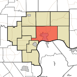
Geography

According to the 2010 census, the township has a total area of 58 square miles (150 km2), of which 57.41 square miles (148.7 km2) (or 98.98%) is land and 0.59 square miles (1.5 km2) (or 1.02%) is water. [1] The streams of Bee Camp Creek, Big Clifty Creek, Crooked Creek, Deans Branch, Dry Fork, Eagle Hollow Creek, Little Clifty Creek, Little Crooked Creek, Razor's Fork, Schnapps Creek, Turkey Run (usually called Turkey Branch locally), West Fork of the Indian-Kentuck Creek and Wolf Run run through this township.

Cities and towns

Extinct towns

Adjacent townships

Cemeteries

The township contains these cemeteries: Booth, Craig, Bramwell, Brisbane, Brown-Bacon, Bryner, Fairmount, Graysville (Miller), Higbie, Indiana Veterans Memorial Cemetery, Jewish, Lund, Minor, Monroe, Olive Branch, Olive Branch, Paul, Pleasant Ridge (Reul), Rykers Ridge Baptist (Old and New), Saint Anthony Roman Catholic, Saint Josephs Roman Catholic, Saint Patricks Roman Catholic, Springdale, Thomas, Underwood, Wirt Baptist and Woodfill.

The Baxter, Bayless, Big Creek, Craig (another Craig Cemetery), Marble Corner, Marble Valley, Monroe and Mt. Monroe cemeteries were relocated to an area just south of Fairmount Cemetery in 1941 when the former Jefferson Proving Ground was created. Bayless was originally in the northern part of the township. The Baxter, Big Creek, Marble Valley, Monroe and Mt. Monroe cemeteries had been in Monroe Township. Marble Corner was relocated from Shelby Township, Ripley County. Some graves from St. Magdalene cemetery were moved from the original site in the same township to St. Patrick's cemetery. The Lund family cemetery, originally located near the Ohio River was moved to the Bayless Cemetery about 1951 during the construction of the Indiana-Kentucky Electric Corp. power plant. Many of the graves in the Old Third Street Cemetery in downtown Madison relocated to Fairmount Cemetery on the Madison hilltop in the 1800s.

Major highways

Airports and landing strips

Related Research Articles

<span class="mw-page-title-main">Canaan, Indiana</span> Census-designated place in Indiana, United States

Canaan is an unincorporated community and census-designated place (CDP) in Shelby Township, Jefferson County, Indiana, United States. As of the 2010 census it had a population of 90.

<span class="mw-page-title-main">Guilford Township, Hendricks County, Indiana</span> Township in Indiana, United States

Guilford Township is one of twelve townships in Hendricks County, Indiana, United States. As of the 2010 census, its population was 27,844.

<span class="mw-page-title-main">Center Township, Greene County, Indiana</span> Township in Indiana, United States

Center Township is one of fifteen townships in Greene County, Indiana, USA. As of the 2020 census, its population was 3,180, down from 3,535 at 2010.

<span class="mw-page-title-main">Taylor Township, Greene County, Indiana</span> Township in Indiana, United States

Taylor Township is one of fifteen townships in Greene County, Indiana, USA. At the 2020 census, its population was 1,098, down from 1,200 at 2010.

<span class="mw-page-title-main">Monroe Township, Allen County, Indiana</span> Township in Indiana, United States

Monroe Township is one of twenty townships in Allen County, Indiana, United States. At the 2010 census, the population was 1,927.

<span class="mw-page-title-main">Haw Creek Township, Bartholomew County, Indiana</span> Township in Indiana, United States

Hawcreek Township is one of twelve townships in Bartholomew County, Indiana, United States. As of the 2010 census, its population was 3,905 and it contained 1,537 housing units.

<span class="mw-page-title-main">Charlestown Township, Clark County, Indiana</span> Township in Indiana, United States

Charlestown Township is one of twelve townships in Clark County, Indiana. As of the 2010 census, its population was 13,450 and it contained 5,382 housing units.

<span class="mw-page-title-main">Fairmount Township, Grant County, Indiana</span> Township in Indiana, United States

Fairmount Township is one of thirteen townships in Grant County, Indiana, United States. As of the 2010 census, its population was 4,239 and it contained 1,909 housing units.

<span class="mw-page-title-main">Jefferson Township, Grant County, Indiana</span> Township in Indiana, United States

Jefferson Township is one of thirteen townships in Grant County, Indiana, United States. As of the 2010 census, its population was 5,839 and it contained 1,758 housing units.

<span class="mw-page-title-main">Mill Township, Grant County, Indiana</span> Township in Indiana, United States

Mill Township is one of thirteen townships in Grant County, Indiana, United States. As of the 2010 census, its population was 10,882 and it contained 4,809 housing units.

<span class="mw-page-title-main">Lancaster Township, Jefferson County, Indiana</span> Township in Indiana, United States

Lancaster Township is one of ten townships in Jefferson County, Indiana, United States. As of the 2020 census, its population was 1,494 and it contained 610 housing units.

<span class="mw-page-title-main">Milton Township, Jefferson County, Indiana</span> Township in Indiana, United States

Milton Township is one of ten townships in Jefferson County, Indiana, United States. As of the 2020 census, its population was 862 and it contained 450 housing units.

<span class="mw-page-title-main">Monroe Township, Jefferson County, Indiana</span> Township in Indiana, United States

Monroe Township is one of ten townships in Jefferson County, Indiana, United States. As of the 2020 census, its population was 374 and it contained 164 housing units.

<span class="mw-page-title-main">Republican Township, Jefferson County, Indiana</span> Township in Indiana, United States

Republican Township is one of ten townships in Jefferson County, Indiana, United States. As of the 2020 census, its population was 1,600 and it contained 663 housing units.

<span class="mw-page-title-main">Saluda Township, Jefferson County, Indiana</span> Township in Indiana, United States

Saluda Township is one of ten townships in Jefferson County, Indiana, United States. As of the 2020 census, its population was 1,333 and it contained 589 housing units. It was created by the Jefferson County Court of Common Pleas on Feb. 13, 1817. Saluda is derived from a Native American name meaning "river of corn".

<span class="mw-page-title-main">Shelby Township, Jefferson County, Indiana</span> Township in Indiana, United States

Shelby Township is one of ten townships in Jefferson County, Indiana, United States. As of the 2020 census, its population was 1,151 and it contained 458 housing units.

<span class="mw-page-title-main">Smyrna Township, Jefferson County, Indiana</span> Township in Indiana, United States

Smyrna Township is one of ten townships in Jefferson County, Indiana, United States. As of the 2020 census, its population was 1,116 and it contained 453 housing units.

China is an unincorporated community in Shelby Township, Jefferson County, Indiana. It spans Shelby and Madison Townships and was for years largely defined by the existence of a general store in Madison Township and the former St. Anthony's Catholic Church in Shelby township. Razor's Fork runs between the two sections. Indiana State Road 62 runs parallel to Razor's Fork in Madison Township, and then crosses the stream and heads north to Canaan.

<span class="mw-page-title-main">Deputy, Indiana</span> Census-designated place in Indiana, United States

Deputy is an unincorporated community and census-designated place (CDP) in Graham Township, Jefferson County, Indiana, United States. By road it is approximately 18 miles (29 km) northwest of Madison, the county seat. As of the 2010 census it had a population of 86.

Lancaster is an unincorporated community in Lancaster Township, Jefferson County, Indiana.

References

  1. 1 2 "Population, Housing Units, Area, and Density: 2010 - County -- County Subdivision and Place -- 2010 Census Summary File 1". United States Census. Archived from the original on February 12, 2020. Retrieved May 10, 2013.
  2. "Explore Census Data". data.census.gov. Retrieved April 10, 2024.
  3. "Township Census Counts: STATS Indiana".
  4. "National Register of Historic Places Listings". Weekly List of Actions Taken on Properties: 6/06/16 through 6/10/16. National Park Service. June 17, 2016.

Baker, J. David, The Postal History of Indiana, 1976, Philatelic Bibliophile, P.O. Box 213971, Louisville, Ky. 1976. Gresham, John M. & Co., 1889. Biographical & Historical Souvenir for the Counties of Clark, Crawford, Harrison, Floyd, Jefferson, Jennings, Scott and Washington.