Republican Township | |
|---|---|
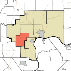 Location in Jefferson County | |
| Coordinates: 38°43′48″N85°33′32″W / 38.73000°N 85.55889°W | |
| Country | United States |
| State | Indiana |
| County | Jefferson |
| Government | |
| • Type | Indiana township |
| Area | |
• Total | 27.55 sq mi (71.4 km2) |
| • Land | 27.44 sq mi (71.1 km2) |
| • Water | 0.11 sq mi (0.28 km2) 0.40% |
| Elevation | 741 ft (226 m) |
| Population (2020) | |
• Total | 1,600 |
| • Density | 58/sq mi (23/km2) |
| GNIS feature ID | 0453786 |
Republican Township is one of ten townships in Jefferson County, Indiana, United States. As of the 2020 census, its population was 1,600 and it contained 663 housing units. [1]
Contents
- Geography
- Unincorporated towns
- Adjacent townships
- Cemeteries
- Major highways
- Airports and landing strips
- References
- External links
Republican Township was created on March 12, 1817, by the Jefferson County Common Pleas Court. It has had the following post offices, which are no longer in operation: Hargan (June 4, 1884 – July 29, 1898); Ramsey's Mills (Dec. 19, 1832-Jan. 14, 1848); Swanville (June 10, 1847-Oct. 23, 1866) and (Jan. 8, 1867-Jan. 15, 1907). There is no active post office in the township.
Ramseys Mills Post Office was renamed Kent, which operated from Jan. 14, 1848 until March 26, 1965, when mail service was transferred to Madison.
Its active churches include the Kent Baptist, Christian and Methodist churches. Past churches include the Ebenezer Methodist (ca. 1840-?): New Liberty Methodist (ca. 1900-1995/90), Providence Methodist (ca. 1830-?), Sharon Hill Presbyterian (1845-after 1945); White River Baptist (1811-1886/87) and White River Christian (founded as a New Light church in 1817, moved to Kent where the Kent Christian Church is its successor).
| Census | Pop. | Note | %± |
|---|---|---|---|
| 1890 | 872 | — | |
| 1900 | 859 | −1.5% | |
| 1910 | 871 | 1.4% | |
| 1920 | 887 | 1.8% | |
| 1930 | 729 | −17.8% | |
| 1940 | 724 | −0.7% | |
| 1950 | 719 | −0.7% | |
| 1960 | 880 | 22.4% | |
| 1970 | 1,061 | 20.6% | |
| 1980 | 1,447 | 36.4% | |
| 1990 | 1,468 | 1.5% | |
| 2000 | 1,534 | 4.5% | |
| 2010 | 1,599 | 4.2% | |
| 2020 | 1,600 | 0.1% | |
| Source: US Decennial Census [2] | |||
