Sketchmap of the Manchester, Buxton, Matlock and Midland Railway and connectionsFragment of a map showing the proposed route of the line. Notice the route through the Goyt Valley. Also the north-facing junction at AmbergateThe various routes followed by the Midland into Manchester
In time it would become part of the Midland Railway's main line between London and Manchester, but it was initially planned as a route from Manchester to the East of England, via the proposed Ambergate, Nottingham, Boston and Eastern Junction Railway which would meet it a little further north along the North Midland line at Ambergate. The act of Parliament, Manchester, Buxton, Matlock and Midlands Junction Railway Act 1846, for a line from just south of Stockport to Ambergate was passed in 1846.
Currently, the section north of Millers Dale is open as the Great Rocks freight line, Derby to Matlock still holds passenger services as the Derwent Valley line, Matlock to Rowsley is the Peak Rail heritage line, and Rowsley to Buxton has become the Monsal Trail for cycling, horse riding and walking.
Ambergate to Rowsley
United Kingdom legislation
Manchester, Buxton, Matlock and Midlands Junction Railway Act 1846
An Act for making a Railway from the Manchester and Birmingham Railway at Cheadle in the County of Chester to or near to the Ambergate Station of the Midlands Railway in the County of Derby, to be called "The Manchester, Buxton, Matlock, and Midlands Junction Railway."
The initial plan was for "An Act for making a Railway from the Manchester and Birmingham Railway at Cheadle in the County of Chester to or near to the Ambergate Station of the Midlands Railway in the County of Derby, to be called "The Manchester, Buxton, Matlock, and Midlands Junction Railway"[1] The bill received royal assent as the Manchester, Buxton, Matlock and Midlands Junction Railway Act 1846 (9 & 10 Vict. c. cxcii).
The line opened as far as Rowsley on 4 June 1849,[2] but went no further, having run out of money[3] giving its promoters something of a problem.
Matlock Bath had long been a tourist town. Since the station at Ambergate had been opened, tourists had been brought in by coach and canal. Around thirty coaches had passed that way each day, with sixty or seventy thousand visitors going on to Chatsworth House.[4] The aim then was to develop the trade further.
The Midland Railway had held shares in the line since it had been first proposed in 1845, its interest being an extension onto its route to London. The Manchester and Birmingham had for some time been looking for a route of its own, and had considered a line through the Churnet Valley (later built by the North Staffordshire Railway), but had instead supported the alternative Matlock route with a substantial shareholding. However, in 1846 it had merged with other lines to become the LNWR, which clearly could not contemplate a competing London line. In 1852 the two companies agreed to lease the line jointly for 19 years, In addition, the Midland would work the line and pay a rent on it, and also take over the Cromford Canal.[4]
Rowsley to Buxton
In 1853, a junction was made to the southern end of the Cromford and High Peak Railway now LNWR-owned, at High Peak Junction, and with the latter's support, the Stockport, Disley and Whaley Bridge Railway connected Manchester to the northern end. In 1857, with the LNWR's barely concealed support, the SD&WBR then gained permission to extend to Buxton. It did so by a roundabout route along a massive escarpment to the east of the Goyt Valley, such that it could never become a through express route. Despite an LNWR petition against the bill and opposition from the SD&WBR, the Midland Railway (Rowsley and Buxton) Act 1860 (23 & 24 Vict. c. lxvi) of 25 May 1860 authorised a 15 miles (24km)[5] line from Rowsley to meet the SD&WBR at Buxton.[4] Work started in September 1860, under Frederic Campion,[5] the Midland Railway's Southern Division engineer,[6] then under Alfred Andrew Langley (from 1883 Midland's Chief Engineer).[7]
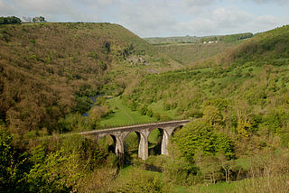
It was the first time the Midland Railway had built in such difficult terrain, with steep hills and deep valleys, Buxton itself being some 1,000 feet (300m) above sea level. The line followed the River Wye as far as Bakewell, with the complication of the cut and coverHaddon Tunnel, and reached Hassop in 1862 There then followed two viaducts – at Millers Dale and Monsal Dale – and eight tunnels, reaching Buxton in 1863[3] at almost the same time as the LNWR reached it from Whaley Bridge. In 1884 John Ruskin complained of the effect on the dales, saying, "your railway drags its close clinging damnation".[8]
All this time passengers were having to change at Ambergate, but in the same year, the Midland added a south-facing junction and moved the station to allow through travel from Derby and the south.[9] However, there was still the problem of the joint control of the line.
For many years, the town of Wirksworth had been campaigning for a branch line from Duffield. The C&HPR was interested, but had insufficient funds. The Midland was initially unenthusiastic, but then realised that the branch could be extended to Rowsley, avoiding the section to Ambergate, being unsure about what might occur when joint lease expired in 1871.[10]
However, the LNWR gave up its share of the line when the lease expired. It was, after all, remote and isolated from the company's main system. The Midland Railway was therefore relieved of the necessity of extending from Wirksworth over a very difficult piece of terrain. The branch opened to Wirksworth in 1867 but was not carried further.
To Manchester
In the shifting alliances and rivalries between the various companies, the Manchester, Sheffield and Lincolnshire Railway also wished to keep the Midland away from the coalmines which it served and, in 1859, was planning a line from Hyde just outside Manchester to New Mills and Hayfield. The company was also being courted by the GNR that planned to run London trains through Retford. Meanwhile, the MS&LR's manager Edward Watkin had his own plans to reach London through Sheffield.
A cement train running west towards Chinley in 1964
It seemed the Midland's only chance was a circuitous route with the help of the Lancashire and Yorkshire Railway, except that it transpired that latter had an agreement with the LNWR not to handle other companies' trains. In 1861, the Midland sent their manager James Allport and some of the directors on a scouting trip around the area, and came by chance upon a party of MS&LR directors riding in a dog cart. The upshot was that Allport who had previously worked for the latter company should arrange a deal. Since it was clear that the Midland was determined to go ahead, it would be better not to have two lines running side by side.[4]
To do this, it built a junction at Millers Dale, which effectively left Buxton on a branch. Thus railway politics deprived what was (particularly at that time) the largest town in the Peak District of a through main-line station. The Midland's line proceeded to the east of, but parallel to, the LNWR's line until it reached a summit at Peak Forest. It then plunged under the LNWR through Dove Holes Tunnel with stations at Chapel-en-le-Frith, Buxworth and Chinley joining the MS&LR at New Mills to run into Manchester London Road, opening in 1867. This section of route is still open for stone freight trains serving the Buxton lime industry as the Great Rocks Line.
Later history
The Midland at last had its route into Manchester from London. Over the years it made some improvements. The route from Romiley through Hyde entailed a long detour, so in 1875 a new more direct line was opened through Reddish.
In 1865 the Midland had become a partner of the Cheshire Lines Committee which opened Manchester Central railway station in 1880. Therefore, the Midland transferred most of its trains there, at first reaching it through Stockport Tiviot Dale. However the route became increasingly congested and was hardly suitable as an express route, so in 1897, the Midland opened a new line from New Mills through Disley Tunnel and Heaton Mersey.[12]
summer 1961 leaflet – on the reverse the Cheap Day Return fare between the terminals was shown as 5/2 (26p).
Closure
The line from Matlock to Buxton was closed in June 1968 by the Labour Minister for Transport, Barbara Castle, not, as is often thought, by the Beeching reforms. Continuing support is being given by a heritage group Peak Rail who have restored the section from Matlock to Rowsley.
Although the track has been lifted between Rowsley and Buxton and is now part of the Monsal Trail, plans to re-open it are still proposed from time to time, and the Derbyshire County Council has pledged to keep the trackbed free of development.[13]
Part of the line has been re-opened by the heritage railway organisation Peak Rail who run services from Matlock to Rowsley, at a current distance of 4 miles (6.4km) in length.
There are plans to extend to Bakewell via the site of Rowsley railway station and a Proposed Haddon halt as part of the Buxton extension project. It will involve reinstating the whole section and Bakewell railway station to their former use once planning permission has been granted, plus full restoration of the old Haddon Tunnel and both Coombs Road and Rowsley Viaducts (along the way between both Bakewell and Rowsley themselves).
Four tunnels (Headstone, Cressbrook, Litton and Chee Tor) between Great Longstone and Peak Forest and Blackwell Mill were re-opened to walkers and cyclists in May 2011.[14]
In March 2018, it was announced that a consortium of quarry companies and the heritage railway Peak Rail is investigating reopening the line between Matlock and Buxton.[15] This section has been identified by Campaign for Better Transport as a phase 2 candidate for reopening.[16]
Bakewell station in 2019Great Longstone for Ashford station in 2019
In March 2020, a bid was made to the Restoring Your Railway fund to get funds for a feasibility study into reinstating the line between Matlock and Buxton. This bid was unsuccessful.[17] In March 2021, the bid was re-submitted as part of the third round of the Restoring Your Railway fund.[18]
In June 2022 it was announced that funding would not be allocated at this time.[19]
The proposal to reinstate the railway, a campaign led by Manchester and East Midlands Rail Action Partnership (MEMRAP), continues to grow support. Working with the Promoter, Peaks and Dales Railway and supported by the Goodshelter Group, the plans include a re provisioned Monsal Trail as well as the return of the railway.[20][21][22]
Peak Rail is a preserved railway in Derbyshire, England, which operates a steam and heritage diesel service for tourists and visitors to both the Peak District and the Derbyshire Dales.
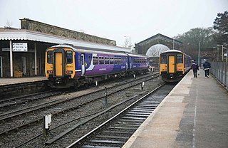
The Derwent Valley line is a railway line between Derby and Matlock in Derbyshire, England. It follows the Midland Main Line as far as Ambergate Junction, just south of Ambergate; it continues to Matlock, following the course of the River Derwent.
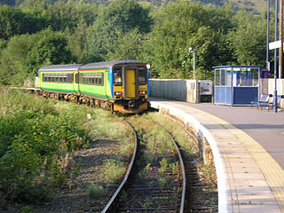
Whatstandwell railway station serves the villages of Whatstandwell and Crich Carr in Derbyshire, England. It is a stop on the Derwent Valley Line, which runs between Derby and Matlock. The station is owned by Network Rail and managed by East Midlands Railway.
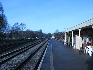
Matlock railway station serves the Derbyshire Dales county town of Matlock, in Derbyshire, England. The station is the terminus of both the Derwent Valley Line from Derby and Peak Rail which operates heritage services to Rowsley South. Both lines are formed from portions of the Midland Railway's former main line to Manchester Central; through running is technically possible, but is not done in normal service. The station is owned by Network Rail and managed by East Midlands Railway.
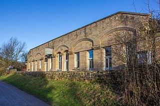
Duffield railway station serves the village of Duffield in Derbyshire, England. The station is located on the Midland Main Line, between Derby and Leeds, 133 miles 8 chains (214.2 km) north of London St Pancras. The unmanned station is served by East Midlands Railway, which operates local services from Derby to Matlock, via the Derwent Valley Line. It is also a junction with the former branch line to Wirksworth, which is now operated as the Ecclesbourne Valley heritage railway.
Ambergate railway station serves the village of Ambergate in Derbyshire, England. It is located on the Derwent Valley Line, which connects Derby and Matlock; it diverges from the Midland Main Line just south of the station at Ambergate Junction. The station owned by Network Rail and managed by East Midlands Railway.
Buxton railway station serves the Peak District town of Buxton in Derbyshire, England. It is managed and served by Northern Trains. The station is 25+3⁄4 miles (41.4 km) south east of Manchester Piccadilly and is the terminus of the Buxton line.
Haddon Tunnel was built by the Midland Railway in 1863 when extending the Manchester, Buxton, Matlock and Midlands Junction Railway from Rowsley to Buxton in Derbyshire, England.
Monsal Dale is a valley in Derbyshire, England, in the White Peak limestone area of the Peak District National Park. It is a Site of Special Scientific Interest (SSSI), a Special Area of Conservation (SAC) (1) and part of a Europe-wide network called Natura 2000.
Dove Holes Tunnel is a tunnel built by the Midland Railway between Peak Forest Signal Box and Chapel-en-le-Frith in Derbyshire in 1860–64, now carrying the Great Rocks Line.
Millers Dale railway station was in Millers Dale, near Tideswell, in Derbyshire, England. It was opened in 1863 by the Midland Railway on its line from Rowsley, extending the Manchester, Buxton, Matlock and Midlands Junction Railway. It closed in 1967 and the site is now used as a car park for the Monsal Trail, which follows the trackbed.
Rowsley South railway station lies approximately a mile short of Rowsley village, the location of the settlement's previous stations. Rowsley South was the third station to be built in the area, constructed by Peak Rail volunteers in the late 1990s.
The Monsal Trail is a cycling, horse riding and walking trail in the Derbyshire Peak District. It was constructed from a section of the former Manchester, Buxton, Matlock and Midland Junction Railway, which was built by the Midland Railway in 1863 to link Manchester with London and closed in 1968. The Monsal Trail is about 8.5 miles (13.7 km) long and opened in 1981. It starts at the Topley Pike junction in Wye Dale, 3 miles (4.8 km) east of Buxton, and runs to Coombs Viaduct, 1 mile (1.6 km) south-east of Bakewell. It follows the valley of the River Wye. The trail passes through Blackwell Mill, Chee Dale, Millers Dale, Cressbrook, Monsal Dale, Great Longstone, Hassop and Bakewell. The trail has numerous landmarks including Headstone Viaduct, Cressbrook Mill, Litton Mill and Hassop railway station, and passes through six tunnels.
Hassop railway station was situated about two miles from the village of Hassop in the Peak District of Derbyshire, England. It was opened in 1862 by the Midland Railway on its extension of the Manchester, Buxton, Matlock and Midlands Junction Railway from Rowsley.
Bakewell railway station served the town of Bakewell in Derbyshire, England. It was built by the Midland Railway on its extension of the Manchester, Buxton, Matlock and Midland Junction Railway line from Rowsley to Buxton. The station was closed in 1967. Peak Rail Heritage Railway intends to reopen the station to trains by extending its existing Matlock to Rowsley South line 4 miles through Rowsley to Bakewell.
The Stockport, Disley and Whaley Bridge Railway was an early railway company in England which was opened in 1857 between Stockport Edgeley and Whaley Bridge.
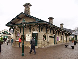
Rowsley railway station was opened in 1849 by the Manchester, Buxton, Matlock and Midlands Junction Railway to serve the village of Rowsley in Derbyshire, England. It was resited in 1862.
The White Peak Loop is a 60-mile (97 km) route for walking, cycling and horse riding in the Peak District of England. The trail combines sections of the High Peak Trail and the Monsal Trail with linking sections through the towns of Buxton, Bakewell and Matlock. The White Peak Loop is being developed by Derbyshire County Council and as of 2022 some sections are not yet complete.
The Wye Valley is the limestone valley of the River Wye in the White Peak of Derbyshire, England. The source of the River Wye is west of Buxton on Axe Edge Moor. One main channel runs underground through Poole's Cavern. The river flows though Buxton Pavilion Gardens and then along a culvert under the town centre. After leaving the flat area of central Buxton, the Wye Valley becomes distinct as a gorge running east for 10 miles (16 km) before the valley broadens at Ashford-in-the Water.
Northwood and Tinkersley is a civil parish within the Derbyshire Dales district, in the county of Derbyshire, England. Named for its main settlements, with a mix of rural and built up areas, it had a population of 665 residents in 2011. The parish is 126 miles (203 km) north west of London, 18 miles (29 km) north west of the county city of Derby, and 3+1⁄2 miles (5.6 km) north west of the nearest market town of Matlock. Northwood and Tinkersley is directly adjacent to the Peak District national park to the west, and shares a border with the parishes of Darley Dale, Rowsley and Stanton.
This page is based on this Wikipedia article Text is available under the CC BY-SA 4.0 license; additional terms may apply. Images, videos and audio are available under their respective licenses.