Astacinga is a municipality in the Mexican state of Veracruz. It is located about 213 km from state capital Xalapa to the south. It has a surface of 69.09 km2. It is located at 18°34′N97°06′W.

Aquila Municipality is a municipality in the Mexican state of Veracruz. It is located about 136 km from state capital Xalapa to the south-west. It has a surface of 35.37 km2. It is located at 18°48′N97°18′W.
Atoyac is a municipality in the Mexican state of Veracruz. It is located about 196 km from state capital Xalapa. It has a surface of 171.09 km2. It is located at 18°55′N96°46′W.

Atzacan is a municipality in the Mexican state of Veracruz. It is located about 198 km from state capital Xalapa. It has a surface of 80.61 km2. It is located at 18°54′N97°05′W.
Ayahualulco is a municipality in the Mexican state of Veracruz.
Coxquihui is a municipality in the Mexican state of Veracruz. It is located in montane central zone of the state, about 95 km from state capital Xalapa. It has a surface of 86.37 km2. It is located at 20°11′N97°35′W.

Coyutla is a municipality in the Mexican state of Veracruz. It is located in central zone of the state, about 110 km from state capital Xalapa. It has a surface of 312.56 km2. It is located at 20°15′N97°39′W.
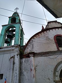
Filomeno Mata is a town and municipality in the Mexican state of Veracruz. It is located in central zone of the state, about 298 km from state capital Xalapa. It has a surface of 62.51 km2. It is located at 20°12′N97°42′W.
Ixhuatlancillo is a municipality in the central zone of the Mexican state of Veracruz, about 165 km from Xalapa, the state capital. It has a surface of 39.48 km2 and is located at 18°54′N97°09′W.
La Perla is a municipality in the Mexican state of Veracruz. It is located in central zone of the State of Veracruz, about 75 km from state capital Xalapa. It has a surface of 199.880 km2. It is located at 18°56′N97°08′W.
Maltrata is a municipality in the Mexican state of Veracruz. It is located in the central zone of the state, about 209 km from the state capital Xalapa. It has a surface of 132.43 km2. It is located at 18°49′N97°17′W.
San Juan Evangelista is a municipality located in the plains of the Sotavento zone in the central zone of the State of Veracruz, about 260 km from state capital Xalapa. It has a surface of 968.94 km2. It is located at 17°53′N95°08′W.
Tehuipango is a municipality located in the montane central zone in the State of Veracruz, about 110 km from state capital Xalapa. It has a surface of 111.04 km2. It is located at 18°31′N97°03′W. Santiago Tehuipango, it was a people belonging to Zongolica's federation, during the 16th century, later it tried to form its own town hall; in 1831 a municipality was consisting already of basics schools and parish of masonry. It was bordering on Mixtla, Eloxitlan, Alcomunga, Astacinga and Texhuacán.
Álamo Temapache is a municipality in the Mexican state of Veracruz. It is located about 90 km from state capital Xalapa. It has a surface of 65.80 km2. It is located at 20°59′21″N97°42′21″W. The municipal seat is at Álamo.
Tlaquilpa is a municipality located in the south zone in the State of Veracruz, about 105 km from the state capital of Xalapa. It has a surface of 58.40 km2. It is located at 18°36′N97°07′W. The name comes from Náhuatl, and means “Bricklayers' place". Tlaquilpa is a very ancient village, which existed before the Spanish conquest. In the 16th century, it came under Zongolica's jurisdiction, with the name of Santa Maria Magdalena. In 1831 it was constituted as a municipality. Tlaquilpa borders on Mixtla de Altamirano, Astacinga and Texhuacán.
Tonayán is a municipality located in the south zone in the Mexican state of Veracruz, about 20 km from state capital Xalapa. It has a surface of 74.03 km2. It is located at 19°41′N97°55′W. The name comes from the language Náhuatl, Tonali-tona-yan; that means “Place where it dawns ". Tonayán was founded as village between the year 1552 and 1564 when a group of inhabitants of the old village of Misantla established in this place to take care of its boundaries that were feeling threatened by the agrarian invasions of the village of Chapultepec.

Zongolica is a municipality located in the south zone in the State of Veracruz, about 100 km from state capital Xalapa. It has a surface of 63.34 km2. It is located at 18°40′N97°00′W. The name comes from Nahuatl Tzontli-coliuhqui 'crafty hair'.
Atoyatempan (municipality) is a town and municipality in the Mexican state of Puebla in south-eastern Mexico.

Cuapiaxtla de Madero (municipality) is a town and municipality in the Mexican state of Puebla in south-eastern Mexico.
Tlaola (municipality) is a town and municipality in the Mexican state of Puebla in south-eastern Mexico.