
Córdoba, officially known as Heroica Córdoba, is a city and the seat of the municipality of the same name in the Mexican state of Veracruz. It was founded in 1618.

Platón Sánchez Municipality is one of the 212 municipalities of the Mexican state of Veracruz. It is located in the state's Huasteca Alta region. The municipal seat is the town of Platón Sánchez.

Otatitlán is a town and municipality in the Mexican state of Veracruz, in the south of the state along the border with the state of Oaxaca. The town is best known for its large black image of a crucified Christ, one of three notable images of this type. Most of the population in Otatitlán is poor and the area is dedicated to agriculture, especially sugar cane and bananas.
Uxpanapa is a municipality in the southeastern part of the state of Veracruz, adjacent to the state of Oaxaca), in Mexico. It is bordered by the municipalities of Jesús Carranza, Hidalgotitlán, Minatitlán, and Las Choapas in Veracruz, as well as Santa María Chimalapa in Oaxaca. It has an area of 2,600 km².

Coacalco de Berriozábal is a city and municipality located in the State of Mexico, Mexico. Its name comes from the Nahuatl, Coa-coatl (snake), cal-calli (home) and -co (at), meaning "at the house of the snake", and was first recorded in 1320. The municipality lies in the Greater Mexico City conurbation, and it is located next to the northern tip of the Mexico City. The official name of its municipal seat is San Francisco Coacalco, and the municipality is named after Felipe Berriozábal.
Acayucan Municipality is one of the 212 municipalities of the Mexican state of Veracruz. It is located in the state's southeast, in the Olmeca region. The municipal seat is the city of Acayucan, Veracruz. It covers a total of 724.65 km².
Chalma is a village (pueblo) in the Mexican state of Veracruz. It is located in the state's Huasteca Alta region. It serves as the municipal seat for the surrounding municipality of Chalma.
Chiconamel Municipality is one of the 212 municipalities of the Mexican state of Veracruz. It is located in the state's Huasteca Alta region. The municipal seat is the village of Chiconamel, Veracruz.
El Higo is one of the 212 municipalities of the Mexican state of Veracruz. It is located in the state's Huasteca Alta region. The municipal seat is the village of El Higo, Veracruz.
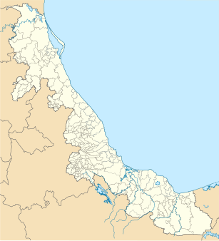
Ozuluama de Mascareñas Municipality is one of the 212 municipalities of the Mexican state of Veracruz. It is located in the state's Huasteca Alta region, on the west shore of Tamiahua Lagoon. The municipal seat is the village of Ozuluama de Mascareñas, Veracruz.

Pánuco is one of the 212 municipalities of the Mexican state of Veracruz. It is located in the Huasteca Alta region of Veracruz and shares borders with the states of San Luis Potosí and Tamaulipas. The municipal seat is the city of Pánuco, Veracruz.
Pueblo Viejo is one of the 212 municipalities of the Mexican state of Veracruz. It is located in the state's Huasteca Alta region. The municipal seat is the city of Ciudad Cuauhtémoc, Veracruz.

Tampico Alto is one of the 212 municipalities of the Mexican state of Veracruz. It is located in the state's Huasteca Alta region, at the northern end of Tamiahua Lagoon. The municipal seat is also called Tampico Alto.
Tantoyuca Municipality is one of the 212 municipalities of the Mexican state of Veracruz. It is located in the state's Huasteca Alta region. The municipal seat is Tantoyuca, Veracruz.

Camarón de Tejeda Municipality is one of the 212 municipalities of the Mexican state of Veracruz. It is located in the state's southeast, in the Las Montañas region. The municipal seat is the city of Camarón de Tejeda. It covers a total of 74.38 km².
Benito Juárez is one of the 212 municipalities of the Mexican state of Veracruz. It is located in the state's Huasteca Baja region. The municipal seat is the village of Benito Juárez, Veracruz.

Castillo de Teayo Municipality is one of the 212 municipalities of the Mexican state of Veracruz. It is located in the state's Huasteca Baja region. The municipal seat is the village of Castillo de Teayo.
Huayacocotla is one of the 212 municipalities of the Mexican state of Veracruz. It is located in the state's Huasteca Baja region. The municipal seat is the town of Huayacocotla.

Catemaco Municipality is one of the 212 municipalities that make up the Mexican state of Veracruz. It is in the state's Los Tuxtlas. The municipal seat is the city of Catemaco.
Cerro Azul Municipality is one of the 212 municipalities of the Mexican state of Veracruz. It is located in the state's Huasteca Baja region. The municipal seat is the city of Cerro Azul, Veracruz.

