Naranjal, Veracruz

Last updated
Naranjal
Municipality
Mexico States blank map.svg
Red pog.svg
Naranjal
Location in Mexico
Coordinates: 18°48′37″N96°57′36″W / 18.81028°N 96.96000°W / 18.81028; -96.96000 Coordinates: 18°48′37″N96°57′36″W / 18.81028°N 96.96000°W / 18.81028; -96.96000 [1]
CountryFlag of Mexico.svg  Mexico
State Flag of Veracruz.svg  Veracruz
Established 28 March 1831
Seat Naranjal
Government [2]
  President Karla Nancy Abad Sosa
Area [3]
  Total 18.599 km2 (7.181 sq mi)
Elevation [1] (of seat) 696 m (2,283 ft)
Population (2010 Census) [3]
  Total 4,507
  Estimate (2015 Intercensal Survey) [4] 4,559
  Density 240/km2 (630/sq mi)
  Seat 2,261
Time zone Central (UTC-6)
  Summer (DST) Central (UTC-5)
Postal codes 94880–94883 [5]
Area code 271
Website Official website

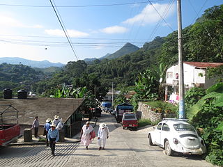
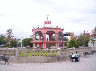
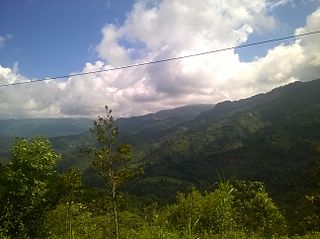
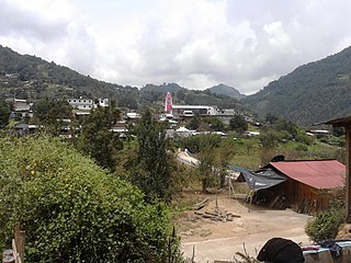
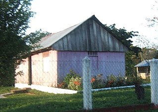
Naranjal (Spanish: "orange grove") is a municipality in the Mexican state of Veracruz, located 10 kilometres (6.2 mi) south of the city of Córdoba.

Spanish language Romance language

Spanish or Castilian is a Romance language that originated in the Castile region of Spain and today has hundreds of millions of native speakers in the Americas and Spain. It is a global language and the world's second-most spoken native language, after Mandarin Chinese.

Municipalities are the second-level administrative divisions of Mexico, where the first-level administrative division is the state. As of the establishment of two new municipalities in Chiapas in September 2017, there are 2,448 municipalities in Mexico, not including the 16 delegaciones of Mexico City. The internal political organization and their responsibilities are outlined in the 115th article of the 1917 Constitution and detailed in the constitutions of the states to which they belong.

Mexico Country in the southern portion of North America

Mexico, officially the United Mexican States, is a country in the southern portion of North America. It is bordered to the north by the United States; to the south and west by the Pacific Ocean; to the southeast by Guatemala, Belize, and the Caribbean Sea; and to the east by the Gulf of Mexico. Covering almost 2,000,000 square kilometres (770,000 sq mi), the nation is the fifth largest country in the Americas by total area and the 13th largest independent state in the world. With an estimated population of over 120 million people, the country is the eleventh most populous state and the most populous Spanish-speaking state in the world, while being the second most populous nation in Latin America after Brazil. Mexico is a federation comprising 31 states and Mexico City, a special federal entity that is also the capital city and its most populous city. Other metropolises in the state include Guadalajara, Monterrey, Puebla, Toluca, Tijuana and León.

Contents

Geography

The municipality of Naranjal is located in central Veracruz at an altitude between 600 and 1,500 metres (2,000–4,900 ft). It borders the municipalities of Fortín to the north, Amatlán de los Reyes to the northeast, Coetzala to the southeast, Zongolica to the south, Tequila to the southwest, and Ixtaczoquitlán to the northwest. [6] The municipality covers an area of 18.599 square kilometres (7.181 sq mi) [3] and comprises 0.03% of the state's area. [1]

Amatlán de los Reyes is a municipality in Veracruz, Mexico. It is located about 105.63 mi from state capital Xalapa to the south. It has an area of 148.9 km2. It is located at 18°51′N96°55′W.

Coetzala in Veracruz, Mexico. It is located in the montane central zone of the State of Veracruz, about 90 km from state capital Xalapa. It has a surface of 26.32 km2. It is located at 18°47′N96°55′W.

Zongolica Municipality and town in Veracruz, Mexico

Zongolica is a municipality located in the south zone in the State of Veracruz, about 100 km from state capital Xalapa. It has a surface of 63.34 km². It is located at 18°40′N97°00′W. The name comes from Nahuatl Tzontli-coliuhqui 'crafty hair'.

The municipality is located on the southern bank of the Río Blanco and is watered by that river and its tributaries. [6] [2] Most of the land in Naranjal (90.41%) is used for agriculture. The dominant soils in the municipality are luvisols, acrisols and vertisols. [6]

Acrisol soil type

An Acrisol is a Reference Soil Group of the World Reference Base for Soil Resources (WRB). It has a clay-rich subsoil and is associated with humid, tropical climates, such as those found in Brazil, and often supports forested areas. In the USDA soil taxonomy, Acrisols correspond to the Humult, Udult and Ustult suborders of the Ultisols and also to Oxisols with a kandic horizon and to some Alfisols. The Acrisols low fertility and toxic amounts of aluminium pose limitations to its agricultural use, favouring in many places its use for silviculture, low intensity pasture and protected areas. Crops that can be successfully cultivated, if climate allows, include tea, rubber tree, oil palm, coffee and sugar cane.

Vertisol Clay-rich soil, prone to cracking

In both the World Reference Base for Soil Resources (WRB) and the USDA soil taxonomy, a Vertisol is a soil in which there is a high content of expansive clay minerals, many of them known as montmorillonite, that form deep cracks in drier seasons or years. In a phenomenon known as argillipedoturbation, alternate shrinking and swelling causes self-ploughing, where the soil material consistently mixes itself, causing some Vertisols to have an extremely deep A horizon and no B horizon.. This heaving of the underlying material to the surface often creates a microrelief known as gilgai.

Naranjal's climate is humid with rain falling mostly in the summer. Average temperatures in the municipality range between 18 and 24 °C (64–75 °F), and average annual precipitation ranges between 2,400 and 2,600 millimetres (94–102 in). [6]

History

Naranjal established its first town council in 1814. [2] On 28 March 1831 it was incorporated under the name of San Cristóbal Naranjal as a municipality in the canton of Orizaba in the state of Veracruz. Naranjal became a free municipality on 15 January 1918. [7]

Administration

The municipal government comprises a president, a councillor (Spanish: síndico), and a trustee (regidor). [2] The current president of the municipality is Karla Nancy Abad Sosa. [8]

Demographics

In the 2010 Mexican Census, the municipality of Naranjal recorded a population of 4507 inhabitants living in 1049 households. [9] The 2015 Intercensal Survey estimated a population of 4559 inhabitants in Naranjal, of whom 71.11% reported being of Indigenous ancestry and 19.61% reported being of African ancestry. [4]

There are 12 localities in the municipality, [1] of which only the municipal seat, also called Naranjal, is classified as urban. It recorded a population of 2261 inhabitants in the 2010 Census. [9]

Economy

The main economic activity in Naranjal is farming. Coffee, bananas and oranges are the main crops grown, comprising respectively 80%, 10% and 7% of the agricultural land in the municipality. [10]

Related Research Articles

Lerdo de Tejada Municipality in Veracruz, Mexico

Lerdo de Tejada is a municipality in the Mexican state of Veracruz, located 207 kilometres (129 mi) southeast of the state capital Xalapa. It is named after Sebastián Lerdo de Tejada, the 27th President of Mexico.

Huehuetla, Puebla Municipality in Puebla, Mexico

Huehuetla is a rural municipality in Puebla, Mexico.

Mazapil Municipality Municipality in Zacatecas, Mexico

Mazapil is a municipality in the Mexican state of Zacatecas and the state's largest municipality by area. The Peñasquito mine, Mexico's largest gold mine, is located in this sparsely populated municipality.

Río Grande Municipality, Zacatecas Municipality in Zacatecas, Mexico

Río Grande is a municipality in the Mexican state of Zacatecas.

Zinapécuaro Municipality in Michoacán, Mexico

Zinapécuaro is a municipality in the Mexican state of Michoacán, located 50 kilometres (31 mi) northeast of the state capital Morelia.

Comapa, Veracruz Municipality in Veracruz, Mexico

Comapa is a municipality in the Mexican state of Veracruz, located about 40 kilometres (25 mi) south of the state capital Xalapa.

Jilotepec, Veracruz Municipality in Veracruz, Mexico

Jilotepec is a municipality in the Mexican state of Veracruz, located 11 kilometres (6.8 mi) north-northwest of the state capital Xalapa.

Las Minas, Veracruz Municipality in Veracruz, Mexico

Las Minas is a municipality in the Mexican state of Veracruz, located 28 kilometres (17 mi) northeast of the state capital Xalapa.

Los Reyes, Veracruz Municipality in Veracruz, Mexico

Los Reyes is a municipality in the Mexican state of Veracruz, located about 100 kilometres (62 mi) south of the state capital Xalapa.

Tepetzintla, Veracruz Municipality in Veracruz, Mexico

Tepetzintla is a municipality in the Mexican state of Veracruz, located 207 kilometres (129 mi) northwest of the state capital of Xalapa and 119 kilometres (74 mi) south of the city of Tampico.

Citlaltépetl, Veracruz Municipality in Veracruz, Mexico

Citlaltépetl is a municipality in the Mexican state of Veracruz, located 223 kilometres (139 mi) northwest of the state capital of Xalapa and 99 kilometres (62 mi) south of the city of Tampico, Tamaulipas.

Tomatlán, Veracruz Municipality in Veracruz, Mexico

Tomatlán is a municipality in the Mexican state of Veracruz, located 58 kilometres (36 mi) south of the state capital of Xalapa.

Xoxocotla, Veracruz Municipality in Veracruz, Mexico

Xoxocotla is a municipality in the Mexican state of Veracruz, located 103 kilometres (64 mi) south of the state capital Xalapa.

Zacualpan, Veracruz Municipality in Veracruz, Mexico

Zacualpan is a municipality in the Mexican state of Veracruz, located 179 kilometres (111 mi) northwest of the state capital of Xalapa and 56 kilometres (35 mi) northeast of the city of Pachuca, Hidalgo.

Zaragoza, Veracruz Municipality in Veracruz, Mexico

Zaragoza is a municipality in the Mexican state of Veracruz, located 297 kilometres (185 mi) southeast of the state capital of Xalapa and 10 kilometres (6.2 mi) southwest of the city of Minatitlán.

Carácuaro Municipality in Michoacán, Mexico

Carácuaro is a municipality in the Mexican state of Michoacán, located 77 kilometres (48 mi) south of the state capital of Morelia.

Churintzio Municipality in Michoacán, Mexico

Churintzio is a municipality in the Mexican state of Michoacán, located 104 kilometres (65 mi) northwest of the state capital of Morelia.

Cojumatlán de Régules Municipality in Michoacán, Mexico

Cojumatlán de Régules is a municipality in the Mexican state of Michoacán, located 180 kilometres (110 mi) west of the state capital of Morelia.

Contepec Municipality in Michoacán, Mexico

Contepec is a municipality in the Mexican state of Michoacán, located 110 kilometres (68 mi) east of the state capital of Morelia.

Juan de la Luz Enriquez, Veracruz town in Veracruz, Mexico

Juan de la Luz Enríquez is a town in the municipality of Jesús Carranza, Veracruz, Mexico. It has 196 inhabitants, as of 2010. It borders to the north with the town of Juan Escutia, to the west with vacant lots of the state of Oaxaca, to the south-east with the town of Casa Blanca and the Uxpanapa Valley and to the south with the municipality of Santa María Chimalapa, also in Oaxaca. It is located 120 meters above sea level. The Latitude is -94.784589 and the Longitude 17.188500, the GPS coordinates are 17° 11 '18.6 'N 94° 49'22.0188 W. The postal code is 96976. and the most used telephone area codes are 972 and 974.

References

  1. 1 2 3 4 "Sistema Nacional de Información Municipal" (in Spanish). SEGOB. 2010. Retrieved 1 March 2018.
  2. 1 2 3 4 "Naranjal". Enciclopedia de los Municipios y Delegaciones de México (in Spanish). INAFED . Retrieved 1 March 2018.
  3. 1 2 3 "Naranjal: Datos generales". Cédulas de información municipal (in Spanish). SEDESOL. 2013. Retrieved 1 March 2018.
  4. 1 2 Panorama sociodemográfico de Veracruz de Ignacio de la Llave 2015 (PDF) (in Spanish). INEGI. 2016. p. 220. ISBN   978-607-739-871-4.
  5. "Consulta Códigos Postales". Catálogo Nacional de Códigos Postales. Mexican Postal Service. 23 February 2018. Retrieved 1 March 2018.
  6. 1 2 3 4 "Compendio de Información Geográfica Municipal 2010: Naranjal, Veracruz de Ignacio de la Llave" (in Spanish). INEGI. Retrieved 1 March 2018.
  7. Estado de Veracruz-Llave. División Territorial de 1810 a 1995 (PDF) (in Spanish). Mexico: INEGI. 1996. pp. 113, 236. ISBN   970-13-1517-0.
  8. Lara, Brenda (29 December 2017). "Nancy Abad Sosa Tomara Protesta con Compromiso y Gratitud a su Gente". Faro Veracruz (in Spanish). Retrieved 1 March 2018.
  9. 1 2 "Resumen municipal: Municipio de Naranjal". Catálogo de Localidades (in Spanish). SEDESOL. Retrieved 1 March 2018.
  10. "Plan Municipal de Desarrollo 2014–2017" (PDF) (in Spanish). Municipal council of Naranjal, Veracruz. p. 34. Retrieved 1 March 2018.