Cosamaloapan is a city located in the plains of the Sotavento zone in the central zone of the Mexican state of Veracruz, about 240 km from Xalapa, the state capital. It has a surface of 323.26 km2. It is located at 18°22′N95°48′W.

Acajete Municipality is a municipality located in the central zone in the Mexican state of Veracruz, about 20 km from state capital Xalapa. It has a surface of 90.48 km2. It is located at 19°58′N97°00′W. In the middle of 1586 this village was formed, on one of the adjoining old men of Tlacolulan's dominion. The decree N ° 64 of November 3, 1893, extinguished the municipality of La Hoya, annexing its territory to San Salvador Acajete. On November 5, 1932, the municipal head-board San Salvador Acajete changes the name to Acajete.

Actopan Municipality is a municipality located in the montane central zone in the Mexican state of Veracruz, about 50 km from the state capital of Xalapa. It is located at 19°30′N96°37′W. Actopan, the municipal head-board is a small city, located near the capital of the state. The region is one of the most important producers of mangoes in the state.

Apazapan is a municipality in the Mexican state of Veracruz. It is located about 65 km from state capital Xalapa. It has a surface of 65.80 km2. It is located at 19°19′N96°43′W. Apazapan was a population totonac in the days of the Spanish conquest that preserved the indigenous language up to the 19th century and there was one of the points marked in the Codex Dehesa, when the Nonoalcos de Zongolíca, crossed Cocolapa, Coscomatepec, Tepeyehualco, Chiconquiaco and for Apazapan they returned to Zongolíca. During the 16th century, it belonged to the marquisate of Paxaca's Valley started to Hernán Cortés.
Atoyac is a municipality in the Mexican state of Veracruz. It is located about 196 km from state capital Xalapa. It has a surface of 171.09 km2. It is located at 18°55′N96°46′W.

Carrillo Puerto Municipality is a municipality in the Mexican state of Veracruz. It is located in the central area of the State of Veracruz, at 18°47′N96°34′W. It has a surface of 246.76 km2 and a population of 18,888 as of 2020. Its seat is Tamarindo and its most populated town is El Palmar (1,259).

Coacoatzintla in a municipality in the Mexican state of Veracruz. It is located in the mountainous central zone of the state, about 11.5 km from the state capital Xalapa. It has a surface of 43.9 km2. It is located at 19°39′N96°56′W.
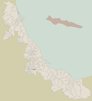
Coahuitlán is a municipality in the Mexican state of Veracruz. It is in the north zone of the state, about 120 km (75 mi) from Xalapa, the state capital. It has a surface of 95.41 km2 (36.84 sq mi). It is at 20°16′N97°43′W.
Cuichapa is a municipality in the Mexican state of Veracruz.
Jáltipan is a municipality in the Mexican state of Veracruz.
Juchique de Ferrer is a municipality in the Mexican state of Veracruz. It is located in the central zone of the state, about 259.10 km from the state capital Xalapa. It has a surface of 934.20 km2. It is located at 19°50′N96°42′W.
Maltrata is a municipality in the Mexican state of Veracruz. It is located in the central zone of the state, about 209 km from the state capital Xalapa. It has a surface of 132.43 km2. It is located at 18°49′N97°17′W.
Rafael Delgado, former known as San Juan del Rio, is a municipality located in the mountainous central zone of the Mexican state of Veracruz, about 140 km from the state capital Xalapa. It has an area of 39.48 square kilometres (15.24 sq mi).
Sochiapa is a municipality located in the central zone of the Mexican State of Veracruz, about 40 km from the state capital Xalapa. It has a surface of 21.39 km2. It is located at 19°12′N96°56′W.For decree of December 10, 1913 suprimió Sochiapa's municipality, passing its territory to form a part of that of Totutla; Later Sochiapa recovered its political category.
Soledad de Doblado is a municipality located in the semiarid zone of the center of the Mexican state of Veracruz, in the plains of the Sotavento of Veracruz, about 75 km from the state capital of Xalapa. It has a surface of 370.96 km2. It is located at 19°03′N96°25′W. On June 16, 1896, by Decree the town was named Soledad de Doblado, in honor of Manuel Doblado, who signed in this place, on February 19, 1862, the preliminary agreements with the representatives of England, Spain and France. By a decree of November 16, 1961 it rose to the category of city.
Tepatlaxco is a municipality located in the montane central zone in the Mexican state of Veracruz, about 55 km from the state capital Xalapa. It has a surface of 99.53 km2. It is located at 19°04′N96°51′W. During the 18th century he is named the people San Martín Ocotitlán, By decree of June 23, 1890 the limits were fixed between the municipalities of Tepatlaxco and Ixhuatlan.
Tequila Municipality is a municipality located in the montane central zone in the Mexican state of Veracruz, about 90 kilometres (56 mi) from the state capital Xalapa. It has an area of 74.85 km2 (28.90 sq mi). It is located at 18°43′N97°04′W.
Tlacotepec de Mejía is a municipality located in the montane central zone in the Mexican state of Veracruz, about 40 km from the state capital Xalapa. It has a surface of 90.48 km2. It is located at 19°12′N96°50′W.

Tlilapan is a municipality located in the central zone in the Mexican state of Veracruz, about 85 kilometres (53 mi) from the state capital of Xalapa. It has an area of 23.85 square kilometres (9.21 sq mi). It is located at 18°48′N97°06′W. The name comes from the Náhuatl language, meaning “Black creek ". The village has existed since the 16th century and, following national independence, and was designated a municipality along with Orizaba, San Andrés Tenejapan, San Francisco Necoxtla, and San Juan del Rio. The municipal cemetery was established in 1880 and, in 1916 the first Municipal President was named.
Totutla is a municipality located in the south zone in the Mexican state of Veracruz, about 40 km from the state capital Xalapa. It has an area of 80.61 km2. It is located at 19°13′N96°58′W. The name comes from the language Náhuatl, Toto-tlan; that means “Among the birds".