
Camerino Z. Mendoza Municipality is a municipality in the Mexican state of Veracruz. It is located about 85 km from state capital Xalapa. It has a surface of 37.84 km2. It is located at 18°48′N97°11′W.In 1898 there is established the head-board of Necoxtla's Municipality, in Santa Rosa; for decree of 1910 in village of Santa Rosa, it rises up to the category of Villa. Santa Rosa Necoxtla, in 1930, is named Camerino Z. Mendoza. By decree of November 5, 1932, the Municipality of Santa Rosa Necoxtla, it is named Camerino Z. Mendoza; the decree of July 4, 1933 raises to the political category of city, the Villa of Camerino Z. Mendoza.

Carlos A. Carrillo is a municipality in the Mexican state of Veracruz.
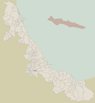
Chinampa de Gorostiza is a municipality in the Mexican state of Veracruz.
Chocamán is a municipality in the Mexican state of Veracruz. It is located about 146 km south of the Veracruz state capital Xalapa. It has an area of 41.13 km2. It is located at 19°01′N97°02′W.
Coahuitlán is a municipality in the Mexican state of Veracruz. It is in the north zone of the State of Veracruz, about 120 km (75 mi) from Xalapa, the state capital. It has a surface of 95.41 km2 (36.84 sq mi). It is at 20°16′N97°43′W.
Coatzintla is a municipality in the Mexican state of Veracruz. It is located in the north of state, about 120 kilometres (75 mi) from the state capital Xalapa. It covers an area of 235.25 square kilometres (90.83 sq mi). It is located at 20°29′N97°28′W.
Chinameca Municipality is a municipality in the Mexican state of Veracruz.
Coscomatepec is a municipality in Veracruz, Mexico. It is located in the mountainous central zone of the state, about 50 km from the state capital Xalapa. It has an area of 130.78 square kilometres (50.49 sq mi). It is located at 19°04′N97°03′W.
Coxquihui is a municipality in Veracruz, Mexico. It is located in montane central zone of the state, about 95 km from state capital Xalapa. It has a surface of 86.37 km2. It is located at 20°11′N97°35′W.

Coyutla is a municipality in Veracruz, Mexico. It is located in central zone of the State of Veracruz, about 110 km from state capital Xalapa. It has a surface of 312.56 km2. It is located at 20°15′N97°39′W.
Cuichapa is a municipality in Veracruz, Mexico.
Filomeno Mata is a town and municipality in Veracruz, Mexico. It is located in central zone of the state, about 298 km from state capital Xalapa. It has a surface of 62.51 km2. It is located at 20°12′N97°42′W.
Isla is a municipality in Veracruz, Mexico. It is located in south zone of the State of Veracruz, about 370 km from state capital Xalapa. It has a surface of 714.80 km2. It is located at 18°02′N95°32′W.
Ixhuatlancillo is in the central zone of the state of Veracruz, Mexico, about 165 km from state capital Xalapa. It has a surface of 39.48 km2 and is located at 18°54′N97°09′W.
Ixmatlahuacan is a municipality in the Mexican state of Veracruz. It is in south zone of Veracruz, about 175 km from the state capital Xalapa. It has an area of 335.59 km2. It is located at 18°27′N95°50′W. Ixmatlahuacan is delimited to the northeast by Acula, to the east by Amatitlán, to the south by Cosamaloapan, to the west by Tierra Blanca, and to the north by Ignacio de la Llave.
Mecatlán is a municipality in Veracruz, Mexico. It is located in the north zone of the State of Veracruz, about 327 km from state capital Xalapa. It has an area of 48.53 km2. It is located at 20°13′N97°41′W.
Oteapan is a Municipality in Veracruz, Mexico. It is in south-east zone of the State of Veracruz, about 394 km from state capital Xalapa. It has an area of 27.97 km2. It is located at 18°00′N94°40′W.
Tamalín is a municipality located in the north zone in the State of Veracruz. It has a surface of 417.85 km2. It is located at 21°20′N97°49′W. By Decree of November 13, 1875 there was raised in municipality Tamalín's congregation that concerned to Tantima's municipality.
Tancoco is a municipality located in the north zone in the State of Veracruz, about 210 km from state capital Xalapa. It has a surface of 145.59 km2. It is located at 21°17′N97°47′W. On the occasion of the development reached by the camp petroleum of Zacamixtle, the municipal head-board was moved to this place. For Decree of December 26, 1929 it returns to the village of Tancoco, its category of Municipality.
Tlaquilpa is a municipality located in the south zone in the State of Veracruz, about 105 km from the state capital of Xalapa. It has a surface of 58.40 km2. It is located at 18°36′N97°07′W. The name comes from Náhuatl, and means “Bricklayers' place". Tlaquilpa is a very ancient village, which existed before the Spanish conquest. In the 16th century, it came under Zongolica's jurisdiction, with the name of Santa Maria Magdalena. In 1831 it was constituted as a municipality. Tlaquilpa borders on Mixtla de Altamirano, Astacinga and Texhuacán.
