Sotavento Region

Last updated
Sotavento Region
Región del Sotavento
Region
Mexico Veracruz Sotavento Region location map.svg
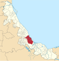
Sotavento Region in the State of Veracruz
CountryFlag of Mexico.svg  Mexico
State Veracruz
Largest city Veracruz
Municipalities
Area
  Total
3,960.69 km2 (1,529.23 sq mi)
  Rank8th
Lowest elevation0 m (0 ft)
Population
 (2020) [2] [a]
  Total
1,085,751
  Rank4th
  Density270/km2 (710/sq mi)
Time zone UTC−6 (CST)
  Summer (DST) UTC−5 (CDT)
Largest municipality by area

Sotavento Region is one of the regions of Veracruz, Mexico. [3] [4]

Contents

Geography

Sotavento Region lies on the southern Gulf Coastal Plain. Sotavento means leeward, and the region lies in the rain shadow of the coastal Sierra de Chiconquiaco, which makes it drier than the rest of Veracruz' coastal lowlands to the north and south. The Veracruz dry forests ecoregion covers much of the region. [5]

It is bounded on the northeast by the Gulf of Mexico, on the east and south by Papaloapan Region, on the west by Mountains Region, and on the north by Capital Region. [3]


Notes

  1. 1 2 Although public, some statistical information about Veracruz provided on the INEGI's website may not be conspicuously displayed and additional steps (query the database, download files) may be required to access it.

References

  1. Estudios Regionales Para la Planeación [Regional Studies for Plannings](PDF) (in Spanish), Xalapa: SEFIPLAN, 2020, p. 15, retrieved 2022-08-06
  2. 1 2 "México en cifras" (in Spanish). INEGI. 2021. Retrieved 2022-08-06.
  3. 1 2 "Veracruz de Ignacio de la Llave: Grado de marginación por municipio, 2005" (PDF). Conapo. Retrieved 31 January 2019.
  4. López-Balderas, Nayali (7 September 2014). "Seroprevalence of hepatitis viruses and risk factors in blood donors of Veracruz, Mexico". The Journal of Infection in Developing Countries. 9 (3): 274–282. doi: 10.3855/jidc.4812 . S2CID   2141145.
  5. "Veracruz dry forests". Terrestrial Ecoregions. World Wildlife Fund. Retrieved 2010-11-19.