McHenry, North Dakota

Last updated

McHenry, North Dakota
McHenry, North Dakota.jpg
McHenry in 2009
ND Foster County McHenry.svg
Location of McHenry, North Dakota
Coordinates: 47°34′35″N98°35′28″W / 47.57639°N 98.59111°W / 47.57639; -98.59111
CountryUnited States
State North Dakota
County Foster
Founded1899
Area
[1]
  Total0.25 sq mi (0.64 km2)
  Land0.25 sq mi (0.64 km2)
  Water0.00 sq mi (0.00 km2)
Elevation
[2]
1,506 ft (459 m)
Population
 (2020)
  Total64
  Density260.16/sq mi (100.36/km2)
Time zone UTC-6 (CST)
  Summer (DST) UTC-5 (CDT)
ZIP Code
58464
Area code 701
FIPS code 38-49260
GNIS feature ID1036142 [2]

McHenry is a city in Foster County, North Dakota, United States. The population was 64 at the 2020 census. [3] McHenry was founded in 1899.

Contents

Geography

According to the United States Census Bureau, the city has a total area of 0.26 square miles (0.67 km2), all land. [4]

Demographics

Historical population
CensusPop.Note
1910 398
1920 299−24.9%
1930 219−26.8%
1940 25014.2%
1950 189−24.4%
1960 155−18.0%
1970 152−1.9%
1980 113−25.7%
1990 85−24.8%
2000 71−16.5%
2010 56−21.1%
2020 6414.3%
2021 (est.)64 [5] 0.0%
U.S. Decennial Census [6]
2020 Census [3]

2010 census

As of the census of 2010, there were 56 people, 31 households, and 20 families residing in the city. The population density was 215.4 inhabitants per square mile (83.2/km2). There were 37 housing units at an average density of 142.3 per square mile (54.9/km2). The racial makeup of the city was 98.2% White and 1.8% from other races. Hispanic or Latino of any race were 1.8% of the population.

There were 31 households, of which 6.5% had children under the age of 18 living with them, 54.8% were married couples living together, 6.5% had a female householder with no husband present, 3.2% had a male householder with no wife present, and 35.5% were non-families. 29.0% of all households were made up of individuals, and 19.4% had someone living alone who was 65 years of age or older. The average household size was 1.81 and the average family size was 2.10.

The median age in the city was 71.3 years. 5.4% of residents were under the age of 18; 1.8% were between the ages of 18 and 24; 10.7% were from 25 to 44; 17.9% were from 45 to 64; and 64.3% were 65 years of age or older. The gender makeup of the city was 46.4% male and 53.6% female.

2000 census

As of the census of 2000, there were 71 people, 36 households, and 27 families residing in the city. The population density was 276.0 inhabitants per square mile (106.6/km2). There were 45 housing units at an average density of 174.9 per square mile (67.5/km2). The racial makeup of the city was 98.59% White, and 1.41% from two or more races. Hispanic or Latino of any race were 1.41% of the population.

There were 36 households, out of which 11.1% had children under the age of 18 living with them, 66.7% were married couples living together, 5.6% had a female householder with no husband present, and 25.0% were non-families. 22.2% of all households were made up of individuals, and 19.4% had someone living alone who was 65 years of age or older. The average household size was 1.97 and the average family size was 2.22.

In the city, the population was spread out, with 8.5% under the age of 18, 4.2% from 18 to 24, 12.7% from 25 to 44, 26.8% from 45 to 64, and 47.9% who were 65 years of age or older. The median age was 64 years. For every 100 females, there were 91.9 males. For every 100 females age 18 and over, there were 85.7 males.

The median income for a household in the city was $26,250, and the median income for a family was $27,813. Males had a median income of $57,917 versus $27,917 for females. The per capita income for the city was $14,702. There were 4.3% of families and 16.7% of the population living below the poverty line, including 100.0% of under eighteens and 5.4% of those over 64.

Climate

This climatic region is typified by large seasonal temperature differences, with warm to hot (and often humid) summers and cold (sometimes severely cold) winters. According to the Köppen Climate Classification system, McHenry has a humid continental climate, abbreviated "Dfb" on climate maps. [7]

Climate data for McHenry 3W, North Dakota (1991–2020 normals, extremes 1909–present)
MonthJanFebMarAprMayJunJulAugSepOctNovDecYear
Record high °F (°C)53
(12)
63
(17)
83
(28)
98
(37)
102
(39)
103
(39)
108
(42)
107
(42)
104
(40)
94
(34)
76
(24)
66
(19)
108
(42)
Average high °F (°C)16.6
(−8.6)
21.4
(−5.9)
34.4
(1.3)
52.0
(11.1)
66.5
(19.2)
75.7
(24.3)
80.8
(27.1)
79.8
(26.6)
70.7
(21.5)
54.3
(12.4)
36.3
(2.4)
21.9
(−5.6)
50.9
(10.5)
Daily mean °F (°C)7.6
(−13.6)
12.0
(−11.1)
25.1
(−3.8)
40.8
(4.9)
54.5
(12.5)
64.6
(18.1)
69.3
(20.7)
67.7
(19.8)
58.5
(14.7)
43.6
(6.4)
27.5
(−2.5)
13.9
(−10.1)
40.4
(4.7)
Average low °F (°C)−1.3
(−18.5)
2.6
(−16.3)
15.7
(−9.1)
29.7
(−1.3)
42.4
(5.8)
53.5
(11.9)
57.8
(14.3)
56.6
(13.7)
46.4
(8.0)
32.9
(0.5)
18.8
(−7.3)
5.8
(−14.6)
30.0
(−1.1)
Record low °F (°C)−45
(−43)
−44
(−42)
−36
(−38)
−13
(−25)
11
(−12)
19
(−7)
35
(2)
28
(−2)
12
(−11)
−5
(−21)
−29
(−34)
−42
(−41)
−45
(−43)
Average precipitation inches (mm)0.55
(14)
0.48
(12)
0.83
(21)
1.20
(30)
2.73
(69)
3.55
(90)
3.64
(92)
2.55
(65)
2.11
(54)
1.81
(46)
0.88
(22)
0.81
(21)
21.14
(537)
Average snowfall inches (cm)11.4
(29)
9.4
(24)
8.2
(21)
4.3
(11)
0.9
(2.3)
0.0
(0.0)
0.0
(0.0)
0.0
(0.0)
0.0
(0.0)
2.5
(6.4)
8.8
(22)
14.3
(36)
59.8
(152)
Average precipitation days (≥ 0.01 in)6.45.85.46.38.710.19.27.96.96.85.56.985.9
Average snowy days (≥ 0.1 in)6.25.33.71.70.30.00.00.00.11.24.17.229.8
Source: NOAA [8] [9]

See also

Related Research Articles

<span class="mw-page-title-main">Hettinger, North Dakota</span> City in North Dakota, United States

Hettinger is a city in, and the county seat of, Adams County, North Dakota, United States. The population was 1,074 at the 2020 census.

<span class="mw-page-title-main">Rogers, North Dakota</span> City in North Dakota, United States

Rogers is a city in Barnes County, North Dakota, United States. The population was 49 at the 2020 census. Rogers was founded in 1897.

<span class="mw-page-title-main">Warwick, North Dakota</span> City in North Dakota, United States

Warwick is a city in Benson County, North Dakota, United States. The population was 55 at the 2020 census. Warwick was founded in 1907.

<span class="mw-page-title-main">Lansford, North Dakota</span> City in North Dakota, United States

Lansford is a city in Bottineau County, North Dakota, United States. The population was 238 at the 2020 census. Lansford was founded in 1903.

<span class="mw-page-title-main">Bantry, North Dakota</span> City in North Dakota, United States

Bantry is a city in McHenry County, North Dakota, United States. The population was 6 at the 2020 census. It is part of the Minot Micropolitan Statistical Area. Bantry was founded in 1905. Bantry was founded by Irish settlers. The City of Bantry dissolved in November 2019 and the area reverted to Bantry township.

<span class="mw-page-title-main">Deering, North Dakota</span> City in North Dakota, United States

Deering is a city in McHenry County, North Dakota, United States. The population was 94 at the 2020 census. It is part of the Minot Micropolitan Statistical Area. Deering was founded in 1903.

<span class="mw-page-title-main">Karlsruhe, North Dakota</span> City in North Dakota, United States

Karlsruhe is a city in McHenry County, North Dakota, United States. The population was 87 at the 2020 census. Karlsruhe was founded in 1912.

<span class="mw-page-title-main">Towner, North Dakota</span> City in North Dakota, United States

Towner is a city in McHenry County, North Dakota. It is the county seat of McHenry County. The population was 479 at the time of the 2020 census. It is part of the Minot Micropolitan Statistical Area. Towner was founded in 1886.

<span class="mw-page-title-main">Upham, North Dakota</span> City in North Dakota, United States

Upham is a city in McHenry County, North Dakota, United States. The population was 135 at the 2020 census. It is part of the Minot Micropolitan Statistical Area. Upham was founded in 1905.

<span class="mw-page-title-main">Wishek, North Dakota</span> City in North Dakota, United States

Wishek is a city in McIntosh County, North Dakota, United States. The population was 864 at the 2020 census.

<span class="mw-page-title-main">Alexander, North Dakota</span> City in North Dakota, United States

Alexander is a city in McKenzie County, North Dakota, United States. The population was 319 at the 2020 census. Alexander was founded in 1905 and is named after early North Dakota politician Alexander McKenzie.

<span class="mw-page-title-main">McVille, North Dakota</span> City in North Dakota, United States

McVille is a city in Nelson County, North Dakota, United States. The population was 392 at the 2020 census. McVille was founded in 1906.

<span class="mw-page-title-main">McClusky, North Dakota</span> City in North Dakota, United States

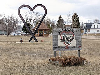
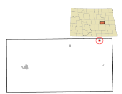
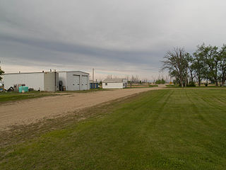
McClusky is a city in Sheridan County, North Dakota, United States. It is the county seat of Sheridan County. The population was 322 at the 2020 census. McClusky was founded in 1905. It is the closest town to the geographical center of North Dakota, which lies approximately five miles to the southwest.

<span class="mw-page-title-main">Pingree, North Dakota</span> City in North Dakota, United States

Pingree is a city in Stutsman County, North Dakota, United States. The population was 41 at the 2020 census. Pingree was founded in 1882.

<span class="mw-page-title-main">Hansboro, North Dakota</span> City in North Dakota, United States

Hansboro is a city in Towner County, North Dakota, United States. The population was 15 at the 2020 census.

<span class="mw-page-title-main">Park River, North Dakota</span> City in North Dakota, United States

Park River is a city in Walsh County, North Dakota, United States. The population was 1,424 at the 2020 census. Park River was founded in 1884.

<span class="mw-page-title-main">Chamberlain, South Dakota</span> City in South Dakota, United States

Chamberlain is a city in Brule County, South Dakota, United States. It is located on the east bank of the Missouri River, at the dammed section of the Lake Francis Case, close to where it is crossed by Interstate 90.

<span class="mw-page-title-main">Wagner, South Dakota</span> City in South Dakota, United States

Wagner is a city in Charles Mix County, South Dakota, United States. The population was 1,490 at the 2020 census. The city is served by Wagner Municipal Airport as well as YST Transit buses.

<span class="mw-page-title-main">Alexandria, South Dakota</span> City in South Dakota, United States

Alexandria is a city in central Hanson County, South Dakota, United States. The population was 649 at the 2020 census. It is the county seat of Hanson County.

<span class="mw-page-title-main">Parkston, South Dakota</span> City in South Dakota, United States

Parkston is a city in Hutchinson County, South Dakota, United States. The population was 1,567 at the 2020 census.

References

  1. "ArcGIS REST Services Directory". United States Census Bureau. Retrieved September 20, 2022.
  2. 1 2 U.S. Geological Survey Geographic Names Information System: McHenry, North Dakota
  3. 1 2 "Explore Census Data". United States Census Bureau . Retrieved July 21, 2022.
  4. "US Gazetteer files 2010". United States Census Bureau. Archived from the original on January 12, 2012. Retrieved June 14, 2012.
  5. "City and Town Population Totals: 2020-2021". United States Census Bureau. July 21, 2022. Retrieved July 21, 2022.
  6. United States Census Bureau. "Census of Population and Housing" . Retrieved February 12, 2014.
  7. Climate Summary for McHenry, North Dakota
  8. "NowData - NOAA Online Weather Data". National Oceanic and Atmospheric Administration. Retrieved September 18, 2021.
  9. "Station: Mc Henry 3W, ND". U.S. Climate Normals 2020: U.S. Monthly Climate Normals (1991-2020). National Oceanic and Atmospheric Administration. Retrieved September 18, 2021.