McVille, North Dakota

Last updated

McVille, North Dakota
McVille, North Dakota - 6184511751.jpg
McVille
Motto(s): 
"Small enough to know you, yet large enough to serve you"
ND Nelson County McVille.svg
Location of McVille, North Dakota
Coordinates: 47°45′55″N98°10′32″W / 47.76528°N 98.17556°W / 47.76528; -98.17556
CountryUnited States
State North Dakota
County Nelson
Founded1906
Area
[1]
  Total1.50 sq mi (3.89 km2)
  Land1.44 sq mi (3.72 km2)
  Water0.07 sq mi (0.17 km2)
Elevation
[2]
1,470 ft (448 m)
Population
 (2020) [3]
  Total392
  Estimate 
(2022) [4]
380
  Density272.98/sq mi (105.37/km2)
Time zone UTC-6 (Central (CST))
  Summer (DST) UTC-5 (CDT)
ZIP code
58254
Area code 701
FIPS code 38-49580
GNIS feature ID1036143 [2]
Website mcville.com

McVille is a city in Nelson County, North Dakota, United States. The population was 392 at the 2020 census. [3] McVille was founded in 1906.

Contents

History

McVille was founded in 1906 after the railroad was established as a continuation from Aneta, North Dakota. McVille was founded by the McDougall family. The town was so named because many of the early residents in the area had last names starting with "Mc".

The original town was a few miles away from its present location. With the advancement of the railroad system, the town was moved.

Prominent early businesses included an elevator, a bank, a blacksmith shop, and a general store.

Geography

According to the United States Census Bureau, the city has an area of 1.51 square miles (3.91 km2), of which 1.44 square miles (3.73 km2) is land and 0.07 square miles (0.18 km2) is water. [5]

Demographics

Historical population
CensusPop.Note
1910 310
1920 54676.1%
1930 513−6.0%
1940 5486.8%
1950 62614.2%
1960 551−12.0%
1970 5835.8%
1980 6267.4%
1990 559−10.7%
2000 470−15.9%
2010 349−25.7%
2020 39212.3%
2022 (est.)380 [4] −3.1%
U.S. Decennial Census [6]
2020 Census [3]

2010 census

As of the census of 2010, there were 349 people, 190 households, and 95 families residing in the city. The population density was 242.4 inhabitants per square mile (93.6/km2). There were 247 housing units at an average density of 171.5 per square mile (66.2/km2). The racial makeup of the city was 98.3% White, 0.3% African American, and 1.4% from two or more races. Hispanic or Latino of any race were 0.3% of the population.

There were 190 households, of which 16.3% had children under the age of 18 living with them, 42.1% were married couples living together, 6.3% had a female householder with no husband present, 1.6% had a male householder with no wife present, and 50.0% were non-families. 47.4% of all households were made up of individuals, and 24.2% had someone living alone who was 65 years of age or older. The average household size was 1.84 and the average family size was 2.59.

The median age in the city was 52.9 years. 15.2% of residents were under the age of 18; 4.6% were between the ages of 18 and 24; 17.5% were from 25 to 44; 35.3% were from 45 to 64; and 27.5% were 65 years of age or older. The gender makeup of the city was 47.0% male and 53.0% female.

2000 census

As of the census of 2000, there were 470 people, 217 households, and 106 families residing in the city. The population density was 326.9 inhabitants per square mile (126.2/km2). There were 266 housing units at an average density of 185.0 per square mile (71.4/km2). The racial makeup of the city was 100.00% White.

There were 217 households, out of which 20.3% had children under the age of 18 living with them, 41.9% were married couples living together, 6.9% had a female householder with no husband present, and 50.7% were non-families. 49.3% of all households were made up of individuals, and 27.6% had someone living alone who was 65 years of age or older. The average household size was 1.95 and the average family size was 2.82.

In the city, the population was spread out, with 18.9% under the age of 18, 3.4% from 18 to 24, 16.4% from 25 to 44, 24.0% from 45 to 64, and 37.2% who were 65 years of age or older. The median age was 52 years. For every 100 females, there were 83.6 males. For every 100 females age 18 and over, there were 83.2 males.

The median income for a household in the city was $21,818, and the median income for a family was $36,250. Males had a median income of $24,531 versus $22,083 for females. The per capita income for the city was $19,776. About 11.9% of families and 16.7% of the population were below the poverty line, including 26.4% of those under age 18 and 12.3% of those age 65 or over.

Climate

This climatic region is typified by large seasonal temperature differences, with warm to hot (and often humid) summers and cold (sometimes severely cold) winters. According to the Köppen Climate Classification system, McVille has a humid continental climate, abbreviated "Dfb" on climate maps. [7]

Related Research Articles

<span class="mw-page-title-main">Hague, North Dakota</span> City in Emmons County, North Dakota, United States

Hague is a city in Emmons County, North Dakota, United States. The population was 70 at the 2020 census. Hague was founded in 1902.

<span class="mw-page-title-main">McHenry, North Dakota</span> City in North Dakota, United States

McHenry is a city in Foster County, North Dakota, United States. The population was 64 at the 2020 census. McHenry was founded in 1899.

<span class="mw-page-title-main">Jud, North Dakota</span> City in North Dakota, United States

Jud is a rural hamlet in LaMoure County, North Dakota, United States. The population was 65 at the 2020 census. Jud was founded in 1904 and named for county settler Judson LaMoure. It is located along unpaved 61st Street SE, 9 miles (14 km) west of U.S. Route 281 and 25 miles (40 km) south of Interstate 94 in the midst of settled farmland and open plains.

<span class="mw-page-title-main">Wishek, North Dakota</span> City in North Dakota, United States

Wishek is a city in McIntosh County, North Dakota, United States. The population was 864 at the 2020 census.

<span class="mw-page-title-main">Mercer, North Dakota</span> City in North Dakota, United States

Mercer is a city in McLean County, North Dakota, United States. The population was 88 at the 2020 census.

<span class="mw-page-title-main">Washburn, North Dakota</span> City in North Dakota, United States

Washburn is a city in southern McLean County, North Dakota, United States. Located along the upper Missouri River, it is the county seat of McLean County. The population was 1,300 at the 2020 census.

<span class="mw-page-title-main">Montpelier, North Dakota</span> City in North Dakota, United States

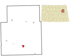
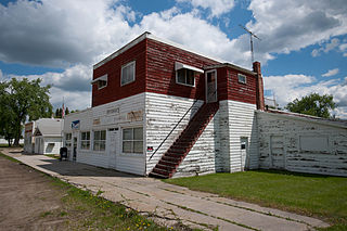
Montpelier is a city in Stutsman County, North Dakota, United States. The population was 85 at the 2020 census. Montpelier was founded in 1885.

<span class="mw-page-title-main">Park River, North Dakota</span> City in North Dakota, United States

Park River is a city in Walsh County, North Dakota, United States. The population was 1,424 at the 2020 census. Park River was founded in 1884.

<span class="mw-page-title-main">White, South Dakota</span> City in South Dakota, United States

White is a city in Brookings County, South Dakota, United States. The population was 537 at the 2020 census.

<span class="mw-page-title-main">Wagner, South Dakota</span> City in South Dakota, United States

Wagner is a city in Charles Mix County, South Dakota, United States. The population was 1,490 at the 2020 census. The city is served by Wagner Municipal Airport as well as YST Transit buses.

<span class="mw-page-title-main">McLaughlin, South Dakota</span> City in South Dakota, United States

McLaughlin is a city in northeastern Corson County, South Dakota, United States. The population was 663 at the 2010 census. It is the largest city on the Standing Rock Indian Reservation. Most Lakȟóta speakers refer to the town as Makáȟleča or Matȟó Akíčita.

<span class="mw-page-title-main">Faulkton, South Dakota</span> City in South Dakota, United States

Faulkton is a city in and county seat of Faulk County, South Dakota, United States. The population was 826 at the 2020 census. The city's nickname is "The Carousel City".

<span class="mw-page-title-main">Alexandria, South Dakota</span> City in South Dakota, United States

Alexandria is a city in central Hanson County, South Dakota, United States. The population was 649 at the 2020 census. It is the county seat of Hanson County.

<span class="mw-page-title-main">Parkston, South Dakota</span> City in South Dakota, United States

Parkston is a city in Hutchinson County, South Dakota, United States. The population was 1,567 at the 2020 census.

<span class="mw-page-title-main">Leola, South Dakota</span> City in South Dakota, United States

Leola is a small city in, and the county seat of, McPherson County, South Dakota, United States. It was founded on May 1, 1884, and named for Leola Haynes, daughter of one of the town's founders. The population was 434 as of the 2020 census.

<span class="mw-page-title-main">Crooks, South Dakota</span> City in South Dakota, United States

Crooks is a city in Minnehaha County, South Dakota, United States and is a suburb of Sioux Falls. The population was 1,362 at the 2020 census. Crooks was named New Hope until 1904. The town's present name honors W. A. Crooks, a local politician.

<span class="mw-page-title-main">Garretson, South Dakota</span> City in South Dakota, United States

Garretson is a city in Minnehaha County, South Dakota, United States. The city had a population of 1,228 at the 2020 census.

<span class="mw-page-title-main">Hartford, South Dakota</span> City in South Dakota, United States

Hartford is a suburban American city in Minnehaha County, South Dakota, a few miles northwest of Sioux Falls. Its population was 3,354 at the 2020 census.

<span class="mw-page-title-main">Woonsocket, South Dakota</span> City in South Dakota, United States

Woonsocket is a city in Sanborn County, South Dakota. The population was 631 at the 2020 census. It is the county seat of Sanborn County.

<span class="mw-page-title-main">Lehr, North Dakota</span> City in North Dakota, United States

Lehr is a city in Logan and McIntosh counties in the State of North Dakota. The population was 81 at the 2020 census. Lehr was founded in 1898.

References

  1. "ArcGIS REST Services Directory". United States Census Bureau. Retrieved September 20, 2022.
  2. 1 2 U.S. Geological Survey Geographic Names Information System: McVille, North Dakota
  3. 1 2 3 "Explore Census Data". United States Census Bureau . Retrieved October 17, 2023.
  4. 1 2 "City and Town Population Totals: 2020-2022". United States Census Bureau. October 17, 2023. Retrieved October 17, 2023.
  5. "US Gazetteer files 2010". United States Census Bureau. Archived from the original on January 12, 2012. Retrieved June 14, 2012.
  6. United States Census Bureau. "Census of Population and Housing" . Retrieved February 15, 2014.
  7. Climate Summary for McVille, North Dakota