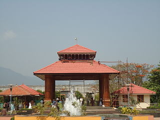
Palakkad District is one of the 14 districts of the Indian state of Kerala. Also, it is the largest district in Kerala from 2006. The city of Palakkad is the district headquarters. Palakkad is bordered on the northwest by the Malappuram District, on the southwest by the Thrissur District, on the northeast by The Nilgiris District, and on the east by Coimbatore district of Tamil Nadu. The district is 24.4% urbanized according to the census of 2011. The district is nicknamed "the granary of Kerala" and "Rice bowl of Kerala".

Idukki is one of the 14 districts of Kerala state, India, created on 26 January 1972 bifurcating Kottayam District. At that time, the district headquarters was at Kottayam. In June 1976 it was moved to Painavu. Idukki lies in the Western Ghats of Kerala. Idukki is the second largest district in area but has the lowest population density. Idukki has a vast forest reserve area; more than a half of the district is covered by forests. The urban areas are densely populated whereas villages are sparsely populated. Idukki is also known as the spice garden of Kerala.

Kakkayur is a small village between Koduvayur, Pallavur and Kunisseri in Palakkad district of Kerala state, south India. Kakkayur is on the Palakkad Nemmara route about 13 km from Palakkad town. It is part of Koduvayur Grama Panchayat. The population is around 8500 and the literacy of the village stands at 86.3%.
Alathur is a town and gram panchayat in the Palakkad District, state of Kerala, India. It is the headquarters of the Alathur Taluk and is situated at the south west end of the district 24 km from the district headquarters at Palakkad. Alathur Taluk is predominantly rural and has an agricultural economy.It is located along the Coimbatore-Cochin national highway NH 47. Gayathripuzha, a tributary of Bharathapuzha, flows through Alathur.
Erimayur is a gram panchayat in the Palakkad district, state of Kerala, India. It is a local government organization that serves the villages of Erimayur-I and Erimayur-II.
Kizhakkancherry is a gram panchayat in the Palakkad district, state of Kerala, India. It is a local government organisation that serves the villages of Kizhakkencheri-I and Kizhakkencheri-II. It was formed in the year of 1951 and is the fourth largest grama panchayath in Kerala. It covers an area of 112.56 km2 and comprises 22 wards. The boundaries are Vadakkencherry (north), Pananjeri (south), Vandazhy (east) and Kannambra (west). The village is located 37.4 km from the city of Palakkad and 34.9 km from Thrissur.

Palakkadpronunciation (help·info), also known as Palghat, is a city and municipality in the state of Kerala in southern India, spread over an area of 26.60 km2 and is the administrative headquarters of the Palakkad District. The city is situated about 350 kilometres (217 mi) north of state capital Thiruvananthapuram and 54 kilometers south west of Coimbatore, and 66 km north east of Thrissur on the Salem-Kanyakumari National Highway NH 47.

Cherpulassery is a town and municipality in the Palakkad district, Kerala, South India. It is home to the Sabarimala temple of Malabar and the Puthanalakkal Bhagavathi Temple.
Ulikkal is a growing town in Kannur District in Kerala. It is the HQ of Ulikkal Panchayath in Iritty Taluk. The town is surrounded by small villages. The people of this area are very adaptable and amicable, who live in harmony, irrespective of religion or culture. Kerala State Hill highway (SH59) passes through Ulikkal.

Panniyannur is a census town in Talassery taluk of Kannur district in the Indian state of Kerala. It is part of Greater Mahé Region.
Chittilamchery is a village in the Palakkad district of Kerala. It is under the administration of the Melarcode Panchayath in the Alathur Taluk.

Ezhome is a village in Kannur district in the Indian state of Kerala. At the 2001 Census of India, Ezhome had a population of 18,479 with 8,710 males and 9,769 females.
Mangalpady is a Panchayath in Kasaragod district, Kerala. Uppala is the major town in this panchayat.
Karakurussi is a village in the Palakkad district, state of Kerala, India. It is administered by its own gram panchayat
Palakkayam is a village in the Palakkad district, state of Kerala, India. It is administrated by the Thachampara grama panchayath. Palakkayam is about 16 km from Siruvani Dam Eco tourism spot, connected to Edakkurussi on Palakkad-Kozhikode National Highway about 33 km from Palakkad and 120 km from Kozhikode. Kanjirapuzha Dam, a masonry earth dam built for providing irrigation is located is located about 6 km from Palakkayam. The nearest airport is Coimbatore, about 100 km and nearest Rly Stn is Palakkad Jn, about 30 km.the nearest hospital assumption hospital kanjirapuzha.nearest school carmel hss palakkayam.
Thiruvazhiyad is a village in Palakkad district in the state of Kerala, India. It forms a part of the Ayiloor gram panchayat.
Nemmara is a gram panchayat in the Palakkad district, state of Kerala, India. It is the local government organisation that serves the villages of Nemmara and Vallanghy. It is also an intermediate panchayat, subordinate to the Palakkad zilla panchayat.
Agali is a small town in Palakkad district in the state of Kerala, India. It forms a part of the Agali gram panchayat.

Chapparapadavu is a village (panchayath) in Kannur district in the Indian state of Kerala. The villages of Koovery, Kottakkanam, and Therandi are part of the panchayath. Chapparapadavu has 14,883 people. Board of Members of the Grama Panchayat, Chapparapadava during 1987-95 Ward 1 Kariyil Narayanan Ward 2. I Damodaran Master 3. M Assainar Haji 4. C P Safiya 5. P Kunhiraman 6. V P Kunhiraman 7. E Kunhiraman 8. Mary Thomas Poovanpuzha 9.V J Chacko Master 10.K Madhavan Master 11. T.C Sebastian.

Ambalapara is a gram panchayat in the Palakkad district, state of Kerala, India. It is the local government organisation that serves the villages of Ambalapara-I and Ambalapara-II, and forms a part of the Ottappallam taluk.


