Mid-City, Los Angeles

Last updated
Mid-City
Mid-Citysignage1.jpg
Mid-City signage located at the intersection of
La Brea Avenue and the Santa Monica Freeway
Location map Western Los Angeles.png
Red pog.svg
Mid-City
Location within Los Angeles
Coordinates: 34°02′30″N118°21′20″W / 34.0418°N 118.3555°W / 34.0418; -118.3555 Coordinates: 34°02′30″N118°21′20″W / 34.0418°N 118.3555°W / 34.0418; -118.3555
Country Flag of the United States.svg  United States of America
State Flag of California.svg  California
County Flag of Los Angeles County, California.svg Los Angeles
Time zone Pacific
Zip Code
90016 & 90019
Area code(s) 323

Mid-City is a neighborhood in Central Los Angeles, California.

Contents

Attractions include restaurants and a post office named for singer Ray Charles, who had his recording studio in Mid-City. The neighborhood hosts eleven public and private schools. The K Line from north-south is proposed to serve this area.

Geography

City of Los Angeles boundaries

The City of Los Angeles Department of Transportation has posted Mid-City signage [1] to mark the area. City installed signs are at the following intersections (from east to west): Hoover Street and Washington Boulevard, Vermont Avenue and Pico Boulevard, Western Avenue and Pico Boulevard, Normandie Avenue and the Santa Monica Freeway, and La Brea Avenue and the Santa Monica Freeway.

Google Maps

Google Maps outlines an area labeled “Mid-City” that roughly runs from Hoover Street on the east to La Cienega Boulevard and Robertson Boulevard on the west. The north is roughly bordered by Olympic Boulevard, and the Santa Monica Freeway is on the south. [2] [lower-alpha 1]

Mapping L.A. boundaries

The Mapping L.A. project of the Los Angeles Times states as follows:

Mid-City is bounded on the north by Pico Boulevard, on the east by Crenshaw Boulevard, on the south by the Santa Monica Freeway, on the southwest by Washington and National boulevards, on the west by Robertson Boulevard and on the northwest by Cadillac Avenue and La Cienega Boulevard. [3] [4] [5] [6]

It is flanked by Carthay and Mid-Wilshire to the north, Arlington Heights to the east, Culver City and West Adams to the south, Palms to the southwest, Beverlywood to the west and Pico-Robertson to the northwest.

Map of Mid-City as delineated by the Los Angeles Times Map of Mid-City, Los Angeles, California.png
Map of Mid-City as delineated by the Los Angeles Times

Population

The Holmes-Shannon House in Victoria Park was built in 1911. Holmes-Shannon House.jpg
The Holmes-Shannon House in Victoria Park was built in 1911.
Apartment building at San Vicente and Pico boulevards Green and white Los Angeles apartments.jpg
Apartment building at San Vicente and Pico boulevards

The 2000 U.S. census counted 52,197 residents in the 3.47-square-mile neighborhood—an average of 15,051 people per square mile, among the highest population densities in Los Angeles County. In 2008, the city estimated that the population had increased to 55,016. The median age for residents was 31, about average for both the city and the county. [5]

Mid-City was said to be "highly diverse" when compared to the city at large, with a diversity index of 0.637. The ethnic breakdown in 2000 was: Latinos, 45.2%; blacks, 38.3%; whites, 9.5%; Asians, 3.9%; and others, 3.1%. Mexico (46) and El Salvador (15.6%) were the most common places of birth for the 35.1% of the residents who were born abroad, a figure that was considered average for the city and county. [5]

The median household income in 2008 dollars was $43,711, considered average for the city. The percentage of households earning $20,000 or less was high, compared to the county at large. The average household size of 2.8 people was just about average for Los Angeles. Renters occupied 68.9% of the housing units, and home- or apartment owners the rest. [5]

The percentages of never-married men (43.2%) and never-married women (35%) were among the county's highest. The census found 2,748 families headed by single parents, the 23.4% rate being considered high for both the city and the county. [5]

Enclaves

Smaller neighborhoods within Mid-City include:

Transportation

Crenshaw Corridor and regional setting. dashed lines represent possible extensions or alignments Click to enlarge. WestsideMetro.svg
Crenshaw Corridor and regional setting. dashed lines represent possible extensions or alignments Click to enlarge.

Electric railways (-1960s)

Mid-City was a key junction and terminus in the days of the electric railways from the early 1900s through the end of service in the 1963.

The Rimpau Loop in Mid-City was an important terminus of the Los Angeles Railway ("Yellow Cars") streetcars. The Pico Blvd. city streetcar line "P" turned around here in the Rimpau Loop. [8] From here, Santa Monica city buses ran to Downtown Santa Monica, and to this day, Pico and Rimpau is the terminus for several Santa Monica Transit lines. [9]

Vineyard Junction in Mid-City was where Pacific Electric "Red Car" lines converged. The lines ran from Downtown Los Angeles south to Venice Boulevard, then West along Venice to Vineyard Junction. From here they went along Venice Blvd. to Venice and Redondo Beach; while others went along San Vicente Blvd. northwest toward what is now West Hollywood as well as via Beverly Hills to Santa Monica. It was the site of an accident on July 13, 1913, in which two wooden streetcars crashed into each other, with 14 people dead and 200 people injured. As a result, the Pacific Electric ordered its future cars to be made of steel, and it was recommended that signaling be introduced on the PE's lines. [10]

Today

As part of their long-range plans, the Los Angeles County MTA has proposed an extension of the K Line, which would place a rail transit station in Mid-City. The proposed rail stop is at the intersection of Pico and San Vicente Boulevards—site of the old Vineyard Junction.

The old Vineyard Junction site is now occupied by the end terminal for the Santa Monica Big Blue Bus.

The K Line would allow Mid-City residents to easy access to the city's east/west rail lines: the D Line along Wilshire Boulevard, the E Line from Downtown Los Angeles to Downtown Santa Monica, and the C Line from Norwalk to Redondo Beach and soon near LAX.

Currently, the Mid-City alignment is unfunded and part of the K Line's Crenshaw Northern Extension Rail Project.

DASH Midtown serves the Mid-City area.

Landmarks and attractions

Oki's Dog on Pico Blvd. Oki's Dog Pico, Los Angeles.jpg
Oki's Dog on Pico Blvd.

Parks and recreation

Education

Mid-city residents aged 25 and older holding a four-year degree amounted to 16.8% of the population in 2000, about average for both the city and the county. [5]

These are the elementary or secondary schools within the neighborhood's boundaries: [5]

Alexander Hamilton High School Hamilton High School LAUSD Entrance.jpg
Alexander Hamilton High School

The Los Angeles Unified School District (LAUSD) operates public schools:

Community Magnet School, an arts and humanities magnet primary school, was located in Mid-City since its founding in 1977, [19] [20] for a period of around 25 years. It had been located in an area within the Los Angeles Center for Enriched Studies campus. [19] By October 2002, Community Magnet had moved to its new location in Bel-Air. [21]

Previously the community was home to the Open Magnet Charter School, which was located on the campus of the Crescent Heights School. The Open school later moved to Westchester. [19] Current charter school includes Stella Middle Charter Academy

Notable residents

Related Research Articles

Hollywood Neighborhood in Los Angeles, California, United States

Hollywood is a neighborhood in the central region of Los Angeles, California. Its name has come to be a shorthand reference for the U.S. film industry and the people associated with it. Many of its studios such as Columbia Pictures, Disney, Paramount Pictures, Warner Bros., and Universal Pictures were founded there; Paramount still has its studios there.

Koreatown, Los Angeles Neighborhood of Los Angeles in California, United States

Koreatown is a neighborhood in central Los Angeles, California, centered near Eighth Street and Irolo Street.

Palms, Los Angeles Neighborhood of Los Angeles in County of Los Angeles, California, United States

Palms is a highly diverse, densely populated community in the Westside region of Los Angeles, California, founded in 1886 and the oldest neighborhood annexed to the city, in 1915. The 1886 tract was marketed as an agricultural and vacation community. Today it is a primarily residential area, with many apartment buildings, ribbons of commercial zoning and a single-family residential area in its northwest corner.

North Hills, known previously as Sepulveda, is a neighborhood in the San Fernando Valley region of the City of Los Angeles.

Beverlywood is a neighborhood in the Westside of the city of Los Angeles, California.

Mar Vista, Los Angeles Neighborhood of Los Angeles in California, United States of America

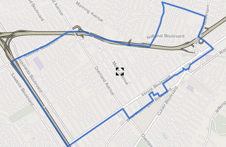
Mar Vista is a neighborhood on the Westside of Los Angeles, California. In 1927, Mar Vista became the 70th community to be annexed to Los Angeles. It was designated as an official city neighborhood in 2006.

Pico-Union, Los Angeles Neighborhood of Los Angeles in California, United States of America

Pico-Union is a neighborhood in Central Los Angeles, California. The name "Pico-Union" refers to the neighborhood that surrounds the intersection of Pico Boulevard and Union Avenue. Located immediately west of Downtown Los Angeles, it is home to over 40,000 residents.

West Los Angeles is an area within the city of Los Angeles, California. The residential and commercial neighborhood is divided by the Interstate 405 freeway, and each side is sometimes treated as a distinct neighborhood, mapped differently by different sources. Each lies within the larger Westside region of Los Angeles County.

West Adams, Los Angeles Neighborhood of Los Angeles in California, United States

West Adams is a historic neighborhood in the South Los Angeles region of Los Angeles, California. The area is known for its large number of historic buildings, structures and notable houses and mansions throughout Los Angeles. It is a youthful, densely populated area with a high percentage of African American and Latino residents. The neighborhood has several public and private schools.

Carthay is a half-square-mile neighborhood in Central Los Angeles, California. It contains Carthay Circle, Carthay Square and South Carthay. There are three Los Angeles Historic Preservation Overlay Zones in Carthay.

Faircrest Heights, Los Angeles Neighborhood of Los Angeles in California, United States of America

Faircrest Heights is a neighborhood in Mid-City, Los Angeles, California.

Arlington Heights, Los Angeles Neighborhood of Los Angeles in California, United States

Arlington Heights is a neighborhood in Central Los Angeles, California.

San Vicente Boulevard Street in Western Los Angeles running southeast of Beverly Hills, United States

San Vicente Boulevard is a major northwest-southeast thoroughfare located in the western portion of the metropolitan area of Los Angeles, CA.

Pico Boulevard is a major Los Angeles street that runs from the Pacific Ocean at Appian Way in Santa Monica to Central Avenue in Downtown Los Angeles, California, USA. It is named after Pío Pico, the last Mexican governor of Alta California.

The western border of Santa Monica, California is the 3-mile (4.8 km) stretch of Santa Monica Bay. On its other sides, the city is bordered by various districts of Los Angeles: the northwestern border is Pacific Palisades, the eastern border is Brentwood north of Wilshire Boulevard and West Los Angeles south of Wilshire, the northeastern border is generally San Vicente Boulevard up to the Riviera Country Club, the southwestern border is Venice Beach and the southern border is with West Los Angeles and Mar Vista.

University Park, Los Angeles Neighborhood of Los Angeles in California, United States

University Park is a 1.17 square miles (3.0 km2) neighborhood in the South Los Angeles region of Los Angeles, California. It is the home of the University of Southern California (USC), Mount St. Mary's College and Hebrew Union College. Additionally, the neighborhood is the home of the historic Shrine Auditorium.

Pico-Robertson

Pico-Robertson is a relatively densely-populated neighborhood in the Westside of Los Angeles, California, flanked on the north, northeast, and west Beverly Hills, on the east by Carthay and Mid-City, on the south by Mid-City, Beverlywood and Cheviot Hills. It is notable for its large Jewish population.

Los Angeles City Council District 10 American legislative district

Los Angeles City Council District 10 is one of the 15 districts of the Los Angeles City Council.

Angelus Vista, Los Angeles Neighborhood of Los Angeles in California, United States

Angelus Vista is a neighborhood in Los Angeles, California.

Pico/Rimpau is an area of Mid-City, Los Angeles, at the junction of Pico Boulevard, Rimpau Street, San Vicente Boulevard, Venice Boulevard, Vineyard Boulevard and West Boulevard. This area is the location of several key former and current transportation hubs and retail shopping centers for the Los Angeles area.

References

  1. "Neighborhood Signs - City of Los Angeles Department of Transportation". Ladot.lacity.org. Retrieved 6 February 2019.
  2. Google (7 September 2017). "The Mid-City Neighborhood as indicated on Google Maps" (Map). Google Maps . Google. Retrieved 7 September 2017.
  3. "Central L.A." Mapping L.A. Retrieved 6 February 2019.
  4. "Westside". Mapping L.A. Retrieved 6 February 2019.
  5. 1 2 3 4 5 6 7 8 "Mid-City". Mapping L.A. Retrieved 6 February 2019.
  6. The Thomas Guide, 2006, pp. 632-3
  7. Reynier Village by Yosuke Kitazawa (KCET, 10 September 2012)
  8. "LARY: Rimpau Look / PE: Vineyard Junction, 1938", PERYHS site
  9. "Metro Opens Sleek New Bus Terminal Today at Pico/Rimpau". Los Angeles Metro. January 11, 2006. Retrieved June 18, 2020.
  10. "100 Years Ago Today: The Tragic Accident That Changed Los Angeles Streetcars Forever". Metro Digital Resources Librarian, Los Angeles Metro. July 13, 2003. Retrieved June 18, 2020.
  11. "Ebony Repertory Theatre Inc in Los Angeles, California (CA)". Nonprofitfacts.com. Retrieved 6 February 2019.
  12. Munoz, Hilda (5 June 2003). "New Marquee Casts Mid-City in Better Light". Articles.latimes.com. Retrieved 6 February 2019.
  13. Brott, Tamar (1 June 2005). "Behind the Scenes at the Comedy Union Los Angeles Magazine". Lamag.com. Retrieved 6 February 2019.
  14. Miller, Jeff (3 February 2005). "The Mint is freshly re-minted". Articles.latimes.com. Retrieved 6 February 2019.
  15. Communications, Emmis (1 June 1997). "Los Angeles Magazine". Emmis Communications. Retrieved 6 February 2019 via Google Books.
  16. "Ray Charles Post Office Building, Near Site of Historic Studios, to be Named in Honor of Music Legend," Entertainment Magazine, July 27, 2005
  17. "Archived copy". Archived from the original on 2019-02-07. Retrieved 2019-02-06.{{cite web}}: CS1 maint: archived copy as title (link)
  18. "Los Angeles Center for Enriched Studies Featured on "School Pride"." NBC Southern California. Friday November 26, 2010. Retrieved on January 15, 2012.
  19. 1 2 3 Groves, Martha. "'Blue Ribbon' School's Move Criticized." Los Angeles Times . December 5, 1999. Retrieved on January 15, 2012.
  20. Mithers, Carol Lynn. "LAUSD's Building Fantasy." (Opinion section) Los Angeles Times . January 13, 2002. 1. Retrieved on January 15, 2012.
  21. "Contact Information." Community Magnet School. October 31, 2002. Retrieved on January 15, 2012. "11301 Bellagio Road Los Angeles, CA 90049"
  22. "Los Angeles Public Library reference file" (PDF). Dbase1.lapl.org. Retrieved 6 February 2019.
  23. Ted Thackrey Jr., "Harold Harby Services Set; Longtime L.A. Councilman," Los Angeles Times, November 29, 1978, page A-30
  24. Kudler, Adrian Glick (May 26, 2015). "Charles Bukowski's Famous Childhood Home in Mid-City LA is For Sale". Curbed LA.
  25. Pearce, Sheldon (January 14, 2019). "Earl Sweatshirt Does Not Exist". Pitchfork .
  26. No Jumper, Blueface Exposed!, archived from the original on 2021-12-21, retrieved 2019-01-26

Notes

  1. Where other reliable sources are available for the boundaries of neighborhoods, they should be treated preferentially to Google Maps and Google Street View. It is difficult if not impossible to verify as they are subject to change and documentation and archives are not available.