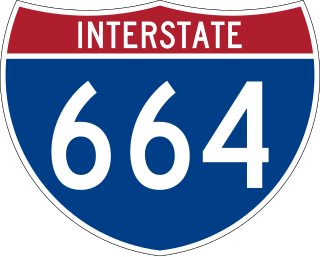
Interstate 664 (I-664) is an auxiliary Interstate Highway in the US state of Virginia. The Interstate runs 20.79 miles (33.46 km) from I-64 and I-264 in Chesapeake north to I-64 in Hampton. I-664 forms the west side of the Hampton Roads Beltway, a circumferential highway serving the Hampton Roads metropolitan area. The Interstate crosses Hampton Roads via the Monitor–Merrimac Memorial Bridge–Tunnel (MMMBT) between Suffolk and Newport News. I-664 is connected to the other major cities of the metropolitan area—Portsmouth, Norfolk, and Virginia Beach—by I-264. The Interstate also has a connection to Portsmouth through State Route 164 (SR 164) and to Suffolk via U.S. Route 13 (US 13), US 58, and US 460.
The Hampton Roads Beltway is a loop of Interstate 64 and Interstate 664, which links the communities of the Virginia Peninsula and South Hampton Roads which surround the body of water known as Hampton Roads and comprise much of the region of the same name in the southeastern portion of Virginia in the United States. It crosses the harbor of Hampton Roads at two locations on large four-laned bridge-tunnel facilities: the eastern half carries Interstate 64 and uses the Hampton Roads Bridge-Tunnel and the western half carries Interstate 664 and uses the Monitor-Merrimac Memorial Bridge-Tunnel. The beltway has the clockwise direction signed as the Inner Loop, and the counter-clockwise direction signed as the Outer Loop. The entire beltway, including the bridge-tunnels, is owned and operated by the Virginia Department of Transportation.
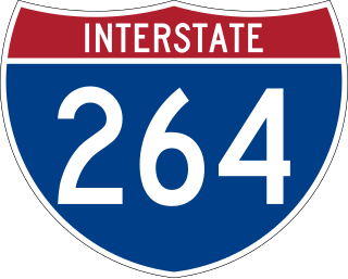
Interstate 264 (I-264) is an Interstate Highway in the US state of Virginia. It serves as the primary east–west highway through the South Hampton Roads region in southeastern Virginia. The route connects the central business districts of Chesapeake, Portsmouth, Norfolk, and Virginia Beach and serves as the most direct link between those cities and the resort beaches along Virginia's Atlantic coast.
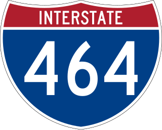
Interstate 464 (I-464) is an Interstate Highway in the US state of Virginia. The highway runs 5.67 miles (9.12 km) from U.S. Route 17 (US 17) and State Route 168 (SR 168) in Chesapeake north to I-264 in Norfolk. I-464 connects two major highway junctions in the South Hampton Roads region. At its southern end, the Interstate meets two major highways that head toward North Carolina, US 17 and SR 168, and I-64, which follows the southern side of the Hampton Roads Beltway. At its northern terminus, I-464 has connections with Downtown Norfolk and Portsmouth via I-264.

Interstate 564 (I-564) is an Interstate Highway in the US state of Virginia. Known as Admiral Taussig Boulevard, after US Navy Rear Admiral Edward D. Taussig, the Interstate runs 3.03 miles (4.88 km) from State Route 337 (SR 337) east to I-64 within the city of Norfolk. I-564 is the primary access highway to Naval Station Norfolk, the world's largest naval base. The Interstate also links I-64 with Norfolk International Terminals via SR 406 and the Wards Corner area of Norfolk through connections with U.S. Route 460 (US 460) and SR 165.

State Route 33 is a primary state highway in the U.S. state of Virginia. The state highway runs 72.23 miles (116.24 km) from U.S. Route 33 and US 250 in Richmond, Virginia east to Chesapeake Boulevard in Stingray Point. SR 33 is a state-numbered eastward extension of US 33 that connects Richmond with West Point and the Middle Peninsula, one of three large peninsulas on the west side of the Chesapeake Bay in Virginia. The state highway is a major thoroughfare in the downtown and East End areas of Richmond. SR 33 serves a suburban area in eastern Henrico County before running concurrently with US 60, Interstate 64 (I-64), and SR 30 east toward West Point. The state highway heads from West Point through Saluda, east of which SR 33 serves as the main highway of Middlesex County.

State Route 161 is a primary state highway in and near Richmond, Virginia, United States. It extends from an interchange with Interstate 95 (I-95) in the independent city of Richmond north to an intersection with U.S. Route 1 in the Lakeside area of central Henrico County.

State Route 168 is a primary state highway in the South Hampton Roads region of the U.S. state of Virginia. It runs from the border with North Carolina through the independent cities of Chesapeake and Norfolk where it ends in the Ocean View area near the Hampton Roads Bridge-Tunnel.

State Route 337 is a primary state highway in the South Hampton Roads area of the U.S. state of Virginia. It runs east from Suffolk to Portsmouth, where it crosses Jordan Bridge. It continues on the east side of the Southern Branch Elizabeth River in the South Norfolk neighborhood of Chesapeake. There it turns north, through Norfolk, crossing the Berkley Bridge into downtown, and ending at the Naval Station Norfolk at Sewell's Point. Most of its length was formed when other highways were rerouted: U.S. Route 460 from Suffolk to South Norfolk, SR 170 from South Norfolk to downtown Norfolk, and US 17 from downtown Norfolk to Sewell's Point. SR 337 is the only numbered highway to cross all three Branches of the Elizabeth River. It crosses the Western Branch as Portsmouth Boulevard at the Hodges Ferry Bridge, the Southern Branch on the Jordan Bridge, and the Eastern Branch on the Berkley Bridge. The Berkley Bridge is a drawbridge. SR 337 also crosses the Lafayette River in the city of Norfolk.

Virginia Beach Boulevard is a major connector highway which carries U.S. Route 58 most of its length and extends from the downtown area of Norfolk to the Oceanfront area of Virginia Beach, passing through the newly developed New Urbanist Town Center development of the latter as it links the two independent cities in the South Hampton Roads subregion of the Hampton Roads region in southeastern Virginia.

U.S. Route 13 (US 13) is a north–south United States Numbered Highway established in 1926 that runs for 518 miles (834 km) from Interstate 95 (I-95) just north of Fayetteville, North Carolina, north to US 1 in Morrisville, Pennsylvania, a northeastern suburb of Philadelphia. In the U.S. state of Virginia, US 13 runs north–south through the Hampton Roads and Eastern Shore regions of the state, using the Chesapeake Bay Bridge–Tunnel to get between the two. In the Hampton Roads area, it uses Military Highway to bypass the city centers. It is most usually a four-lane highway, sometimes up to freeway or expressway standards with controlled access.

U.S. Route 460 (US 460) in Virginia runs east-west through the southern part of the Commonwealth. The road has two separate pieces in Virginia, joined by a relatively short section in West Virginia. Most of US 460 is a four-lane divided highway and is a major artery in the southern third of the state. From Petersburg to Suffolk, US 460 is a four-lane non-divided highway. It is a popular alternative to Interstate 64 (I-64) when going from Richmond and other points in central Virginia to the Currituck Sound and Outer Banks of North Carolina, avoiding the congestion and tunnels of the more northerly I-64 corridor. The road passes through several small towns that built up at stops along the railroad line.

U.S. Route 17 (US 17) is a part of the United States Numbered Highway System that runs from Punta Gorda, Florida, to Winchester, Virginia. In Virginia, the U.S. Highway runs 255.83 miles (411.72 km) from the North Carolina state line in Chesapeake north to its northern terminus at US 11, US 50, and US 522 in Winchester. US 17 is a major highway in the eastern half of Virginia. The U.S. Highway connects the Albemarle Region of North Carolina with the Hampton Roads metropolitan area. Within the urban area, US 17 passes through the South Hampton Roads cities of Chesapeake, Portsmouth, and Suffolk and the Virginia Peninsula city of Newport News. Between Yorktown and Fredericksburg, the U.S. Highway serves as the primary highway of the Middle Peninsula. At Fredericksburg, US 17 leaves the Atlantic Plain; the highway passes through the Piedmont town of Warrenton and crosses the Blue Ridge Mountains on its way to Winchester in the Shenandoah Valley. The route from Tappahannock to Winchester roughly follows the Confederate march during the Civil War to Gettysburg.

State Route 165 is a primary state highway in the U.S. state of Virginia. The state highway runs 39.75 miles (63.97 km) from U.S. Route 17 Business in Chesapeake north to SR 337 in Norfolk. SR 165 is a C-shaped route that connects Chesapeake and Norfolk in the Hampton Roads metropolitan area indirectly via Virginia Beach. The highway's east–west segment connects the Chesapeake communities of Deep Creek and Great Bridge with the Princess Anne part of Virginia Beach. SR 165's northwest–southeast portion connects the Princess Anne area with Virginia Beach's Salem and Kempsville communities and with Norfolk. Within Norfolk, the state highway parallels Interstate 64 (I-64) while passing through the eastern and northern areas of the city near Norfolk International Airport and Naval Station Norfolk. Much of SR 165 is a multi-lane divided highway, but there are significant two-lane stretches in all three of the independent cities the highway serves.

State Route 166 is a primary state highway in the U.S. state of Virginia. The state highway runs 15.47 miles (24.90 km) from U.S. Route 17 in Chesapeake north to US 60 in Virginia Beach.

State Route 190 is a primary state highway in the U.S. state of Virginia. The state highway runs 15.43 miles (24.83 km) from SR 166 in Chesapeake east and north to SR 225 in Virginia Beach. SR 190 is a J-shaped route that connects the central part of Chesapeake with the western part of Virginia Beach.
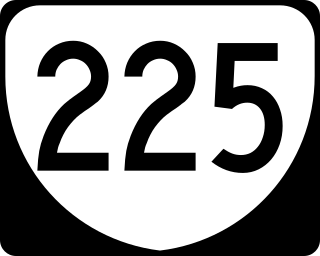
State Route 225 is a primary state highway in the U.S. state of Virginia. Known as Independence Boulevard, the state highway runs 5.40 miles (8.69 km) from South Boulevard north to U.S. Route 60 within the independent city of Virginia Beach. SR 225 connects Interstate 264 (I-264) with US 58 in the Pembroke Manor area of the city and with US 13 near Naval Amphibious Base Little Creek and the Chesapeake Bay Bridge-Tunnel. The unnumbered portion of Independence Boulevard to the south connects those areas with the Princess Anne section of the city.
State Route 247 is a primary state highway in the U.S. state of Virginia. The state highway runs 5.31 miles (8.55 km) from SR 337 east to SR 165 within the independent city of Norfolk. SR 247 is a major east–west thoroughfare that connects U.S. Route 460 and Interstate 64 (I-64) with Norfolk International Airport.
State Route 403 is a 1.02-mile (1.64 km) primary state highway that runs along the border of the independent cities of Norfolk and Virginia Beach in Virginia, United States, that connects Virginia State Route 165 (SR 165) with U.S. Route 58 (US 58). It also connects with Interstate 264 (I‑264).
The Bowers Hill interchange is a large interchange complex where the Hampton Roads Beltway intersects with Interstate 264 (I-264) as well as Military Highway, which carries the three U.S. Highways. It is named for the unincorporated community surrounding it, Bowers Hill, Virginia, which itself is a part of the independent city of Chesapeake.
