Millrise | ||||||||||||||
|---|---|---|---|---|---|---|---|---|---|---|---|---|---|---|
Neighbourhood | ||||||||||||||
 Millrise Location of Millrise in Calgary | ||||||||||||||
| Coordinates: 50°55′06″N114°05′05″W / 50.91833°N 114.08472°W | ||||||||||||||
| Country | ||||||||||||||
| Province | ||||||||||||||
| City | ||||||||||||||
| Quadrant | SW | |||||||||||||
| Ward | 13 | |||||||||||||
| Established | 1982 | |||||||||||||
| Annexed | 1961 | |||||||||||||
| Government | ||||||||||||||
| • Mayor |
| |||||||||||||
| • Administrative body | Calgary City Council | |||||||||||||
| • Councillor |
| |||||||||||||
| Area | ||||||||||||||
• Total | 1.8 km2 (0.69 sq mi) | |||||||||||||
| Elevation | 1,080 m (3,540 ft) | |||||||||||||
| Population (2006) [2] | ||||||||||||||
• Total | 6,509 | |||||||||||||
| • Average Income | $70,870 | |||||||||||||
| Website | Millrise Community Association | |||||||||||||
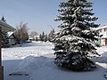
Millrise (The Rise) is a suburban residential neighbourhood in the southwest quadrant of Calgary, Alberta. It is located south of Fish Creek Provincial Park, and is bounded by 146 Avenue S to the north, Macleod Trail to the east, Shawnessy Boulevard to the south and James McKevitt Road to the west.
Contents
The land was annexed to the City of Calgary in 1961 and Millrise was established in 1982. It is represented in the Calgary City Council by the Ward 13 councillor. [1]
The community is served by the Fish Creek-Lacombe station of the C-Train LRT system.