Woodlands, Calgary

Last updated
Woodlands
Neighbourhood
Woodlands1-Szmurlo.jpg
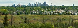
Residences overlooking Fish Creek Park
Calgary street map.png
Red pog.svg
Woodlands
Location of Woodlands in Calgary
Coordinates: 50°56′29″N114°06′32″W / 50.94139°N 114.10889°W / 50.94139; -114.10889
CountryFlag of Canada (Pantone).svg  Canada
Province Flag of Alberta.svg  Alberta
City Flag placeholder.svg  Calgary
QuadrantSW
Ward 13
Established1976
Government
[1]
  Mayor Jyoti Gondek
  Administrative body Calgary City Council
  CouncillorDan McLean
Area
  Total2.9 km2 (1.1 sq mi)
Elevation
1,070 m (3,510 ft)
Population
 (2006) [2]
  Total6,529
   Average Income
$71,234
Website Woodlands Community Association

Woodlands is a residential neighbourhood in the southwest quadrant of Calgary, Alberta. The community is bordered by Fish Creek Provincial Park to the south, 24 Street SW to the west, Anderson Road SW to the north, and 14 Street SW to the east. The Canyon Meadows Golf course is entirely contained within the boundaries of Woodlands.

Contents

Woodlands was established in 1976. It is represented in the Calgary City Council by the Ward 13 councillor. [1]

Demographics

In the City of Calgary's 2012 municipal census, Woodlands had a population of 6,201 living in 2,397 dwellings, a 0% increase from its 2011 population of 6,201. [3] With a land area of 2.8 km2 (1.1 sq mi), it had a population density of

Residents in this community had a median household income of $71,234 in 2000, and there were 14.2% low income residents living in the neighbourhood. [5] As of 2000, 22.9% of the residents were immigrants. A proportion of 11.6% of the buildings were condominiums or apartments, and 24.9% of the housing was used for renting. [2]

Education

Woodlands is home to Woodlands Elementary School (CBE), as well as William Roper Hull School, a K-12 school owned by the CBE in partnership with Hull Services with programs for students with various behavioral, emotional, social and mental challenges. [6] There is also the Tsuu T'Ina Bullhead Adult Education Centre is situated next to William Roper School.

See also

Related Research Articles

Lakeview is a residential community in the southwestern quadrant of Calgary, Alberta, Canada.

<span class="mw-page-title-main">Bankview, Calgary</span> Neighbourhood in Calgary, Alberta, Canada

Bankview is a neighbourhood in the southwest quadrant of the city of Calgary, Alberta.

Mount Royal is an area of Calgary, Alberta and is home to the neighbourhoods of Upper Mount Royal and Lower Mount Royal, which are separated by an escarpment that runs along Cameron and Royal Avenues in an east-west direction. Upper Mount Royal has an area redevelopment plan in place.

Killarney, also known as Killarney/Glengarry, is a residential neighbourhood in the city of Calgary, Alberta, Canada. It is bounded by 17th Avenue S.W. on the north, 37th Street S.W. on the west, Richmond Road S.W. on the south, and 25A Street S.W. on the east. It was named after Glengarry County, Ontario, as the place the first settlers originated from.

Richmond is a residential neighbourhood in the southwest quadrant of Calgary, Alberta.

Braeside is a residential neighbourhood in the southwest quadrant of Calgary, Alberta. It is located north of Anderson Road, south of Southland Drive, west of 14th Street SW and east of 24th Street SW.

Shaganappi is a residential neighbourhood in the southwest quadrant of Calgary, Alberta. It is located between 17 Avenue SW and the Bow River. The Shaganappi golf course is located north of the Bow Trail.

Glendale is a residential neighbourhood in the southwest quadrant of Calgary, Alberta. It is located south of 17th Avenue SW, east of Sarcee Trail and Signal Hill and west of 37 Street SW and Killarney. The Optimist Athletic Park is located in this community.

Woodbine is a residential neighbourhood in the southwest quadrant of Calgary, Alberta. It is located at the western edge of the city, and is bordered on the north by Anderson Road, on the west by Tsuut'ina Trail, on the east by 24th Street West, and to the south by Fish Creek Provincial Park.

Rosemont is a residential neighbourhood in the northwest quadrant of Calgary, Alberta. It is bounded by Northmount Drive to the north, by Cambrian Drive to the east, by 23 Avenue N and the Confederation Park to the south and by 14 Street W to the west.

Elboya is a residential neighbourhood in the southwest quadrant of Calgary, Alberta. It is bounded by the Elbow River to the north, 4th Street SW / 45 Avenue SW / Macleod Trail to the east, 50 Avenue S to the south and Elbow Drive to the west. Stanley Park borders the community to the northeast.

<span class="mw-page-title-main">Cliff Bungalow, Calgary</span> Neighbourhood in Calgary, Alberta, Canada

Cliff Bungalow is an inner city residential neighbourhood in the southwest quadrant of Calgary, Alberta. Centered along 5 Street SW, it is bordered by Elbow River to the south, by Uptown 17th Avenue to the north and by Fourth Street to the east.

Palliser is a residential neighbourhood in the southwest quadrant of Calgary, Alberta. It is bounded to the north by 90 Ave SW, to the east by 19 Street SW, to the south by Southland Drive SW and to the west by 24 Street SW. The Tom Brook Athletic Park is located within the neighbourhood.

Pump Hill is a residential neighbourhood in the southwest quadrant of Calgary, Alberta. It is bounded to the north by 90th Avenue SW and the Glenmore Reservoir, to the east by 14 Street SW, to the south by Southland Drive and to the west by 19 Street SW.

Roxboro is an inner city residential neighbourhood in the southwest quadrant of Calgary, Alberta, Canada. It is bounded to the north and west by the Elbow River and to the south by 33 Avenue SW of Roxboro, in a bend of the Elbow River, lies the community of Rideau Park.

Elbow Park is an affluent residential neighbourhood in the southwest quadrant of Calgary, Alberta. It is one of the oldest and wealthiest communities in the city. It is bordered to the south and east by Elbow River, to the east by Elbow Drive, to the north by Council Way and to the west by 14 Street W.

North Glenmore Park is a residential neighbourhood in the southwest quadrant of Calgary, Alberta. It is bounded by 50 Avenue SW to the north, Glenmore Athletic Park, Lakeview Golf Course, and Earl Grey Golf Club to the east, Earl Grey Golf Club to the south, and Crowchild Trail SW to the west.

Highwood is a residential neighbourhood in the northwest quadrant of Calgary, Alberta. it is bounded to the north by McKnight Boulevard, to the east by 4 Street W, to the south by 40 Avenue N and to the west by John Laurie Boulevard. Nose Hill Park is located west of the community.

<span class="mw-page-title-main">Highland Park, Calgary</span> Neighbourhood in Calgary, Alberta, Canada

Highland Park is a residential neighbourhood in the northwest quadrant of Calgary, Alberta. It is bounded to the north by McKnight Boulevard, to the east by Edmonton Trail, to the south by 32 Avenue N and to the west by 4 Street W. Confederation Park and Nose Hill Park are located in close proximity. The Queens Park Cemetery occupies the southwestern corner of the neighbourhood, and the Highland golf course is developed in the north.

<span class="mw-page-title-main">Monterey Park, Calgary</span> Neighbourhood in Calgary, Alberta, Canada

Monterey Park is a residential neighbourhood in the northeast quadrant of Calgary, Alberta. It is at the eastern edge of the city, bounded by McKnight Boulevard to the north, 68 Street E to the west, Trans-Canada Highway to the south and 84 Street E to the east.

References

  1. 1 2 "Calgary Elections". City of Calgary. 2017. Retrieved November 12, 2017.
  2. 1 2 City of Calgary (2006). "Woodlands Community Statistics" (PDF). Retrieved 2007-05-09.
  3. 1 2 "2012 Civic Census Results" (PDF). City of Calgary. 2012. Retrieved February 4, 2013.
  4. "Community Boundaries" (Esri shapefile). City of Calgary. Retrieved February 5, 2013.
  5. City of Calgary (2004). "Ward 13 Profile" (PDF). Retrieved 2007-05-09.
  6. "William Roper Hull School". school.cbe.ab.ca. Retrieved 2023-10-15.