Mineral Springs, Arkansas | |
---|---|
Coordinates: 33°52′35″N93°55′7″W / 33.87639°N 93.91861°W | |
Country | United States |
State | Arkansas |
County | Howard |
Government | |
• Mayor | Vera Marks |
Area | |
• Total | 2.14 sq mi (5.53 km2) |
• Land | 2.13 sq mi (5.52 km2) |
• Water | 0.00 sq mi (0.01 km2) |
Elevation | 341 ft (104 m) |
Population (2020) | |
• Total | 1,085 |
• Density | 508.67/sq mi (196.39/km2) |
Time zone | Central |
• Summer (DST) | Central |
ZIP code | 71851 |
Area code | 870 |
FIPS code | 05-46040 |
GNIS feature ID | 2404272 [2] |
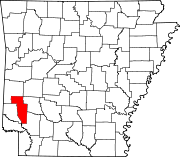
Mineral Springs is a city in Howard County, Arkansas, United States. The population was 1,208 at the 2010 census. [3]
Mineral Springs is located in southern Howard County at 33°52′35″N93°55′7″W / 33.87639°N 93.91861°W (33.876358, -93.918599). [4] Arkansas Highway 27 runs through the center of town, leading northeast 7 miles (11 km) to Nashville, the county seat, and west 13 miles (21 km) to Ben Lomond. Arkansas Highway 355 joins Highway 27 on Runnels Street through the center of Mineral Springs, but it leads north 12 miles (19 km) to Center Point and south 4.5 miles (7.2 km) to Tollette.
According to the United States Census Bureau, Mineral Springs has a total area of 2.30 square miles (5.95 km2), of which 2.28 square miles (5.90 km2) are land and 0.02 square miles (0.05 km2), or 0.84%, are water. [3]
Census | Pop. | Note | %± |
---|---|---|---|
1880 | 546 | — | |
1900 | 278 | — | |
1910 | 432 | 55.4% | |
1920 | 777 | 79.9% | |
1930 | 712 | −8.4% | |
1940 | 731 | 2.7% | |
1950 | 751 | 2.7% | |
1960 | 616 | −18.0% | |
1970 | 761 | 23.5% | |
1980 | 936 | 23.0% | |
1990 | 1,004 | 7.3% | |
2000 | 1,264 | 25.9% | |
2010 | 1,208 | −4.4% | |
2020 | 1,085 | −10.2% | |
U.S. Decennial Census [5] |
Race | Number | Percentage |
---|---|---|
White (non-Hispanic) | 310 | 28.57% |
Black or African American (non-Hispanic) | 538 | 49.59% |
Native American | 3 | 0.28% |
Other/Mixed | 50 | 4.61% |
Hispanic or Latino | 184 | 16.96% |
As of the 2020 United States census, there were 1,085 people, 470 households, and 315 families residing in the city.
As of the census [7] of 2000, there were 1,264 people, 466 households, and 354 families residing in the city. The population density was 546.3 inhabitants per square mile (210.9/km2). There were 519 housing units at an average density of 224.3 per square mile (86.6/km2). The racial makeup of the city was 51.19% White, 41.46% Black or African American, 0.16% Native American, 0.08% Asian, 5.78% from other races, and 1.34% from two or more races. 10.92% of the population were Hispanic or Latino of any race.
There were 466 households, out of which 40.3% had children under the age of 18 living with them, 51.7% were married couples living together, 19.7% had a female householder with no husband present, and 24.0% were non-families. 20.8% of all households were made up of individuals, and 10.7% had someone living alone who was 65 years of age or older. The average household size was 2.71 and the average family size was 3.07.
In the city, the population was spread out, with 30.5% under the age of 18, 7.8% from 18 to 24, 29.5% from 25 to 44, 20.8% from 45 to 64, and 11.4% who were 65 years of age or older. The median age was 33 years. For every 100 females, there were 92.1 males. For every 100 females age 18 and over, there were 83.9 males.
The median income for a household in the city was $29,853, and the median income for a family was $31,150. Males had a median income of $24,286 versus $16,775 for females. The per capita income for the city was $12,477. About 16.2% of families and 21.1% of the population were below the poverty line, including 26.5% of those under age 18 and 14.8% of those age 65 or over.
Public education of early childhood, elementary and secondary school students is provided by the Mineral Springs Saratoga School District, which leads to graduation from Mineral Springs High School.
Howard County is a county located in the U.S. state of Arkansas. As of the 2020 census, the population was 12,785. The county seat is Nashville. Howard County is Arkansas's 74th county, formed on April 17, 1873, and named for James Howard, a state senator. It is a dry county.
Hempstead County is a county located in the U.S. state of Arkansas. As of the 2020 census, the population was 20,065, down from 22,609 at the 2010 census. The county seat is Hope. Hempstead County is Arkansas's fourth county, formed on December 15, 1818, alongside Clark and Pulaski counties. The county is named for Edward Hempstead, a delegate to the U.S. Congress from the Missouri Territory, which included present-day Arkansas at the time. It is an alcohol prohibition or dry county.
Garland County is located in the U.S. state of Arkansas. As of the 2020 census, the population was 100,180. The county seat is Hot Springs.
Whelen Springs is a town in Clark County, Arkansas, United States. The population was 92 at the 2010 census. From 1930 through 1939 the town thrived, being a main hub of operations for the then powerful Ozan Lumber Company.
McNeil is a town in Columbia County, Arkansas, United States. The population was 516 at the 2010 census, down from 662 in 2000. The community was named after William B. McNeil, founder of the College Hill Academy.
Taylor is a city in Columbia County, Arkansas, United States. The population was 566 at the 2010 census.
Mountain Pine is a city in Garland County, Arkansas, United States. It is part of the Hot Springs Metropolitan Statistical Area. The population was 770 at the 2010 United States Census. It is located immediately southeast of Lake Ouachita below the Blakely Mountain Dam. The city consists of five defined neighborhoods, Pinewood (north), South Mountain Pine, a business district, Cozy Acres (southwest) and Mountain View/Timberland area.
Blevins is a city in Hempstead County, Arkansas, United States. The population was 315 at the 2010 census, down from 365 in 2000. It is part of the Hope Micropolitan Statistical Area.
Fulton is a town in Hempstead County, Arkansas, United States. The population was 201 at the 2010 census. It is part of the Hope Micropolitan Statistical Area. The community is named after steamboat inventor Robert Fulton.
McCaskill is a town in Hempstead County, Arkansas, United States. The population was 96 at the 2010 census. It is part of the Hope Micropolitan Statistical Area.
Oakhaven is a town in Hempstead County, Arkansas, United States. The population was 63 at the 2010 census. It is part of the Hope Micropolitan Statistical Area.
Ozan is a town in Hempstead County, Arkansas, United States. The population was 85 at the 2010 census. It is part of the Hope Micropolitan Statistical Area.
Tollette is a town in southern Howard County, Arkansas, United States. The population was 240 at the 2010 census, down from 324 in 2000.
Bradley is a city in Lafayette County, Arkansas, United States. The population was 628 at the 2010 census.
Lewisville is a city in Lafayette County, Arkansas, United States. The population was 1,280 at the 2010 census. It is the county seat of Lafayette County.
West Fork is a city in Washington County, Arkansas, United States. The population is 2,331 at the 2020 census. It is part of the Northwest Arkansas region.
Dillard is a town in Rabun County, Georgia, United States. As of the 2020 census, the city population was 337.
Lydia is an unincorporated community and census-designated place (CDP) in Iberia Parish, Louisiana, United States. The population was 952 at the 2010 census, down from 1,079 at the 2000 census. It is part of the New Iberia Micropolitan Statistical Area.
Saltillo is a city in Lee County, Mississippi, located in the northern part of the Tupelo micropolitan area. The population was 4,922 at the 2020 Census.
North Codorus Township is a township in York County, Pennsylvania, United States. The population was 9,149 at the 2020 census.