Minnehaha | |
|---|---|
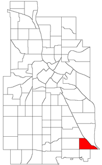 Location of Minnehaha within the U.S. city of Minneapolis | |
| Country | United States |
| State | Minnesota |
| Counties | Hennepin |
| City Council Ward | 12 |
| Government | |
| • Council Member | Aurin Chowdhury |
| Area | |
• Total | 0.558 sq mi (1.45 km2) |
| Population (2020) [2] | |
• Total | 4,292 |
| • Density | 7,700/sq mi (3,000/km2) |
| Time zone | UTC-6 (CST) |
| • Summer (DST) | UTC-5 (CDT) |
| ZIP code | 55417 |
| Area code | 612 |
| Census | Pop. | Note | %± |
|---|---|---|---|
| 1980 | 4,138 | — | |
| 1990 | 4,334 | 4.7% | |
| 2000 | 4,058 | −6.4% | |
| 2010 | 3,980 | −1.9% | |
| 2020 | 4,292 | 7.8% |
Minnehaha is a neighborhood in the Nokomis community in Minneapolis, Minnesota. Its boundaries are Minnehaha Parkway to the north, Hiawatha Avenue to the east, 54th Street to the south, and 34th Avenue to the west. It is located in Ward 12 [3] of the Minneapolis City Council, currently represented by council member Aurin Chowdhury.
It shares a neighborhood organization with the Keewaydin, Morris Park, and Wenonah neighborhoods, which are collectively referred to as Nokomis East and served by the Nokomis East Neighborhood Association (NENA). [4]
The 50th Street/Minnehaha Park station of the METRO Blue Line is located in Minnehaha. 44°54′38″N93°12′56″W / 44.9105°N 93.2156°W [5]