
Rayagada district is a district in southern Odisha, a state in India, which became a separate district in October 1992. Its population consists mainly of tribes, primarily the Khonds and the Soras. In addition to Odia, Kui and Sora are spoken by the district's indigenous population. It was founded by Maharajah Biswanatha Deba Gajapati of the Surjyabansha dynasty of Jeypore.

Ganjam district is a district in the Indian state of Odisha. Ganjam's total area is 8,206 km² (3,168 mi²). The district headquarters is Chhatrapur. Ganjam is divided into three sub-divisions Chhatrapur, Berhampur, and Bhanjanagar. The Imperial Gazetteer of India 1908 lists Ganjam, along with the Thanjavur and South Canara districts, as the three districts of the Madras Presidency where Brahmins were most numerous. As of 2011 it is the most populous district of Odisha.
Nabarangpur district, also known as Nabarangapur district or Nawarangpur district, is a district of Odisha, India. The city of Nabarangpur is the district capital. Most of its population is tribal and the land is heavily forested. It borders Kalahandi and Koraput districts. Nabarangpur district is situated at 19.14′ latitude and 82.32′ longitude at an average elevation of 572 metres (1,877 ft).

Khordha district is an administrative division of the state of Odisha, India. It was formed on April 1, 1993, by the division of former Puri District into Puri, Khordha and Nayagarh districts. In the year 2000 the district name was changed to Khordha. The district headquarters is Khordha Town. The capital city of Bhubaneswar is located in this district. Khordha is the most urbanized of all the districts of Odisha.

Gajapati district is a district of Odisha State in India. It was created from Ganjam District on 2 October, 1992. Gajapati district was named after Krushna Chandra Gajapati Narayan Deb, the King of the Paralakhemundi estate and the first Prime Minister of Orissa, who is remembered for his contribution in the formation of a separate state, and inclusion of his estate in Odisha. The district headquarters at Paralakhemundi, formerly a Zamindari, has been clustered within a radius of approximately 5 kilometers around the geometric centre of Paralakhemundi. The District is a part of the Red Corridor. As of 2011 it is the third least populous district of Odisha, after Debagarh and Boudh.

Angul district; also known as Anugul, is one of the thirty districts of Odisha in eastern India. The city of Angul is the district headquarters of Angul district.
Balasore District also known as Baleswar District or Baleshwar District, is an administrative district of Odisha state, in eastern India. Balasore is one of the coastal districts of Odisha and lies on the northernmost part of the state.

Angul is a town and a municipality and the headquarters of Angul district in the state of Odisha, India. Angul has an average elevation of 195 m (640 ft) above sea level. The total geographical area of the district is 6232 km2. From the point of view of area, it stands 11th among the 30 Districts of Odisha.
Chhatrapur is a town and a Notified Area Council since 1955 in Ganjam district in the state of Odisha, India. It is the district headquarters town of Ganjam district. Chhatrapur is a Tehsil / Block (CD) in the Ganjam District of Odisha. According to Census 2011 information the sub-district code of Chhatrapur block is 03085. Total area of Chhatrapur is 124 km2 (48 sq mi) including 119.92 km2 (46.30 sq mi) rural area and 4.40 km2 (1.70 sq mi) urban area. Chhatrapur has a population of 94,683 people. There are 20,415 houses in the sub-district. There are about 46 villages in Chhatrapur block.
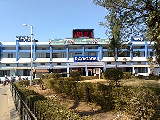
Rayagada is a municipality in Rayagada district in the Indian state of Odisha. It is the administrative headquarters of Rayagada district.
Aska is a Vidhan Sabha constituency of Ganjam district, Odisha.
Talsara is a Vidhan Sabha constituency of Sundergarh district, Odisha. Area of this constituency includes Balisankara block, Bargaon block, Subdega block and ten Gram panchayats of Lephripada block.
Digapahandi is a Vidhan Sabha constituency of Ganjam district, Odisha.
Paralakhemundi is a Vidhan Sabha constituency of Gajapati district, Odisha.

Mohana is a Vidhan Sabha constituency in Gajapati district, Odisha.
Aul is a town and the headquarters of Aul CD Block and Aul Tehsil in Kendrapara district in the Indian state of Odisha. It is 17 km from Chandabali. Aul is surrounded by the river Kharasrota and Brahmani on north and south respectively. To its east is Bhitarkanika National Park.
Barchana or Badchana, is a town and community development block in the Jajpur district of Odisha state in India.
Nuagada is a village and Community Development Block in the Gajapati District of Odisha state in India. The Block comes under the administrative control of Serango and R.Udayagiri Police station. The Block had a population of 57,027 in 2020 census. Mohana is its Vidhan Sabha constituency. This constituency includes Mohana block, R.Udayagiri block, Nuagada block and Rayagada block.
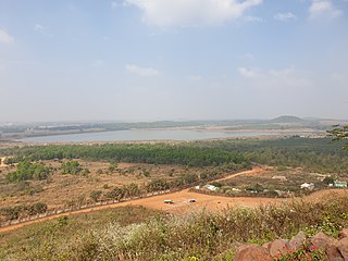
Rayagada is a village and Community Development Block in the Gajapati District of Odisha state in India. The Block comes under the administrative control of Rayagada Police station. The Block had a population of 99,568 in 2020 census. Mohana is its Vidhan Sabha constituency. This constituency includes Mohana block, R.Udayagiri block, Nuagada block and Rayagada block.
Gumma is a village and Community Development Block in the Gajapati District of Odisha state in India.The Block comes under the administrative control of Serango Police station. The Block had a population of 72,808 in 2020 census. Paralakhemundi is its Vidhan Sabha constituency.This constituency includes Gumma block, Kashinagar block, Paralakhemundi block.

