Murchison, Texas

Last updated

Murchison, Texas
U.S. Post Office, Murchison, TX IMG 0568.JPG
U.S. Post Office in Murchison, Texas
TXMap-doton-Murchison.PNG
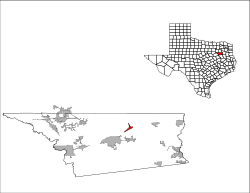
Location of Murchison, Texas
Henderson County Murchison.svg
Coordinates: 32°16′42″N95°45′19″W / 32.27833°N 95.75528°W / 32.27833; -95.75528
Country United States
State Texas
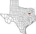
County Henderson
Area
[1]
  Total1.58 sq mi (4.09 km2)
  Land1.58 sq mi (4.09 km2)
  Water0.00 sq mi (0.00 km2)
Elevation
[2]
456 ft (139 m)
Population
 (2010)
  Total594
  Estimate 
(2019) [3]
599
  Density379.59/sq mi (146.56/km2)
Time zone UTC-6 (Central (CST))
  Summer (DST) UTC-5 (CDT)
ZIP code
75778
Area code(s) 903, 430
FIPS code 48-50076 [4]
GNIS feature ID1375068 [2]
First United Methodist Church on Texas State Highway 31 in Murchison First United Methodist Church, Murchison, TX IMG 0569.JPG
First United Methodist Church on Texas State Highway 31 in Murchison

Murchison is a city in Henderson County, Texas, United States. The population was 594 at the 2010 census. [5]

Contents

Geography

Murchison is located northeast of the center of Henderson County at 32°16′42″N95°45′19″W / 32.27833°N 95.75528°W / 32.27833; -95.75528 (32.278405, –95.755179). [6] Texas State Highway 31 passes through the center of town, leading southwest 8 miles (13 km) to Athens, the county seat, and east 27 miles (43 km) to Tyler.

According to the United States Census Bureau, Murchison has a total area of 1.6 square miles (4.1 km2), all land. [5]

Demographics

Historical population
CensusPop.Note
1970 432
1980 51318.8%
1990 510−0.6%
2000 59216.1%
2010 5940.3%
2019 (est.)599 [3] 0.8%
U.S. Decennial Census [7]

At the 2000 census there were 592 people in 217 households, including 161 families, in the city. The population density was 373.9 inhabitants per square mile (144.4/km2). There were 238 housing units at an average density of 150.3 per square mile (58.0/km2). The racial makeup of the city was 94.93% White, 0.17% African American, 0.51% Native American, 0.17% Asian, 3.55% from other races, and 0.68% from two or more races. Hispanic or Latino of any race were 6.08%. [4]

Of the 217 households 31.3% had children under the age of 18 living with them, 60.8% were married couples living together, 10.6% had a female householder with no husband present, and 25.8% were non-families. 21.7% of households were one person and 14.7% were one person aged 65 or older. The average household size was 2.73 and the average family size was 3.14.

The age distribution was 29.9% under the age of 18, 8.8% from 18 to 24, 23.3% from 25 to 44, 24.2% from 45 to 64, and 13.9% 65 or older. The median age was 35 years. For every 100 females, there were 87.9 males. For every 100 females age 18 and over, there were 82.0 males.

The median household income was $33,281 and the median family income was $36,071. Males had a median income of $30,938 versus $17,500 for females. The per capita income for the city was $14,986. About 15.7% of families and 20.0% of the population were below the poverty line, including 28.3% of those under age 18 and 23.5% of those age 65 or over.

Education

Public education in the city of Murchison is provided by the Murchison Independent School District.

Related Research Articles

McDougald Township is a township in Lake of the Woods County, Minnesota, United States. The population was 236 at the 2000 census.

<span class="mw-page-title-main">Briar Creek, Pennsylvania</span> Borough in Pennsylvania, United States

Briar Creek is a borough in Columbia County, Pennsylvania, United States. It is part of Northeastern Pennsylvania. The population was 597 at the 2020 census. It is part of the Bloomsburg-Berwick micropolitan area.

<span class="mw-page-title-main">Leonard, Texas</span> City in Texas, United States

Leonard is a city in Fannin County, Texas, United States. The population was 1,990 at the 2010 census.

<span class="mw-page-title-main">Rotan, Texas</span> City in Texas, United States

Rotan is a city in Fisher County, Texas, United States. The population was 1,508 at the 2010 census, down from 1,611 at the 2000 census.

<span class="mw-page-title-main">Southmayd, Texas</span> City in Texas, United States

Southmayd is a city in Grayson County, Texas, United States. The population was 992 at the 2010 census. It is part of the Sherman–Denison Metropolitan Statistical Area.

<span class="mw-page-title-main">Athens, Texas</span> City in Texas, United States

Athens is a city and the county seat of Henderson County, Texas, in the United States. As of the 2020 census, the city population was 12,857. The city has called itself the "Black-Eyed Pea Capital of the World." Athens was selected as one of the first "Certified Retirement Communities" in Texas. Athens was incorporated in 1856 and was named after Athens, the capital of Greece.

<span class="mw-page-title-main">Berryville, Texas</span> Town in Texas, United States

Berryville is a town in Henderson County, Texas, United States. The population was 824 at the 2020 census, down from 975 at the 2010 census.

<span class="mw-page-title-main">Chandler, Texas</span> City in Texas, United States

Chandler is a city in Henderson County, Texas, United States, at the northern end of Lake Palestine. Its population was 3,275 at the 2020 census, up from 2,734 at the 2010 census.

<span class="mw-page-title-main">Poynor, Texas</span> Town in United States

Poynor is a town in Henderson County, Texas, United States. The population was 305 at the 2010 census.

<span class="mw-page-title-main">Kennard, Texas</span> City in Texas, United States

Kennard is a city in Houston County, Texas, United States. Its population was 337 at the 2010 census. The main street is Texas State Highway 7.

<span class="mw-page-title-main">Lone Oak, Texas</span> City in Texas, United States

Lone Oak is a city in Hunt County, Texas, United States. The population was 643 at the 2020 census, 598 at the 2010 census, up from 521 at the 2000 census.

<span class="mw-page-title-main">Oak Ridge, Kaufman County, Texas</span> Town in Texas, United States

Oak Ridge is a town in Kaufman County, Texas, United States. The population was 495 at the 2010 census, up from 400 at the 2000 census.

<span class="mw-page-title-main">LaCoste, Texas</span> City in Texas, United States

La Coste is a city in Medina County, Texas, United States. The population was 1,119 at the 2010 census. It is part of the San Antonio Metropolitan Statistical Area.

<span class="mw-page-title-main">Cool, Texas</span> City in Texas, United States

Cool is a city in Parker County, Texas, United States. The population was 211 at the 2020 census.

<span class="mw-page-title-main">Point Blank, Texas</span> City in Texas, United States

Point Blank is a city in San Jacinto County, Texas, United States. The population was 643 at the 2020 census.

<span class="mw-page-title-main">New Chapel Hill, Texas</span> City in Texas, United States

New Chapel Hill is a city in Smith County, Texas, United States. The population was 620 at the 2020 census. It is part of the Tyler, Texas Metropolitan Statistical Area.

<span class="mw-page-title-main">Lakeside, Tarrant County, Texas</span> Place in Texas, United States

Lakeside is a town in Tarrant County, Texas, United States. The population was 1,649 at the 2020 census.

<span class="mw-page-title-main">Tye, Texas</span> City in Texas, United States

Tye is a city in Taylor County, Texas, United States. The population was 1,242 at the 2010 census. It is part of the Abilene, Texas Metropolitan Statistical Area.

<span class="mw-page-title-main">Edom, Texas</span> City in Texas, United States

Edom is a city in Van Zandt County, Texas, United States. The population was 375 at the 2010 census.

<span class="mw-page-title-main">Hawkins, Texas</span> City in Texas, United States

Hawkins is a city in Wood County, Texas, United States. The population was 1,274 at the 2020 census. It is located twenty miles north of the larger city of Tyler. Just east of the community is Jarvis Christian University, a historically black institution of higher learning.

References

  1. "2019 U.S. Gazetteer Files". United States Census Bureau. Retrieved August 7, 2020.
  2. 1 2 U.S. Geological Survey Geographic Names Information System: Murchison, Texas
  3. 1 2 "Population and Housing Unit Estimates". United States Census Bureau. May 24, 2020. Retrieved May 27, 2020.
  4. 1 2 "U.S. Census website". United States Census Bureau . Retrieved January 31, 2008.
  5. 1 2 "Geographic Identifiers: 2010 Census Summary File 1 (G001): Murchison city, Texas". American Factfinder. U.S. Census Bureau. Archived from the original on February 13, 2020. Retrieved February 12, 2018.
  6. "US Gazetteer files: 2010, 2000, and 1990". United States Census Bureau. February 12, 2011. Retrieved April 23, 2011.
  7. "Census of Population and Housing". Census.gov. Retrieved June 4, 2015.