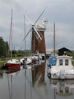
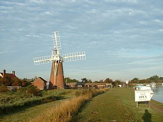
Horsey Windpump is a windpump or drainage windmill in the care of the National Trust in the village of Horsey, on The Broads near Great Yarmouth, Norfolk, England. The structure is a grade II* listed building.

Brograve Mill is a windpump located on Brograve level in the parish of Sea Palling within the Norfolk Broads National Park, United Kingdom. It can be found at grid reference TG448235 and is approximately 1 mile north of Horsey Mere. The mill is a Grade II listed building.

Lockgate Mill also referred to locally and historically as Freethorpe Mill, 'Banham's Black Mill' and 'Duffel's Mill' is a windpump located on the Halvergate Marshes in the detached parish of Freethorpe within The Broads in the English county of Norfolk. It is approximately 2 miles (3.2 km) west of Great Yarmouth, and 3 miles (4.8 km) north-east of Berney Arms on the northern edge of Breydon Water. The structure is a Grade II listed building.

Berney Arms Windmill is a tower mill located at Berney Arms alongside the River Yare at the south-western end of Breydon Water in the English county of Norfolk. The windmill is in an isolated spot in The Broads around 3.5 miles (5.6 km) north-east of the village of Reedham and 4 miles (6.4 km) south-west of Great Yarmouth. The mill has no road access but can be accessed by boat, by foot or from Berney Arms railway station. It is a Scheduled Ancient Monument under the care of English Heritage.

Hunsett Mill is located on the east bank of the River Ant one mile north of Barton Broad in the English county of Norfolk. The Windmill is 1.2 miles south west of the town of Stalham. The mill structure is a grade II listed building.

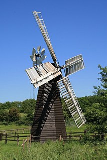
Clayrack Drainage Windmill is located at How Hill in the English county of Norfolk. It is on the east bank of the River Ant close to How Hill, a large Edwardian building which houses the Norfolk Broads Study Centre. The Drainage mill is 1¾ miles west of the village of Ludham.

Bidborough Mill is a Grade II listed, house converted tower mill west of Bidborough, Kent, England. It is now incorporated into a housing development called Mill Court, on the south side of the B2176 Penshurst Road.

South Marsh Mill is a grade II listed tower mill at Arundel, Sussex, England which has been converted to residential use.
Wandsworth Common Windmill is a conserved grade II listed smock mill at Wandsworth Common, in the London Borough of Wandsworth in the United Kingdom.

Stock Windmill is a grade II* listed tower mill at Stock, Essex, which has been restored.
Eastbridge Windpump is a smock mill at the Museum of East Anglian Life, Stowmarket, Suffolk, England which has been restored to working order.

Flixton Road Mill is a tower mill at Bungay, Suffolk, England which has been truncated and converted to residential accommodation. The structure is a Grade II listed building.

Blackshore Mill is a Grade II listed tower mill at Reydon, Suffolk, England which has been conserved.

Marsh Mill is an 18th-century tower windmill in Thornton, Lancashire, England. It was built in 1794 by Ralph Slater for local landowner Bold Hesketh. It functioned as a corn mill until the 1920s and has been fully restored. It is a good example of a complete English windmill and has been designated a Grade II* listed building.
Stracey Arms Windpump is a windpump located at Tunstall in the civil parish of Halvergate, Norfolk, England. It is a grade II* listed building.
Tunstall is a village within the civil parish of Halvergate in the Broadland district of Norfolk, England. It lies some 14 miles (22.5 km) south-east of Norwich alongside the River Bure.
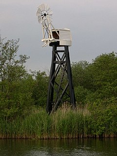
Hobb's Mill, also knowb as Hobbs Drainage Mill, is an open trestle windpump which stands by the side of the River Bure in Horning, North Norfolk, England, and is a Grade II* listed structure.

The Acle Straight, also known as the Acle New Road is a major road between Acle and Great Yarmouth in Norfolk. It is part of the A47 trunk road.