Locations
A - B
| Location | Name of mill and grid reference | Type | Maps | First mention or built | Last mention or demise | Photograph |
|---|---|---|---|---|---|---|
| Ashcott | ST 442 377 | 1736 1760 | 1736 | 1760, gone by 1784 | ||
| Bawdrip | Approximately ST 347 397 | 1660 1675 | 1660 | 1675 | ||
| Bedminster | ST 592 714 | 1769 | 1769 | 1769 | ||
| Bedminster | ST 583 701 | 1769 | 1769 | 1769 | ||
| Berrow | 1330s | 1330s | ||||
| Berrow | ST 294 523 | Tower | 1782 | 1773 | Demolished 1890s | |
| Bickenhall | Approximately ST 282 180 | |||||
| Bleadon | Bleadon Level | Early 17th century | Early 17th century | |||
| Brent Knoll | Approximately ST 335 516 | 1675 | 1330s | 1675 | ||
| Brent Knoll | Shackleton's Mill ST 332 509 | Tower | 1861 | Demolished early 1900s | ||
| Bridgwater | Stowey Farm [1] | Titt iron wind engine | 1893 [1] | |||
| Bridgwater Without | ST 318 384 | Sunk post | 15th century | 15th century | ||
| Brockley | ST 473 661 | Tower | 1769 1782 | 1529 | 1782, gone by 1829 | |
| Burnham on Sea | ST 309 484 | Post | 1675 | 1675 | 1786 | |
| Burnham on Sea | Allen's Mill Sandway Mill ST 309 484 | Tower | 1840s | Demolished June 1869 | ||
| Burnham on Sea | Burnham Brewery [1] | Titt iron wind engine | 1894 [1] | |||
| Burnham Without | Blew Mill Burnham Mill Edithmead Mill ST 337 490 | Post | 1675 1760 | 1675 | 1885 | |
| Burnham Without | Highbridge Mill ST 322 485 | Sunk post | 1675 | 1675 | 1675 | |
| Burnham Without | Approximately ST 343 472 | Post | 1803 | 1867 | ||
| Burnham Without | Watchfield Mill ST 348 470 | tower | 1817 | 1817 | Windmill World | |
| Butcombe | ST 517 628 | Sunk post | 13th century | 13th century | ||
| Butleigh | Approximately ST 513 324 | 1675 1817 | 1675 | 1817 |
C - E
| Location | Name of mill and grid reference | Type | Maps | First mention or built | Last mention or demise | Photograph |
|---|---|---|---|---|---|---|
| Catcott | Catgut Mill approximately ST 388 383 | 1675 | 1675 | 1675 | ||
| Chapel Allerton | ST 414 504 | 1317 | 1736 | |||
| Chapel Allerton | Ashton Mill ST 414 504 | Tower | 1774 | Windmill World |  | |
| Charlton Horethorne | Approximately ST 674 239 | Demolished c. 1784 | ||||
| Charlton Mackrell | (two mills) ST 516 292 | 1467 | 1467 | |||
| Charlton Mackrell | Baskett's Mill ST 516 292 | Tower | 1592 | 1757, gone by 1810 | ||
| Chedzoy | ST 345 371 | 1817 1822 | Sunk post | 1685 | Blown down 7 December 1827 | |
| Churchill, Somerset | Approximately ST 445 601 | 1652 | 1652 | |||
| Compton Dundon | Approximately ST 495 339 | 1675 | c. 1660 | 1675 | ||
| Cossington | Approximately ST 356 400 | 1675 | 1675 | 1675 | ||
| Croscombe | Titt iron wind engine | 1899 [1] | ||||
| Curry Rivel | Willtown Mill ST 388 246 | Tower | 1822 | 1822 | Demolished c. 1930 | |
| Curry Rivel | Week Mill Wick Mill ST 403 265 | Sunk post | 1760 | 1760 | 1775, gone by 1820 | |
| Ditcheat | Blindmill approximately ST 627 341 | |||||
| Durston | ST 294 280 | Sunk post | ||||
| Durston | ST 297 278 | Sunk post | Gone by 1817 | |||
| East Brent | ST 356 518 | Post | 1675 1760 1822 | 1675 | c. 1880 | |
| East Brent | Edingworth ST 357 530 | Post |
G - H
| Location | Name of mill and grid reference | Type | Maps | First mention or built | Last mention or demise | Photograph |
|---|---|---|---|---|---|---|
| Glastonbury | Approximately ST 519 390 | 1244 | 1309 | |||
| Glastonbury | Windmill Hill Mill approximately ST 505 395 | Late 15th or early 16th century | Late 15th or early 16th century | |||
| Glastonbury | Wearyall Hill Mill approximately ST 495 384 | 1660 1675 | 1640 | c. 1775 | ||
| Glastonbury | Common Moor Mill | 1722 | 1722 | |||
| Glastonbury | The Elms [1] | Titt iron wind engine | 1892 [1] | |||
| Greinton | Approximately ST 417 371 | 1660 1675 | 1660 | 1675, gone by 1742 | ||
| Hardington Mandeville | Approximately ST 511 114 | |||||
| High Ham | Stembridge Mill ST 433 305 | Tower | 1822 | Windmill World | 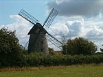 | |
| High Ham | Sedgemoor Hill Mill approximately ST 435 307 | 1660 1760 | 1660 | 1779 | ||
| High Ham | Turn Hill Mill ST 427 298 | 1660 | 1660 | 1660 | ||
| Hinton Charterhouse | Titt iron wind engine | 1895 [1] |  | |||
| Huish Episcopi | Bowden's Mill approximately,br> ST 415 286 | Tower | 1874 | Demolished c. 1885 | ||
| Huish Episcopi | Pibsbury Mill ST 433 265 | Tower | 1823 | Collapsed April 1915 | ||
| Huish Episcopi | Wearne Mill approximately ST 424 298 | 1660 | 1585 | 1664 | ||
| Hutton | ST 361 589 | 1309 | 1309 | |||
| Hutton | ST 361 589 | 1482 | 1482 | |||
| Hutton | Hutton Mill ST 361 589 | 1809 | 1809 | 1864 | ||
| Hutton | Oldmixon Mill approximately ST 337 580 | 1736 1760 | 1736 | 1760 |
K - M
| Location | Name of mill and grid reference | Type | Maps | First mention or built | Last mention or demise | Photograph |
|---|---|---|---|---|---|---|
| Kenn | Kenn Mill ST 411 696 | 1821 | Truncated c. 1900 | |||
| Kingsdon | Approximately ST 512 269 | 1628 | 1694 | |||
| Langport | Big Mill approximately ST 422 268 | 1344 | Blown down 16 January 1362 | |||
| Locking | Vale Mill Locking Moor Mill ST 359 617 | tower | c. 1813 | |||
| Long Ashton | 1312 | 1312 | ||||
| Long Sutton | Upton Mill approximately ST 454 266 | 1349 | 1538 | |||
| Low Ham | Approximately ST 443 285 | 1660 | 1660 | Derelict in 1779 | ||
| Lympsham | Batch Farm Mill ST 326 551 | Tower | 1758 | 1758 | ||
| Mark | ST 387 378 | 1700 | Blown down 26 November 1703 | |||
| Mark | Mark Causeway | Blown down 26 November 1703 | ||||
| Middlezoy | Approximately ST 366 328 | 1660 | 1660 | 1660 | ||
| Middlezoy | Approximately ST 366 328 | Tower | 1822 | 1822 | 1885 | |
| Montacute | Approximately ST 506 170 | 1560 | 1560 | |||
| Moorlinch | Knoll Hill Mill ST 400 372 | Post | 1660 1675 1760 | 1660 | 1760 | |
| Moorlinch | ST 400 372 | Tower | Early 19th century | 1889 |
N - P
| Location | Name of mill and grid reference | Type | Maps | First mention or built | Last mention or demise | Photograph |
|---|---|---|---|---|---|---|
| North Cheriton | Approximately ST 686 258 | 1766 | 1766 | |||
| North Curry | ST 315 248 | c. 1840 | c. 1840 | |||
| Othery | 1308 [2] | 1346, gone by 1403 [2] | ||||
| Othery | 1515 [2] | Demolished c. 1811 [2] | ||||
| Othery | Approximately ST 377 313 | 1660 | 1598 [2] | 1701 [2] | ||
| Paulton | ST 656 567 | |||||
| Pawlett | ||||||
| Pawlett | Hams Mill ST 277 411 | Tower | Demolished 1880s | |||
| Pitney | 1605 | 1691 | ||||
| Portbury | Okey Mill approximately ST 509 740 | 1769 1782 | 1769 | 1782 | ||
| Portishead | Portishead Mill ST 458 767 | Tower | 1832 | Windmill World |  | |
| Puriton | Approximately ST 319 411 | Tower | 1610 1675 1760 | 1610 | Demolished early 20th century | |
| Puriton | Approximately ST 325 409 | 1675 | 1675 | 1675 | ||
| Puriton | Approximately ST 325 409 | 1817 | 1817 | c. 1840 |
S - U
| Location | Name of mill and grid reference | Type | Maps | First mention or built | Last mention or demise | Photograph |
|---|---|---|---|---|---|---|
| St Cuthbert Out | Approximately ST 577 474 | |||||
| Seavington St Michael | c. 1212 | c. 1212 | ||||
| Shapwick | ST 422 373 | 1330s | 1330s | |||
| Shapwick | ST 422 373 | Post | 1660 1760 1782 | 1660 | Blown down 29 November 1836 | |
| Shapwick | ST 425 374 | Tower | c. 1836 | 1860 | ||
| Somerton | 1276 | 1330 | ||||
| Somerton | Mileburgh approximately ST 480 275 | 1334 | 1484 | |||
| Somerton | South Field | 1575 | 1619 | |||
| Somerton | Applin's Mill approximately ST 477 283 | 1736* 1760 | 1715 | 1802 | ||
| Somerton | Crane's Mill approximately ST 490 275 | 1616 | 1779, gone by 1802 | |||
| Somerton | William Champion's Mill | 1651 | 1651 | |||
| Somerton | South Hill Mill Cullen's Mill approximately ST 471 271 | 1675 | 1675 | 1749 | ||
| Stawell, Somerset | Approximately ST 368 389 | 1660 1675 | 1660 | 1675 | ||
| Stawell | Cock Hill Mill Stoll Mill approximately ST 376 387 | 1675 | 1675 | 1675 | ||
| Stawell | Sutton Mill ST 369 365 | 1685 | 1685 | |||
| Stockland Bristol | (two mills) ST 249 439 | 1317 | 1317 | |||
| Stoke St Gregory | ST 339 277 | |||||
| Stoke St Gregory | ST 354 269 | Tower | 1704 | 1787 | ||
| Street | c. 1255 | c. 1255 | ||||
| Street | Millfield Mill approximately ST 492 362 | 1660 1675 | 1660 | 1675 | ||
| Street | Ivythorn Mill approximately ST 477 345 | 1822 | 1822 | 1822 | ||
| Uphill | Uphill Mill ST 317 583 | Tower | 1782 | 1782 | Truncated 1934 Windmill World |  |
W
| Location | Name of mill and grid reference | Type | Maps | First mention or built | Last mention or demise | Photograph |
|---|---|---|---|---|---|---|
| Walton | 1342 | 1342 | ||||
| Walton | Walton Mill ST 462 352 | Post | 1660 1675 | 1660 | Collapsed c. 1725 | |
| Walton | Walton Mill ST 462 352 | Tower | 1741 | Windmill World |  | |
| Weare | Weare Mill ST 406 515 | 1760 | 1760 | Windmill World |  | |
| Wedmore | Maltfield Farm Mill ST 441 474 | Tower | 1760 1782 | 1760 | Demolished 1886 | |
| Wedmore | ST 425 428 | Post | 1678 | Moved to Mark, 1700 | ||
| Wedmore | Burnt Mill approximately ST 426 509 | |||||
| Wedmore | Heath House Mill ST 421 469 | 1737 | Burnt down c. 1740 | |||
| Wedmore | Heath House Mill Westfield Mill ST 421 469 | tower | 1775 | Demolished 1962 | ||
| Wedmore | Stoughton Mill ST 419 487 | Tower | 1817 | 1817 | 1875 | |
| West Huntspill | Approximately ST 310 453 | 1675 | 1675 | 1675 | ||
| West Monkton | (two mills) | 1364 | Mid-16th century | |||
| West Monkton | Burlinch Mill ST 265 295 | Tower | 1817 |  | ||
| West Monkton | Woodball Mill ST 255 293 | |||||
| West Pennard | Approximately ST 560 382 | 1362 | 1362 | |||
| Westonzoyland | 1330s | 1330s | ||||
| Westonzoyland | Penzoy Mill ST 339 350 | 1822 | 1822 | 1822 | ||
| Westonzoyland | Westonfield Mill approximately ST 365 346 | 1833 | 1833 | |||
| Williton | Great Mill approximately ST 102 342 | |||||
| Winford | Broadfield Mill ST 515 649 | Tower | 1880s | Windmill World |  | |
| Woolavington | (two mills) | 1222 | 1222 | |||
| Woolavington | ST 347 408 | 1736 1760 1783 1822 | 1630 | Demolished 1967 | ||
| Worle | Worle Mill ST 352 632 | Tower | 1760 1782 | 1760 | Windmill World |  |
| Worlebury | Approximately ST 326 627 | 1736 1760 | 1736 | 1760 |