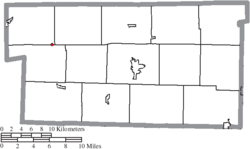
Nashville, Ohio | |
---|---|
Coordinates: 40°35′45″N82°06′47″W / 40.59583°N 82.11306°W | |
Country | United States |
State | Ohio |
County | Holmes |
Area | |
• Total | 0.07 sq mi (0.18 km2) |
• Land | 0.07 sq mi (0.18 km2) |
• Water | 0.00 sq mi (0.00 km2) |
Elevation | 1,224 ft (373 m) |
Population (2020) | |
• Total | 183 |
• Density | 2,652.17/sq mi (1,031.39/km2) |
Time zone | UTC-5 (Eastern (EST)) |
• Summer (DST) | UTC-4 (EDT) |
ZIP code | 44661 |
Area code | 330 |
FIPS code | 39-53634 [3] |
GNIS feature ID | 2399437 [2] |
Nashville is a village in Holmes County, Ohio, United States. The population was 183 at the 2020 census.
In 1833, Nashville contained six houses and one tavern. [4]
According to the United States Census Bureau, the village has a total area of 0.08 square miles (0.21 km2), all land. [5]
Census | Pop. | Note | %± |
---|---|---|---|
1870 | 208 | — | |
1880 | 217 | 4.3% | |
1900 | 266 | — | |
1910 | 268 | 0.8% | |
1920 | 211 | −21.3% | |
1930 | 177 | −16.1% | |
1940 | 200 | 13.0% | |
1950 | 234 | 17.0% | |
1960 | 234 | 0.0% | |
1970 | 221 | −5.6% | |
1980 | 211 | −4.5% | |
1990 | 181 | −14.2% | |
2000 | 172 | −5.0% | |
2010 | 197 | 14.5% | |
2020 | 183 | −7.1% | |
U.S. Decennial Census [6] |
As of the census [7] of 2010, there were 197 people, 76 households, and 57 families living in the village. The population density was 2,462.5 inhabitants per square mile (950.8/km2). There were 91 housing units at an average density of 1,137.5 per square mile (439.2/km2). The racial makeup of the village was 99.5% White and 0.5% from two or more races. Hispanic or Latino of any race were 0.5% of the population.
There were 76 households, of which 47.4% had children under the age of 18 living with them, 51.3% were married couples living together, 17.1% had a female householder with no husband present, 6.6% had a male householder with no wife present, and 25.0% were non-families. 22.4% of all households were made up of individuals, and 13.1% had someone living alone who was 65 years of age or older. The average household size was 2.59 and the average family size was 2.98.
The median age in the village was 28.9 years. 34% of residents were under the age of 18; 7.2% were between the ages of 18 and 24; 32% were from 25 to 44; 15.8% were from 45 to 64; and 11.2% were 65 years of age or older. The gender makeup of the village was 51.3% male and 48.7% female.
As of the census [3] of 2000, there were 172 people, 68 households, and 45 families living in the village. The population density was 2,416.6 inhabitants per square mile (933.1/km2). There were 80 housing units at an average density of 1,124.0 per square mile (434.0/km2). The racial makeup of the village was 98.84% White, and 1.16% from two or more races. Hispanic or Latino of any race were 1.16% of the population.
There were 68 households, out of which 32.4% had children under the age of 18 living with them, 52.9% were married couples living together, 5.9% had a female householder with no husband present, and 32.4% were non-families. 30.9% of all households were made up of individuals, and 11.8% had someone living alone who was 65 years of age or older. The average household size was 2.53 and the average family size was 3.20.
In the village, the population was spread out, with 26.2% under the age of 18, 11.6% from 18 to 24, 24.4% from 25 to 44, 24.4% from 45 to 64, and 13.4% who were 65 years of age or older. The median age was 35 years. For every 100 females there were 115.0 males. For every 100 females age 18 and over, there were 108.2 males.
The median income for a household in the village was $34,375, and the median income for a family was $40,000. Males had a median income of $24,306 versus $22,813 for females. The per capita income for the village was $16,068. About 4.5% of families and 11.2% of the population were below the poverty line, including 29.4% of those under the age of eighteen and none of those 65 or over.
Trommald is a city in Crow Wing County, Minnesota, United States. The population was 99 at the 2020 census. It is part of the Brainerd Micropolitan Statistical Area.
Chain-O-Lakes is a village in Roaring River Township of southeast Barry County, Missouri, United States. The population was 126 at the 2010 census.
Parkdale is a village in northern Jefferson County, Missouri, United States. The population was 170 at the 2010 census.
Marlborough is a village in St. Louis County, Missouri, United States. The population was 2,179 at the 2010 census.
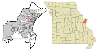
Sycamore Hills is a village in St. Louis County, Missouri, United States. The population is 560 at the 2020 census.
Roaming Shores is a village in Ashtabula County, Ohio, United States. The population was 1,586 at the 2020 census.
Walton Hills is a village in Cuyahoga County, Ohio, United States. The population was 2,033 at the 2020 census. A suburb of Cleveland, it is a part of the Cleveland metropolitan area.
Gordon is a village in Darke County, Ohio, United States. The population was 245 at the 2020 census.
Wayne Lakes is a village in Darke County, Ohio, United States. The population was 693 at the 2020 census.
Addyston is a village in Miami Township, Hamilton County, Ohio, United States. Located along the Ohio River, it is a western suburb of the neighboring city of Cincinnati. The population was 927 at the 2020 census.
Cleves is a village in Miami Township, Hamilton County, Ohio, United States. Located along the Ohio River, it is a western suburb of Cincinnati. The population was 3,414 at the 2020 census.
Elmwood Place is a village in Hamilton County, Ohio, United States. The population was 2,087 at the 2020 census. Except for a small portion which touches neighboring St. Bernard, Elmwood Place is nearly surrounded by the city of Cincinnati.
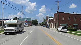
Mowrystown is a village in Highland County, Ohio, United States. The population was 385 at the 2020 census.
Tarlton is a village in Fairfield and Pickaway counties in the U.S. state of Ohio. The population was 254 at the 2020 census.
Kekoskee is a village in Dodge County, Wisconsin, United States. The population was 161 at the 2010 census.
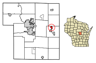
Nelsonville is a village in Portage County, Wisconsin, United States. The population was 155 at the 2010 census.
Hubbardston is a village in the U.S. state of Michigan. It is mostly in North Plains Township in Ionia County, and partially in Lebanon Township in Clinton County. Its population was 395 at the 2010 census.
Wilson is a village in Belmont and Monroe counties in the U.S. state of Ohio. The population was 129 at the 2020 census. It is part of the Wheeling metropolitan area.
Dorchester is a village in Clark and Marathon counties in the U.S. state of Wisconsin, along the 45th parallel. It is part of the Wausau, Wisconsin Metropolitan Statistical Area. The population was 876 at the 2010 census. Of this, 871 were in Clark County, and only 5 were in Marathon County.
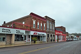
Bloomington is a village in Grant County, Wisconsin, United States. The population was 735 as of the 2010 census. The village is located within the Town of Bloomington.