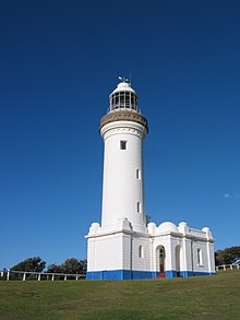
The Macquarie Lighthouse, also known as South Head Upper Light, is the first, and is the longest serving, lighthouse site in Australia. It is located on Dunbar Head, on Old South Head Road, Vaucluse in the Municipality of Woollahra local government area of New South Wales, Australia. The lighthouse is situated approximately 2 kilometres (1 mi) south of South Head near the entrance to Sydney Harbour. There has been a navigational aid in this vicinity since 1791 and a lighthouse near the present site since 1818. The current heritage-listed lighthouse was completed in 1883. The lighthouse and associated buildings were designed by James Barnet and built from 1881 to 1883.

Smoky Cape Lighthouse is a heritage-listed active lighthouse located on Smoky Cape, a headland in Arakoon east of the town of South West Rocks, Kempsey Shire, New South Wales, Australia, and within the Hat Head National Park. It directs boats towards the entrance to the Macleay River, which is located just to the north of the lighthouse.

Cape Byron Light, also called Cape Byron Lightstation, is an active heritage-listed lighthouse and now interpretative centre, interpretative space, maritime museum, administration office, retail building, accommodation, tourist attraction and visitor attraction located at Lighthouse Road, Byron Bay, Cape Byron, Byron Shire, New South Wales, Australia. It was designed by Charles Harding and Cecil W. Darley and built from 1899 to 1901 by Messrs Mitchell & King. It is also known as Cape Byron Lightstation, Byron Bay Lighthouse, Cape Byron Headlan and Cape Byron Headland Reserve. The property is owned by NSW National Parks & Wildlife Service.

Crowdy Head Light is an active lighthouse located at Crowdy Head, a headland between Forster and Port Macquarie, New South Wales, Australia. It is registered with the Register of the National Estate.

Fingal Head Light is an active lighthouse located at Fingal Head, New South Wales, Australia, a headland about 5 kilometres (3.1 mi) south of Point Danger, which marks the Queensland border.

The Montague Island Light is a heritage-listed active lighthouse located on Barunguba / Montague Island, an island in the Tasman Sea, 9 kilometres (5.6 mi) offshore from Narooma on the south coast of New South Wales, Australia. The lighthouse is located at the highest point of the island. It was designed by James Barnet and NSW Colonial Architect and built from 1878 to 1881 by J. Musson and completed By W. H. Jennings. It is also known as the Montague Island Lightstation and its setting. The property is owned by the Office of Environment and Heritage, an agency of the Government of New South Wales. It was added to the New South Wales State Heritage Register on 2 April 1999, and the Commonwealth Heritage List on 22 June 2004.

The Barrenjoey Head Lighthouse is a heritage-listed lighthouse at Barrenjoey Headland, Palm Beach, Northern Beaches Council, New South Wales, Australia. It was designed by James Barnet, the New South Wales Colonial Architect and built by Isaac Banks. It is also known as Barrenjoey Head Lightstation. The property is owned by Office of Environment and Heritage, an agency of the Government of New South Wales. The lightstation was added to the New South Wales State Heritage Register on 2 April 1999.

The Point Stephens Light is a heritage-listed active lighthouse located on Point Stephens, a point on an unnamed headland at the east of Fingal Bay, 4.25 km (2.64 mi) south of the entrance of Port Stephens, New South Wales, Australia. The light serves to assist vessels entering Port Stephens. It is considered an endangered lighthouse due to remote location and old age.
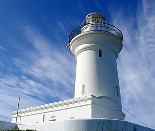
South Solitary Island Light is an active lighthouse on South Solitary Island, an island within the Solitary Islands Marine Park, about 15 kilometres (9.3 mi) northeast of Coffs Harbour, New South Wales, Australia. The lighthouse is located at the summit of the island. It is considered the most isolated lighthouse on the New South Wales coast. It was first in New South Wales to use kerosene over colza oil, and the last to do so before converting to electric power.

Warden Head Light, also known as Ulladulla Lighthouse, is an active lighthouse on Warden Head, a headland south of Ulladulla, New South Wales, Australia, guarding the entrance to the Port of Ulladulla. It is one of only two wrought iron lighthouses in New South Wales, the other being its sibling, Wollongong Breakwater Lighthouse. It is also notable for two relocations: the tower was constructed in 1873 on the Ulladulla Breakwater, and relocated in 1889 to its current location. Its keeper's house was relocated to a different location in the 1920s.
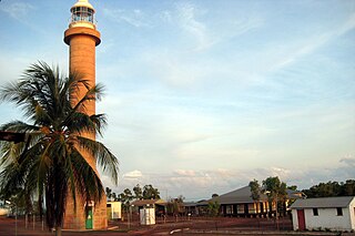
Cape Don Light is an active lighthouse located on Cape Don, at the tip of the Cobourg Peninsula, Northern Territory, Australia, in Garig Gunak Barlu National Park, marking the entrance to the Dundas Strait. It is Australia's northernmost traditional lighthouse. The station served on the important route to Darwin, between the peninsula and Melville Island. The tower was constructed in 1915–1917, during the "Golden Age of Australian Lighthouses" (1913–1920), and the tower was manned until 1983. During the entire period that the tower was manned it also maintained meteorological records which were well placed to assist in cyclone development tracking. The complex consists of the lighthouse, three residences and ancillary buildings.
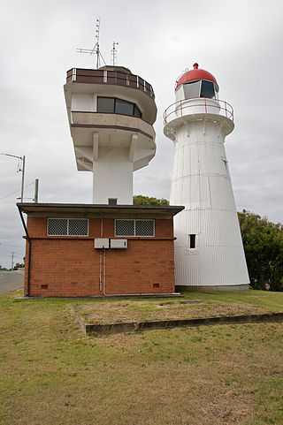
Old Caloundra Light, also known as Old Caloundra Head Light or Cape Caloundra Light, is an inactive lighthouse located in Caloundra on the Sunshine Coast in South East Queensland, Australia. It is the oldest surviving building in Caloundra. The lighthouse was active between 1896 and 1968. The tower was relocated twice. In 1970 it was relocated from its original location to Woorim Park in Caloundra, and in 1999 it was returned to its original site on Canberra Terrace near downtown Caloundra, where it stands today.

Cape Capricorn Light is an active heritage-listed lighthouse located on Cape Capricorn, a coastal headland on the northeast point of Curtis Island, in Gladstone Region, Central Queensland, Australia. The lighthouse, constructed in 1964, is the third at this site, following a timber frame lighthouse constructed in 1875 and a concrete lighthouse constructed around 1937. It was added to the Queensland Heritage Register on 31 August 2001.

Lady Elliot Island Light is an active lighthouse located on Lady Elliot Island, the southernmost coral cay of the Great Barrier Reef, 46 nautical miles north-east of Bundaberg, Queensland, Australia. The lighthouse is located on the western side of the island. It was the third lighthouse erected in Queensland after its formation in 1859 and the first in Australia to be constructed of a timber frame clad with iron plates. The original lighthouse was deactivated in 1995 and the light was replaced by a modern skeletal tower standing close to the original lighthouse.
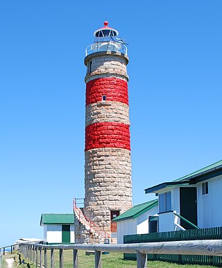
Cape Moreton Light, also listed as North Point Range Rear Light, is a heritage-listed active lighthouse located on Cape Moreton, a rocky headland located at the north eastern tip of Moreton Island, a large sand island on the eastern side of Moreton Bay, on the coast of South East Queensland, Australia. It marks the northern entrance to Moreton Bay and Brisbane and also serves as the rear light for the North Point Range. With its two distinctive red bands, it also serves as a daymark. It is the oldest lighthouse in Queensland, and the only one to be built by the New South Wales Government before the separation of Queensland, which took place in 1859. It is also the only lighthouse in Queensland to be built of stone.

Cape Cleveland Light is an active heritage-listed lighthouse located on the northern tip of Cape Cleveland, a promontory projecting into the Coral Sea west of Cleveland Bay in the locality of Cape Cleveland about 40 kilometres (25 mi) east of Townsville, Queensland, Australia. The lighthouse marks the northern point of the Cape, and the entrance to Cleveland Bay.

Double Island Point Light is an active lighthouse located at the summit of Double Island Point, a coastal headland within the Cooloola section of the Great Sandy National Park. It is located at the southern end of Wide Bay, 70 kilometres (43 mi) north of Noosa Heads, Queensland, Australia.

Low Isles Light, also known as Low Islets Light or Low Island Light, is an active lighthouse located on Low Island, a coral cay which together with Woody Island forms the Low Isles group, about 13 kilometres (8.1 mi) northeast of Port Douglas, Queensland, Australia. The island is situated on the western edge of the main shipping channel into the harbour of Port Douglas, and it marks the entrance to the channel. Built in 1878, it was the first lighthouse in Far North Queensland and more specifically the first to light the Inner Passage of the Great Barrier Reef. Its construction is typical to Queensland lighthouses of the time, timber frame clad with galvanized iron, and it is the fourth lighthouse of this type constructed in Queensland, though it is the first of them to use portholes.

Caloundra Lighthouses are a heritage-listed pair of lighthouses at 3 Canberra Terrace, near Arthur Street, Kings Beach, Caloundra, Sunshine Coast Region, Queensland, Australia. The first, known as the Old Caloundra Light, was designed by Francis Drummond Greville Stanley and built in 1896; the second, New Caloundra Light, was built in 1968. They were added to the Queensland Heritage Register on 5 February 2010.
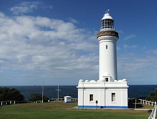
Norah Head Lightstation Precinct is a heritage-listed former lighthouse precinct located at Bush Street, Norah Head in the Central Coast local government area of New South Wales, Australia. The Norah Head lighthouse and associated buildings were designed by Cecil W. Darley and built in 1903. The precinct was added to the New South Wales State Heritage Register on 13 April 2007.
