
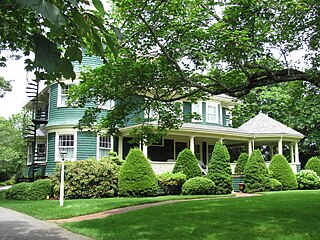
Harwich is a New England town on Cape Cod, in Barnstable County in the state of Massachusetts in the United States. At the 2020 census it had a population of 13,440. Harwich experiences a seasonal increase to roughly 37,000. The town is a popular vacation spot, located near the Cape Cod National Seashore. Harwich's beaches are on the Nantucket Sound side of Cape Cod. Harwich has three active harbors. Saquatucket, Wychmere and Allen Harbors are all in Harwich Port. The town of Harwich includes the villages of Pleasant Lake, West Harwich, East Harwich, Harwich Port, Harwich Center, North Harwich and South Harwich.

Montgomery is a census-designated place (CDP) in Chatham County, Georgia, United States. The population was 4,443 at the 2020 United States Census, down slightly from 4,523 in 2010. It is a suburb of Savannah and is part of the Savannah metropolitan area.

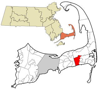
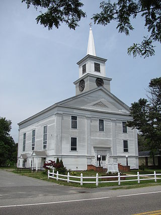
East Harwich is a census-designated place (CDP) and village in the town of Harwich in Barnstable County, Massachusetts, United States. The population was 4,872 at the 2010 census.
Harwich Port is a small seaside community and census-designated place (CDP) situated along Nantucket Sound in the town of Harwich in Barnstable County, Massachusetts, United States. It is named after the port of Harwich in Essex, England. As of the 2010 census, the CDP had a population of 1,644. It is a popular vacation spot on Cape Cod and is home to the Wychmere Beach Club and the Allen Harbor Yacht Club. Also, one of its popular mottos is "Three Harbors, One Port", referencing to Saquatucket, Wychmere, and Allen Harbor, which are all located in Harwich Port. Well known residents include Bill O'Brien, former head coach and general manager of the Houston Texans.
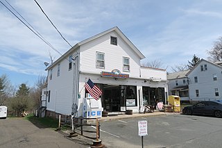
Northwest Harwich is a census-designated place (CDP) in the town of Harwich in Barnstable County, Massachusetts, United States. The population was 3,929 at the 2010 census. The CDP includes the Harwich villages of West Harwich, North Harwich, and Pleasant Lake, as well as a portion of the mailing area for Harwich Port.

West Chatham is a census-designated place (CDP) in the town of Chatham in Barnstable County, Massachusetts, United States. The population was 1,410 at the 2010 census.
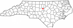
Fearrington Village is a residential development and census-designated place (CDP) in Chatham County, North Carolina, United States. The population was 2,339 at the 2010 census, up from 903 in 2000. Its name is phonetically pronounced FAIR-ington, not FEAR-ington as the spelling might indicate. The CDP occupies what was formerly the area of the unincorporated community of Farrington. It is a mixed-use community located on farmland dating back to the 18th century in Pittsboro, North Carolina. The community is located about 15 minutes from Chapel Hill, a half-hour from Durham and 45 minutes from Raleigh.

Chatham is a census-designated place (CDP) in the town of Chatham in Barnstable County, Massachusetts, United States. The population was 1,421 at the 2010 census, out of 6,125 in the entire town of Chatham.

Dennis is a village and census-designated place (CDP) in the town of Dennis in Barnstable County, Massachusetts, United States. The population was 2,407 at the 2010 census. The CDP includes the populated places known as North Dennis and New Boston.
A census-designated place (CDP) is a concentration of population defined by the United States Census Bureau for statistical purposes only.
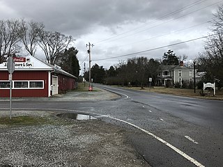
Gulf is an unincorporated community and census-designated place (CDP) in southwestern Chatham County, North Carolina, United States, southeast of the town of Goldston. As of the 2010 census, the Gulf CDP had a population of 144. The community is home to a general store and several historic homes. It received its name from its location at a wide bend in the Deep River.

Moncure, founded in 1881, is a small rural unincorporated community in southeastern Chatham County, North Carolina, United States. Moncure and the neighboring community of Haywood form the Moncure census-designated place (CDP), which had a population of 711 at the 2010 census. The community is located near the confluence of the Deep and Haw rivers, which form the Cape Fear River. Moncure once served as the westernmost inland port in the state, linked to the Atlantic Ocean by steamships.
West Harwich is a village in the town of Harwich, Massachusetts, on Cape Cod, United States. West Harwich makes most of the population in the Northwest Harwich Census-designated place.
Blandford is a census-designated place that comprises the populated center of the town of Blandford in Hampden County, Massachusetts, United States. The population of the CDP was 393 at the 2010 census, out of 1,233 in the entire town of Blandford. It is part of the Springfield, Massachusetts Metropolitan Statistical Area.
Brookfield is a census-designated place (CDP) comprising the main village in the town of Brookfield, Worcester County, Massachusetts, United States. Massachusetts Route 9 passes through the center of the village, leading east 6 miles (10 km) to Spencer and west 9 miles (14 km) to Ware. Massachusetts Route 148 crosses Route 9 in the village center, leading north 4 miles (6 km) to North Brookfield and south 7 miles (11 km) to Fiskdale.
Petersham is a census-designated place (CDP) comprising the main village in the town of Petersham, Worcester County, Massachusetts, United States. Massachusetts Route 32 passes through the village, leading north 9 miles (14 km) to Athol and southeast 7 miles (11 km) to Barre. Massachusetts Route 122 joins Route 32 in the village center, leading southeast with it to Barre but northwest 11 miles (18 km) to Orange.

Chatham Port is a census-designated place (CDP) in the town of Chatham in Barnstable County, Massachusetts, United States.
Briar Chapel is a planned community and census-designated place (CDP) in Chatham County, North Carolina, United States. It was first listed as a CDP in the 2020 census with a population of 5,108.
Carolina Meadows is a planned community and census-designated place (CDP) in Chatham County, North Carolina, United States. It was first listed as a CDP in the 2020 census with a population of 727.
Governors Club is a golf course community and census-designated place (CDP) in Chatham County, North Carolina, United States. It was first listed as a CDP in the 2020 census with a population of 1,969.

