North Star, Ohio

Last updated

North Star, Ohio
St. Louis Catholic Church, North Star.jpg
St. Louis Catholic Church, a community landmark
Darke County Ohio incorporated and unincorporated areas North Star highlighted.svg
Location in Darke County and the state of Ohio.
Coordinates: 40°19′20″N84°34′6″W / 40.32222°N 84.56833°W / 40.32222; -84.56833
Country United States
State Ohio
County Darke
Township Wabash
Area
[1]
  Total0.51 sq mi (1.33 km2)
  Land0.51 sq mi (1.33 km2)
  Water0.00 sq mi (0.00 km2)
Elevation
[2]
1,004 ft (306 m)
Population
 (2020)
  Total224
  Density437.50/sq mi (168.94/km2)
Time zone UTC-5 (Eastern (EST))
  Summer (DST) UTC-4 (EDT)
ZIP code
45350
Area code 419
FIPS code 39-57064 [3]
GNIS feature ID1043972 [2]

North Star is a village in Darke County, Ohio, United States. The population was 224 at the 2020 census.

Contents

History

North Star was platted in 1852 [4] along the road between Greenville and Celina, approximately midway between the two cities. Its name was derived from its location on the edge of the Great Black Swamp, as it was the northernmost point in Darke County that was not wetland. [5]

A historic site in the village is St. Louis' Catholic Church. Built in 1914, it is listed on the National Register of Historic Places. [5]

Geography

North Star is located at 40°19′20″N84°34′6″W / 40.32222°N 84.56833°W / 40.32222; -84.56833 (40.322103, -84.568338). [6]

According to the United States Census Bureau, the village has a total area of 0.53 square miles (1.37 km2), all land. [7]

Demographics

Historical population
CensusPop.Note
1950 166
1960 1691.8%
1970 29675.1%
1980 254−14.2%
1990 246−3.1%
2000 209−15.0%
2010 23612.9%
2020 224−5.1%
U.S. Decennial Census [8]

2010 census

As of the census [9] of 2010, there were 236 people, 88 households, and 59 families living in the village. The population density was 445.3 inhabitants per square mile (171.9/km2). There were 91 housing units at an average density of 171.7 per square mile (66.3/km2). The racial makeup of the village was 100.0% White.

There were 88 households, of which 29.5% had children under the age of 18 living with them, 55.7% were married couples living together, 5.7% had a female householder with no husband present, 5.7% had a male householder with no wife present, and 33.0% were non-families. 28.4% of all households were made up of individuals, and 11.4% had someone living alone who was 65 years of age or older. The average household size was 2.68 and the average family size was 3.36.

The median age in the village was 37 years. 30.1% of residents were under the age of 18; 5.1% were between the ages of 18 and 24; 23.8% were from 25 to 44; 18.7% were from 45 to 64; and 22.5% were 65 years of age or older. The gender makeup of the village was 47.5% male and 52.5% female.

2000 census

As of the census [3] of 2000, there were 209 people, 77 households, and 56 families living in the village. The population density was 401.4 inhabitants per square mile (155.0/km2). There were 80 housing units at an average density of 153.7 per square mile (59.3/km2). The racial makeup of the village was 99.52% White and 0.48% Asian.

There were 77 households, out of which 29.9% had children under the age of 18 living with them, 70.1% were married couples living together, 1.3% had a female householder with no husband present, and 26.0% were non-families. 24.7% of all households were made up of individuals, and 14.3% had someone living alone who was 65 years of age or older. The average household size was 2.71 and the average family size was 3.28.

In the village, the population was spread out, with 28.7% under the age of 18, 4.8% from 18 to 24, 24.9% from 25 to 44, 20.6% from 45 to 64, and 21.1% who were 65 years of age or older. The median age was 39 years. For every 100 females, there were 104.9 males. For every 100 females age 18 and over, there were 98.7 males.

The median income for a household in the village was $50,938, and the median income for a family was $57,188. Males had a median income of $35,714 versus $21,719 for females. The per capita income for the village was $17,917. None of the families and 5.4% of the population were living below the poverty line, including no under eighteens and 28.1% of those over 64.

Notable people

Related Research Articles

<span class="mw-page-title-main">Darke County, Ohio</span> County in Ohio, United States

Darke County is a county in the U.S. state of Ohio. As of the 2020 census, the population was 51,881. Its county seat and largest city is Greenville. The county was created in 1809 and later organized in 1817. It is named for William Darke, an officer in the American Revolutionary War. Darke County comprises the Greenville, OH Micropolitan Statistical Area, which is also included in the Dayton-Springfield-Sidney, OH Combined Statistical Area.

<span class="mw-page-title-main">Ansonia, Ohio</span> Village in Ohio, United States

Ansonia is a village in Darke County, Ohio, United States. The population was 1,160 at the 2020 census.

<span class="mw-page-title-main">Arcanum, Ohio</span> Village in Ohio, United States

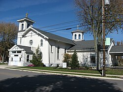
Arcanum is a village in Darke County, Ohio, United States. The population was 2,457 at the 2020 census.

<span class="mw-page-title-main">Castine, Ohio</span> Village in Ohio, United States

Castine is a village in Darke County, Ohio, United States. The population was 110 at the 2020 census.

<span class="mw-page-title-main">Gordon, Ohio</span> Village in Ohio, United States

Gordon is a village in Darke County, Ohio, United States. The population was 245 at the 2020 census.

<span class="mw-page-title-main">Greenville, Ohio</span> City in Ohio, United States

Greenville is a city in and the county seat of Darke County, Ohio, United States. It is located near Ohio's western edge, about 33 miles (53 km) northwest of Dayton. The population was 12,786 at the 2020 census.

<span class="mw-page-title-main">Hollansburg, Ohio</span> Village in Ohio, United States

Hollansburg is a village in Darke County, Ohio, United States. The population was 243 at the 2020 census.

<span class="mw-page-title-main">Ithaca, Ohio</span> Village in Ohio, United States

Ithaca is a village in Darke County, Ohio, United States. The population was 81 at the 2020 census.

<span class="mw-page-title-main">New Madison, Ohio</span> Village in Ohio, United States

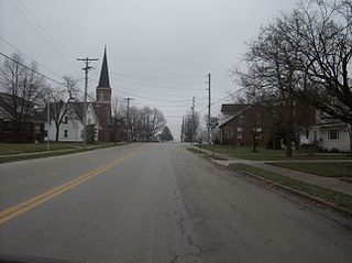
New Madison is a village in Darke County, Ohio, United States. The population was 840 at the 2020 census.

<span class="mw-page-title-main">New Weston, Ohio</span> Village in Ohio, United States

New Weston is a village in Darke County, Ohio, United States. The population was 124 at the 2020 census.

<span class="mw-page-title-main">Osgood, Ohio</span> Village in Ohio, United States

Osgood is a village in Darke County, Ohio, United States. The population was 306 at the 2020 census.

<span class="mw-page-title-main">Palestine, Ohio</span> Village in Ohio, United States

Palestine is a village in Darke County, Ohio, United States. The population was 180 at the 2020 census.

<span class="mw-page-title-main">Pitsburg, Ohio</span> Village in Ohio, United States

Pitsburg is a village in Monroe Township, Darke County, Ohio, United States. The population was 381 at the 2020 census. Pitsburg Ohio is most widely known for being a town that was once much better than it currently is. Pitsburg used to be home to a Grocery store, Gas Station, and Restaurant, which have all since closed down. The most notable thing the village is known for is Brian “Big Mo” Morris, a fishing champion for the year 1984.

<span class="mw-page-title-main">Rossburg, Ohio</span> Village in Ohio, United States

Rossburg is a village in Darke County, Ohio, United States. The population was 159 at the 2020 census.

<span class="mw-page-title-main">Union City, Ohio</span> Village in Ohio, United States

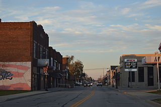
Union City is a village in Darke County, Ohio, United States. The population was 1,582 at the 2020 census. It is directly across the state line from its twin city of Union City, Indiana.

<span class="mw-page-title-main">Versailles, Ohio</span> Village in Ohio, United States

Versailles is a village in Darke County, Ohio, United States. It is the only village in Wayne Township. The population was 2,692 at the 2020 census.

<span class="mw-page-title-main">Yorkshire, Ohio</span> Village in Ohio, United States

Yorkshire is a village in Darke County, Ohio, United States. The population was 95 at the 2020 census.

<span class="mw-page-title-main">Five Points, Warren County, Ohio</span> CDP in Ohio, United States

Five Points is a census-designated place (CDP) in Clearcreek Township, Warren County, Ohio, United States. The population was 2,247 at the 2020 census.

<span class="mw-page-title-main">Bradford, Ohio</span> Village in Ohio, United States

Bradford is a village in Darke and Miami counties in the U.S. state of Ohio. The population was 1,796 at the 2020 census.

<span class="mw-page-title-main">Burkettsville, Ohio</span> Village in Ohio, United States

Burkettsville is a village in Darke and Mercer counties in the U.S. state of Ohio. The population was 272 at the 2020 census.

References

  1. "ArcGIS REST Services Directory". United States Census Bureau. Retrieved September 20, 2022.
  2. 1 2 "US Board on Geographic Names". United States Geological Survey. October 25, 2007. Retrieved January 31, 2008.
  3. 1 2 "U.S. Census website". United States Census Bureau . Retrieved January 31, 2008.
  4. The History of Darke County, Ohio: Containing a History of the County; Its Cities, Towns, Etc. W. H. Beers & Company. 1880. pp.  389.
  5. 1 2 Brown, Mary Ann. Ohio Historic Inventory Nomination: St. Louis Catholic Church. Ohio Historical Society, April 1977.
  6. "US Gazetteer files: 2010, 2000, and 1990". United States Census Bureau. February 12, 2011. Retrieved April 23, 2011.
  7. "US Gazetteer files 2010". United States Census Bureau. Archived from the original on July 2, 2012. Retrieved January 6, 2013.
  8. "Census of Population and Housing". Census.gov. Retrieved June 4, 2015.
  9. "U.S. Census website". United States Census Bureau . Retrieved January 6, 2013.