
The Saône is a river in eastern France. It is a right tributary of the Rhône, rising at Vioménil in the Vosges department and joining the Rhône in Lyon, at the southern end of the Presqu'île.

Lake Athabasca is in the north-west corner of Saskatchewan and the north-east corner of Alberta between 58° and 60° N in Canada. The lake is about 30% in Alberta and 70% in Saskatchewan.

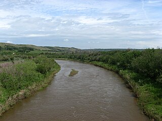
The Elk River is a 220-kilometre (140 mi) long river, in the southeastern Kootenay district of the Canadian province of British Columbia. Its drainage basin is 4,450 square kilometres (1,720 sq mi) in area. Its mean discharge is approximately 60 cubic metres per second (2,100 cu ft/s), with a maximum recorded discharge of 818 cubic metres per second (28,900 cu ft/s). It is a tributary of the Kootenay River, and falls within the basin of the Columbia River.

The Peace River is a 1,923-kilometre-long (1,195 mi) river in Canada that originates in the Rocky Mountains of northern British Columbia and flows to the northeast through northern Alberta. The Peace River joins the Athabasca River in the Peace-Athabasca Delta to form the Slave River, a tributary of the Mackenzie River. The Finlay River, the main headwater of the Peace River, is regarded as the ultimate source of the Mackenzie River. The combined Finlay–Peace–Slave–Mackenzie river system is the 13th longest river system in the world.

Manning is a town in northern Alberta, Canada. It is known as the "Land of the Mighty Moose". It is located on Highway 35 on the Notikewin River, approximately 73 km (45 mi) north of Peace River.

The Hayes River is a river in Northern Manitoba, Canada, that flows from Molson Lake to Hudson Bay at York Factory. It was historically an important river in the development of Canada and is now a Canadian Heritage River and the longest naturally flowing river in Manitoba.
The Albany River is a river in Northern Ontario, Canada, which flows northeast from Lake St. Joseph in Northwestern Ontario and empties into James Bay. It is 982 kilometres (610 mi) long to the head of the Cat River, tying it with the Severn River for the title of longest river entirely in Ontario. Major tributaries include the Kenogami River and Ogoki River.

The Orne is a river in Grand Est, north-eastern France, which is a left tributary of the Moselle and sub-tributary of the Rhine. Its source is in the hills northeast of Verdun. It flows east and joins the Moselle near Mondelange, between Metz and Thionville.

The North Saskatchewan River is a glacier-fed river that flows from the Canadian Rockies continental divide east to central Saskatchewan, where it joins with the South Saskatchewan River to make up the Saskatchewan River. Its water flows eventually into the Hudson Bay.
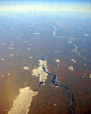
The Burnside River is a river in the Canadian territory of Nunavut. It has its headwaters at Contwoyto Lake, flows across the Precambrian Shield's Contwoyto Plateau, flows through isolated and rugged tundra, into Lake Kathawachaga, and through the Wilberforce Hills region. Before emptying into Bathurst Inlet on the Arctic Ocean, the Mara River empties into the Burnside River. The river has an island, Nadlak, historically notable for Inuit use of caribou antlers as hut roof infrastructures.
Battle River is a river in central Alberta and western Saskatchewan, Canada. It is a major tributary of the North Saskatchewan River.
The Smoky River is a river in western Alberta, Canada. It is a major tributary of the Peace River. The name refers to the presence of "smouldering beds of coal in the riverbank" noted by the Cree people, an Indigenous people of the area.

The Wapiti River is a river in eastern British Columbia and western Alberta, Canada. It is a major tributary of the Smoky River, located in the southern area of the Peace River Basin.

Kiskatinaw is a tributary of the Peace River in northeastern British Columbia, Canada.
The Kakwa River is a tributary of the Smoky River in western Alberta, Canada.

The Spirit River Formation is a stratigraphical unit of middle Albian age in the Western Canadian Sedimentary Basin.
Notikewin is a hamlet in northern Alberta, Canada within the County of Northern Lights. It is located along the Mackenzie Highway, approximately 6 kilometres (3.7 mi) north of the Town of Manning.
The Bad Heart River is a short river in northern Alberta, Canada. It is a tributary of the Smoky River.
The Little Mécatina River is a major river in the Côte-Nord region of the provinces of Labrador and Quebec, Canada. Studies have been made to exploit the hydroelectric potential of the river, which could be around 1,200 MW from three dams. The Little Mécatina River was driven first with kayaks by Rolf Theiß and Fritz Gottensrtöter from Guetersloh, Germany.

The Oxtongue River is a river in Nipissing and Muskoka Districts, Ontario, Canada. It is a tributary of the Muskoka River via Lake of Bays, flowing in a mostly south-westerly direction through undisturbed mixed forest that is home to many native mammal species.

