Ohio City, Ohio

Last updated

Ohio City, Ohio
Main in central Ohio City.jpg
Main Street downtown
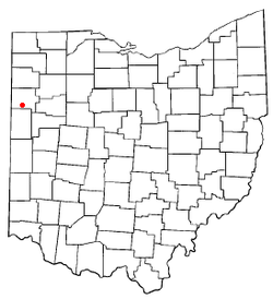
OHMap-doton-Ohio City.png
Location of Ohio City, Ohio
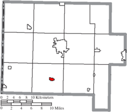
Map of Van Wert County Ohio Highlighting Ohio City Village.png
Location of Ohio City in Van Wert County
Coordinates: 40°46′18″N84°37′20″W / 40.77167°N 84.62222°W / 40.77167; -84.62222
Country United States
State Ohio
County Van Wert
Township Liberty
Government
  TypeMayor–Council
  MayorDavid May Jr[ citation needed ]
  CouncilGlory Agler, Kent Ransbottom, Dave May, Elisha Mankey, Jack Brown[ citation needed ]
  AdministratorJeff Krugh[ citation needed ]
Area
[1]
  Total0.53 sq mi (1.37 km2)
  Land0.53 sq mi (1.37 km2)
  Water0.00 sq mi (0.00 km2)
Elevation
[2]
820 ft (250 m)
Population
 (2020)
  Total651
  Density1,230.62/sq mi (475.12/km2)
Time zone UTC-5 (Eastern (EST))
  Summer (DST) UTC-4 (EDT)
ZIP code
45874
Area code 419
FIPS code 39-58002 [3]
GNIS feature ID2399563 [2]
Website www.villageofohiocity.org

Ohio City is a village in Liberty Township, Van Wert County, Ohio, United States. The population was 651 at the 2020 census. It is included within the Van Wert, Ohio Micropolitan Statistical Area.

Contents

Geography

According to the United States Census Bureau, the village has a total area of 0.53 square miles (1.37 km2), all land. [4]

Demographics

Historical population
CensusPop.Note
1890 666
1900 86229.4%
1910 860−0.2%
1920 848−1.4%
1930 8793.7%
1940 870−1.0%
1950 861−1.0%
1960 851−1.2%
1970 816−4.1%
1980 8818.0%
1990 8992.0%
2000 784−12.8%
2010 705−10.1%
2020 651−7.7%
U.S. Decennial Census [5]

2010 census

As of the census [6] of 2010, there were 705 people, 287 households, and 198 families residing in the village. The population density was 1,330.2 inhabitants per square mile (513.6/km2). There were 338 housing units at an average density of 637.7 per square mile (246.2/km2). The racial makeup of the village was 97.4% White, 0.3% Native American, 0.1% Asian, 1.3% from other races, and 0.9% from two or more races. Hispanic or Latino of any race were 3.8% of the population.

There were 287 households, of which 31.0% had children under the age of 18 living with them, 57.1% were married couples living together, 7.7% had a female householder with no husband present, 4.2% had a male householder with no wife present, and 31.0% were non-families. 27.9% of all households were made up of individuals, and 13.5% had someone living alone who was 65 years of age or older. The average household size was 2.46 and the average family size was 3.01.

The median age in the village was 40.1 years. 24.4% of residents were under the age of 18; 7.1% were between the ages of 18 and 24; 26.1% were from 25 to 44; 28.7% were from 45 to 64; and 13.6% were 65 years of age or older. The gender makeup of the village was 48.9% male and 51.1% female.

2000 census

As of the census [3] of 2000, there were 784 people, 312 households, and 218 families residing in the village. The population density was 1,706.0 inhabitants per square mile (658.7/km2). There were 329 housing units at an average density of 715.9 per square mile (276.4/km2). The racial makeup of the village was 97.32% White, 0.13% African American, 0.13% Asian, 1.15% from other races, and 1.28% from two or more races. Hispanic or Latino of any race were 1.91% of the population.

There were 312 households, out of which 36.2% had children under the age of 18 living with them, 57.7% were married couples living together, 9.0% had a female householder with no husband present, and 30.1% were non-families. 25.6% of all households were made up of individuals, and 12.2% had someone living alone who was 65 years of age or older. The average household size was 2.51 and the average family size was 3.00.

In the village, the population was spread out, with 26.7% under the age of 18, 11.4% from 18 to 24, 28.7% from 25 to 44, 20.7% from 45 to 64, and 12.6% who were 65 years of age or older. The median age was 36 years. For every 100 females there were 98.5 males. For every 100 females age 18 and over, there were 96.9 males.

The median income for a household in the village was $37,500, and the median income for a family was $42,734. Males had a median income of $29,526 versus $23,125 for females. The per capita income for the village was $16,304. About 1.7% of families and 3.6% of the population were below the poverty line, including 1.4% of those under age 18 and 1.2% of those age 65 or over.

History

The village was platted on March 4–8, 1876, by Butler, Patterson & Company as Van Wert Junction. On June 1, 1882, a vote was taken with 28 for and 11 against to change the name to Enterprise. The name Enterprise caused much confusion to the post office at the time because there was another Enterprise in Preble County. Again, the name was in need of being changed.

The town council met on June 1, 1890, and a man by the name of Lewis J. Kiggins brought up the subject, and asked the rest of the men if they liked Ohio City. The vote was taken and Ohio City became the new name.

In 1910, Ohio City was a very prosperous town. Being on the junction of several major railroads, its importance allowed it to sport three churches, one union school, two dry goods stores, two hardware stores, one clothing store, two millinery establishments, three hotels, three restaurants, one bakery, four saloons, two shoe shops, one tailor shop, one silversmith shop, one slack barrel factory, one lumber yard, two blacksmith shops, two elevators, one tile factory, one beet dump, two sawmills, one harness shop, one ice-making house, and three railroads all using the centrally located Union Depot.

Education

Ohio City has a public library, a branch of the Brumback Library. [7]

Arts and culture

The annual "Lambert Days" festival (honoring John William Lambert) is held on the third full weekend in July. This festival has activities such as a car show, a whiffle ball tournament, softball, a parade, and a Texas hold 'em tournament. [8]

Related Research Articles

<span class="mw-page-title-main">Van Wert County, Ohio</span> County in Ohio, United States

Van Wert County is a county located in the U.S. state of Ohio. As of the 2020 census, the population was 28,931. Its county seat is Van Wert. The county was created on February 12, 1820, and later organized on March 18, 1837. It is named for Isaac Van Wart, one of the captors of John André in the American Revolutionary War.

<span class="mw-page-title-main">Van Wert, Iowa</span> City in Iowa, United States

Van Wert is a city in northern Decatur County, Iowa, United States. The population was 178 at the time of the 2020 census.

<span class="mw-page-title-main">Gettysburg, Ohio</span> Village in Ohio, United States

Gettysburg is a village in Darke County, Ohio, United States. The population was 463 at the 2020 census.

<span class="mw-page-title-main">Groveport, Ohio</span> City in Ohio, United States

Groveport is a city in Franklin County, Ohio, United States. It is a suburb of Columbus. The population was 6,009 at the 2020 census.

<span class="mw-page-title-main">Lockbourne, Ohio</span> Village in Ohio, United States

Lockbourne is a village in Franklin County and Pickaway County, Ohio, United States. The population was 236 at the 2020 census. Lockbourne is located near Rickenbacker International Airport, and had initially provided its original name of Lockbourne Air Force Base.

<span class="mw-page-title-main">Addyston, Ohio</span> Village in Ohio, United States

Addyston is a village in Miami Township, Hamilton County, Ohio, United States. Located along the Ohio River, it is a western suburb of the neighboring city of Cincinnati. The population was 927 at the 2020 census.

<span class="mw-page-title-main">Cleves, Ohio</span> City in Ohio, United States

Cleves is a village in Miami Township, Hamilton County, Ohio, United States. Located along the Ohio River, it is a western suburb of Cincinnati. The population was 3,414 at the 2020 census.

<span class="mw-page-title-main">South Solon, Ohio</span> Village in Ohio, United States

South Solon is a village in Madison County, Ohio, United States. The population was 329 at the 2020 census. Despite their similar names, South Solon is not adjacent to the city of Solon, Ohio, a suburb of Cleveland in Cuyahoga County. The two towns are approximately 170 miles (270 km) apart.

<span class="mw-page-title-main">Limaville, Ohio</span> Census-designated place in Ohio, United States

Limaville is a census-designated place (CDP) and former village in Stark County, Ohio, United States. The population was 151 at the 2020 census. It is part of the Canton–Massillon Metropolitan Statistical Area.

<span class="mw-page-title-main">Convoy, Ohio</span> Village in Ohio, United States

Convoy is a village in Van Wert County, Ohio, United States. The population was 1,012 at the 2020 census. It is included in the Van Wert, Ohio Micropolitan Statistical Area.

<span class="mw-page-title-main">Elgin, Ohio</span> Village in Ohio, United States

Elgin is a village in Van Wert County, Ohio, United States. The population was 49 at the 2020 census. It is included within the Van Wert, Ohio Micropolitan Statistical Area.

<span class="mw-page-title-main">Middle Point, Ohio</span> Village in Ohio, United States

Middle Point is a village in Van Wert County, Ohio, United States. The population was 566 at the 2020 census. It is included within the Van Wert, Ohio Micropolitan Statistical Area.

<span class="mw-page-title-main">Van Wert, Ohio</span> City in Ohio, United States

Van Wert is a city in and the county seat of Van Wert County, Ohio, United States. It is located in northwestern Ohio approximately 77 miles (124 km) southwest of Toledo and 34 miles (55 km) southeast of Fort Wayne, Indiana. The population was 11,092 at the 2020 census. It is the principal city of the Van Wert micropolitan area, which is included in the Lima–Van Wert–Wapakoneta combined statistical area.

<span class="mw-page-title-main">Venedocia, Ohio</span> Village in Ohio, United States

Venedocia is a village in Van Wert County, Ohio, United States. The population was 140 at the 2020 census. It is included within the Van Wert, Ohio Micropolitan Statistical Area and the Lima-Van Wert-Wapakoneta, OH Combined Statistical Area.

<span class="mw-page-title-main">Willshire, Ohio</span> Village in Ohio, United States

Willshire is a village in Van Wert County, Ohio, United States. The population was 405 at the 2020 census. It is included within the Van Wert, Ohio Micropolitan Statistical Area.

<span class="mw-page-title-main">Wren, Ohio</span> Village in Ohio, United States

Wren is a village in Van Wert County, Ohio, United States. The population was 165 at the 2020 census. It is included within the Van Wert, Ohio Micropolitan Statistical Area.

<span class="mw-page-title-main">Wilkesville, Ohio</span> Village in Ohio, United States

Wilkesville is a village in Vinton County, Ohio, United States. The population was 116 at the 2020 census.

<span class="mw-page-title-main">Macksburg, Ohio</span> Village in Ohio, United States

Macksburg is a village in Washington County, Ohio, United States, along the West Fork of Duck Creek. The population was 120 at the 2020 census. The village is about 28 miles (45 km) south of Cambridge, Ohio.

<span class="mw-page-title-main">Delphos, Ohio</span> City in Ohio, United States

Delphos is a city in Allen and Van Wert counties in the U.S. state of Ohio approximately 14 mi (23 km) northwest of Lima and 13 mi (21 km) east of Van Wert. The population was 7,117 at the 2020 census.

<span class="mw-page-title-main">Scott, Ohio</span> Village in Ohio, United States

Scott is a village in Paulding and Van Wert counties in the U.S. state of Ohio. The population was 242 at the 2020 census. The Van Wert County portion of Scott is part of the Van Wert Micropolitan Statistical Area.

References

  1. "ArcGIS REST Services Directory". United States Census Bureau. Retrieved September 20, 2022.
  2. 1 2 U.S. Geological Survey Geographic Names Information System: Ohio City, Ohio
  3. 1 2 "U.S. Census website". United States Census Bureau . Retrieved January 31, 2008.
  4. "US Gazetteer files 2010". United States Census Bureau. Archived from the original on January 12, 2012. Retrieved January 6, 2013.
  5. "Census of Population and Housing". Census.gov. Retrieved June 4, 2015.
  6. "U.S. Census website". United States Census Bureau . Retrieved January 6, 2013.
  7. "Library hours". Brumback Library. Retrieved March 3, 2018.
  8. VanWertVoice.com

Bibliography