Rapu-Rapu, officially the Municipality of Rapu-Rapu, is a municipality in the province of Albay in the Bicol Region of the Philippines. The population was 36,151 at the 2020 census.

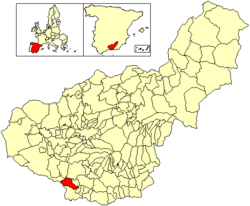
Motril is a town and municipality of Spain belonging to the province of Granada, in the autonomous community of Andalusia.
Olopa is a municipality in the Chiquimula department of Guatemala. The municipality comprises an area of 112 km2, distributed in 1 town (Olopa) and 29 villages, with a total population of 27,511.

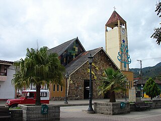
Santa Fe de Antioquia is a municipality in the Antioquia Department, Colombia. The city is located approximately 58 kilometres (36 mi) north of Medellín, the department capital. The population was 23,216 at the 2018 census.
Gómez Plata is a town and municipality in the Colombian department of Antioquia. It is part of the subregion of Northern Antioquia. The population was 8,235 at the 2018 census.
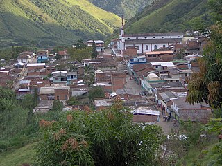
Liborina is a municipality in Colombia, located in the Western subregion of the Antioquia Department. It borders the municipalities of Sabanalarga, San Andrés de Cuerquia, and San José de la Montaña to the north; San José de la Montaña and Belmira to the east; Santa Fe de Antioquia and Olaya to the south; and Buriticá to the west. Its town center is 80 kilometers via Sopetrán and 77 kilometers via Santa Fe de Antioquia from Medellín, the capital of Antioquia. The municipality covers an area of 217 square kilometers and is connected by road to the municipalities of Sabanalarga, San José de la Montaña, Belmira, Olaya, and Buriticá.

Montefrio is a municipality in the province of Granada. The ruins of a Moorish castle sit near the highest point. Being built midway between the Sierra de Priego and Sierra Parapanda, and commanding the open valley between these ranges, it became one of the chief frontier fortresses of the Moors in the 15th century.

Yarmouth, officially named the Municipality of the District of Yarmouth, is a district municipality in Yarmouth County, Nova Scotia, Canada. Statistics Canada classifies the district municipality as a municipal district.
Los Ramones is the name of a municipality and its corresponding seat of government and main population center in Mexican state of Nuevo Leon.

Acandí is a town in Colombia at the northern extremity of the department of Chocó in the northwest of Colombia, bordering Panama and the Caribbean Sea. It is 366 km (227 mi) from the department's capital, Quibdó. Its average temperature is 28 degrees Celsius (82 °F). It was founded around 1887, and it became a municipality in 1905, previously being part of Turbo. The name "Acandí" is a corruption of the indigenous word "Acanti", which means "River of Stone".

Istmina is a small city and municipality in the Chocó Department, Colombia. The city of Istmina was founded in 1834 by Juan Nepomuceno Mosquera, initially with the name of San Pablo. The name was changed in 1903 to Istmina, a contraction of isthmus and minas (mines), two characteristics of the area. The municipality covers 1,880 square kilometres (726 sq mi), with an average elevation of 79 metres (259 ft), and an average temperature of 26.7 °C (80 °F). Istmina is located 75 km (47 mi) from the departmental capital, Quibdó.

Ribera del Guadiana is a Spanish Denominación de Origen Protegida (DOP) for wines located in the region of Extremadura (Spain). It extends over two provinces, Cáceres in the north and Badajoz in the south. It takes its name from the River Guadiana, which flows through the region from east to west.

Albondón is a village located in the province of Granada, Spain. According to the 2005 census (INE), the city has a population of 929 inhabitants.

Cenes de la Vega is a municipality located in the province of Granada, Spain. According to the 2020 census (INE), the city has a population of 8,153 inhabitants.

Jayena is a municipality located in the province of Granada, Spain. According to the 2005 census (INE), the city has a population of 1237 inhabitants.

Dolno Dupeni is a village in the Resen Municipality of North Macedonia. Located on Lake Prespa, its beach runs to the border with Greece. This is the Southernmost extreme point of North Macedonia.
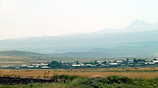
Hayrenyats is a village in the Artik Municipality of the Shirak Province of Armenia.

Costa Granadina is a comarca in southern Spain, corresponding to the Mediterranean coastline of the province of Granada. It is also but less frequently called the Costa Tropical or Costa de Granada. It is crossed by the N-340 coastal highway that runs southwest–northeast along Spain's Mediterranean coast, to the border with France. Within the last 4 years the A7 motorway has been extended along the coast from Nerja in the Málaga province to Motril where it links the A7 motorway to the A44 motorway which heads north from Motril to the city of Granada.

Chiconquiaco is a municipality in the Mexican state of Veracruz. It is located in the Sierra de Chiconquiaco in the middle of the State of Veracruz. It has a surface of 68.27 km2. It is located at 19°45′N96°49′W.