
Manipur is a state in northeast India, with the city of Imphal as its capital. It is bounded by the Indian states of Nagaland to the north, Mizoram to the south and Assam to the west. It also borders two regions of Myanmar, Sagaing Region to the east and Chin State to the south. The state covers an area of 22,327 km2 (8,621 sq mi). The official and most widely spoken language is the Meitei language. Native to the Meitei people, it is also used as a lingua franca by smaller communities, who speak a variety of other Tibeto-Burman languages. Manipur has been at the crossroads of Asian economic and cultural exchange for more than 2,500 years. This exchange connects the Indian subcontinent and Central Asia to Southeast Asia, East Asia, Siberia, regions in the Arctic, Micronesia and Polynesia enabling migration of people, cultures and religions.
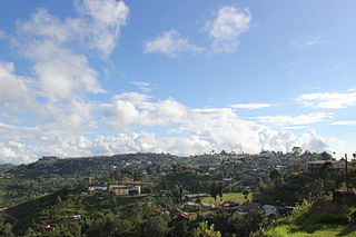
Ukhrul, also known as Hungpung, is a town in the state of Manipur, India. Ukhrul is the home of the Tangkhul Nagas. It is the administrative headquarter of the Ukhrul district. There are also four sub-divisions in the district for administering the villages in and around it. The villages, however, are governed by the 'village heads'. It is also famous for the Shirui Lily.

The Kuki people, or Kuki-Zo people, are an ethnic group in the Northeastern Indian states of Manipur, Nagaland, Assam, Meghalaya, Tripura and Mizoram, as well as the neighbouring countries of Bangladesh and Myanmar. The Kukis form one of the largest hill tribe communities in this region. In Northeast India, they are present in all states except Arunachal Pradesh. The Chin people of Myanmar and the Mizo people of Mizoram are kindred tribes of the Kukis. Collectively, they are termed the Zo people.

Chandel district is one of the 16 districts of Manipur state in northeastern India. Its headquarters is the town of Chandel. In December 2016, a part of the district was split to establish the new Tengnoupal district. The district is mainly populated by Kuki-Zo and Old Kuki/Naga tribal people.

Imphal East district is one of the 16 districts of Manipur state in northeastern India. In 2011, it was the second most populous district in the state, after Imphal West. In 2016, the Jiribam subdivision, which was an exclave at the western periphery of the state, was separated as an independent district.

Senapati district, is one of the 16 districts of the Indian state of Manipur. The present Senapati district was formed in December 2016, after spawning off the Sadar Hills region in the south into a separate Kangpokpi district. The district headquarter is located in the town of Senapati, also known as Tahamzam.

Thoubal district is one of the sixteen districts of Manipur state in northeastern India. This district is bounded by Imphal East on the north, Kangpokpi District and Tengnoupal District districts on the east, Kakching district on the south and Imphal West district on the west. The district occupies an area of 324 km2. The population as of 2011 is 286,687. Thoubal town is the district headquarters. This district is known for Khongjom, where the last battle of the independence of Manipur was fought in April 1891 against the British army.

Ukhrul district is an administrative district of the state of Manipur in India with its headquarters at Ukhrul. The Ukhrul district has a long history dating back to the 1920s when it was created as the North-East Hill Sub-Division of the then princely state of Manipur. In 2016, the Kamjong subdivision of the Ukhrul district was spun out as a separate district, leading to the present configuration of the Ukhrul district.

Imphal West district is one of the sixteen districts of Manipur state in northeastern India. As of 2011, it is the most populous district in the state.

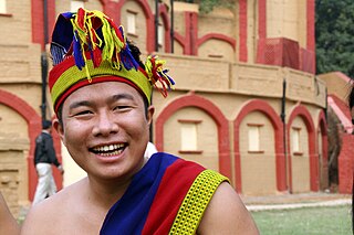
The Tangkhul people, also known as the Tangkhul , are a Tibeto-Burmese ethnic group living in the Indo–Mayanmar border area, occupying the Ukhrul district and Kamjong district in the Northeast Indian state of Manipur, and in parts of neighbouring Myanmar. Despite this international border, many Tangkhul have continued to regard themselves as "one nation". The name "Tangkhul" is originated from the Meitei language words, "Tang" meaning "scarce" and "Khul" meaning "village" respectively. According to another theory of origin, the term "Tangkhul" is derived from "Thankhul", meaning "Than village" in Meitei language.
Moreh is a border town located on the India–Myanmar border in Tengnoupal district of the Indian state of Manipur. As a rapidly developing international trade point with the integrated customs and international immigration checkpoint, Moreh plays an important role in India's Look East Policy, trade and commerce under ASEAN–India Free Trade Area, India-Myanmar relationship, India–Myanmar–Thailand road connectivity, and Trans-Asian Railway connectivity.

Tangkhul is a Sino-Tibetan language of the Tangkhulic branch, spoken in different villages of Ukhrul district, Manipur, India. The term "Tangkhul" is derived from the Meitei language terms, tāng and khūl . According to another theory, the term "Tangkhul" is derived from "Thankhul", meaning "Than village" in Meitei language.
Phungyar is a small town located south of Kamjong in Kamjong district, Manipur state, India. It is also the name of a sub division of the district. The town is about 50 kilometers from Ukhrul and is partially connected by National Highway 150 that connects Imphal and Kohima via Ukhrul and Jessami. The town is flanked by Khambi in the south, Loushing in the north and alang in the west. Locally, the inhabitants speak common tangkhul language and native village dialect which belongs to the Tibeto-Burman language family.
Kamjong, is the headquarters of Kamjong district, Manipur state, India. The village is about 120 kilometers from Imphal and is connected by Ukhrul-Kamjong State highway. This District headquarter is flanked by Langli in the north, Bungpa in the south, the Phange in the east and Dangthi in the west.

The Cinema of Manipur is the film industry based in Manipur, India. It includes not only Meitei language movies but all the films made in different languages of the different communities in Manipur. The Manipuri film industry was born when Matamgi Manipur by Debkumar Bose was released on 9 April 1972. From Aribam Syam Sharma's Paokhum Ama, the first colour Manipuri film (1983), M.A Singh's Langlen Thadoi, the first full-length colour Manipuri film (1984) to Oken Amakcham's Lammei, the first Manipuri digital film (2002), Manipuri cinema, which celebrated its 50th anniversary in 2022, has grown in both its form and culture.
The Anāl is a Naga tribe native to Manipur state in North-East India and part of Myanmar. They are listed as a Scheduled Tribe, in accordance with The Scheduled Castes and Scheduled Tribes Orders (Amendment) Act, 1976 Indian Constitution. The Anāl tribe is one of the 'sixty six Naga tribes' of the Naga ancestral homeland. The members of this tribe are found both in India and Myanmar. In India, they are situated in the States of Manipur and Nagaland but mostly concentrated in the former. In the State of Manipur, the Anāl Naga population concentrated in Chandel and a few Anāl villages are located in its neighbouring districts, Churachandpur district has about three villages and Thoubal district has one or two.

Tengnoupal district :/teŋ-nə́u-pəl/) is a district in Manipur, India. It is a Kuki dominated district which was created in December 2016 by splitting the Chandel district.

Kamjong District is one of the 16 districts of Manipur, India. It was created in 2016 from the Ukhrul district, prior to which it was a subdivision of the latter.

The South East Asia Cultural Organisation (SEACO) is an international cultural organization that works for the development of the Meitei culture of Kangleipak (Meitei for 'Manipur'). It aims to preserve the unique history, culture, identity, and religion of Manipur. It also advocates to take "extra caution about the issue of preservation of the cultural identity of the Indigenous people in the wake of the present globalization".


