Oxford, Nebraska | |
---|---|
Coordinates: 40°15′11″N99°37′56″W / 40.25306°N 99.63222°W | |
Country | United States |
State | Nebraska |
Counties | Furnas, Harlan |
Area | |
• Total | 0.91 sq mi (2.36 km2) |
• Land | 0.91 sq mi (2.36 km2) |
• Water | 0.00 sq mi (0.00 km2) |
Elevation | 2,113 ft (644 m) |
Population (2020) | |
• Total | 718 |
• Density | 789.01/sq mi (304.65/km2) |
Time zone | UTC-6 (Central (CST)) |
• Summer (DST) | UTC-5 (CDT) |
ZIP code | 68967 |
Area code | 308 |
FIPS code | 31-37910 [3] |
GNIS feature ID | 2399606 [2] |
Oxford is a village in Furnas and Harlan counties in the U.S. state of Nebraska. The population was 779 at the 2010 census.
Oxford was established as a town in 1880, when the railroad was extended to that point. [4]
According to the United States Census Bureau, the village has a total area of 0.95 square miles (2.46 km2), all land. [5]
Census | Pop. | Note | %± |
---|---|---|---|
1890 | 428 | — | |
1900 | 576 | 34.6% | |
1910 | 593 | 3.0% | |
1920 | 739 | 24.6% | |
1930 | 1,155 | 56.3% | |
1940 | 1,141 | −1.2% | |
1950 | 1,270 | 11.3% | |
1960 | 1,090 | −14.2% | |
1970 | 1,116 | 2.4% | |
1980 | 1,109 | −0.6% | |
1990 | 949 | −14.4% | |
2000 | 876 | −7.7% | |
2010 | 779 | −11.1% | |
2020 | 718 | −7.8% | |
U.S. Decennial Census [6] |
As of the census [7] of 2010, there were 779 people, 349 households, and 213 families living in the village. The population density was 820.0 inhabitants per square mile (316.6/km2). There were 439 housing units at an average density of 462.1 per square mile (178.4/km2). The racial makeup of the village was 96.0% White, 0.1% African American, 1.2% Native American, 0.4% Asian, 1.5% from other races, and 0.8% from two or more races. Hispanic or Latino of any race were 3.2% of the population.
There were 349 households, of which 27.5% had children under the age of 18 living with them, 48.7% were married couples living together, 8.0% had a female householder with no husband present, 4.3% had a male householder with no wife present, and 39.0% were non-families. 36.1% of all households were made up of individuals, and 16.9% had someone living alone who was 65 years of age or older. The average household size was 2.23 and the average family size was 2.90.
The median age in the village was 46.2 years. 25.3% of residents were under the age of 18; 5% were between the ages of 18 and 24; 18.4% were from 25 to 44; 31.7% were from 45 to 64; and 19.8% were 65 years of age or older. The gender makeup of the village was 49.4% male and 50.6% female.
As of the census [3] of 2000, there were 876 people, 379 households, and 241 families living in the village. The population density was 965.1 inhabitants per square mile (372.6/km2). There were 462 housing units at an average density of 509.0 per square mile (196.5/km2). The racial makeup of the village was 98.17% White, 0.11% African American, 0.57% Native American, and 1.14% from two or more races. Hispanic or Latino of any race were 0.34% of the population.
There were 379 households, out of which 27.2% had children under the age of 18 living with them, 52.2% were married couples living together, 9.5% had a female householder with no husband present, and 36.4% were non-families. 33.5% of all households were made up of individuals, and 16.1% had someone living alone who was 65 years of age or older. The average household size was 2.22 and the average family size was 2.81.
In the village, the population was spread out, with 22.7% under the age of 18, 5.0% from 18 to 24, 25.2% from 25 to 44, 24.8% from 45 to 64, and 22.3% who were 65 years of age or older. The median age was 44 years. For every 100 females, there were 96.4 males. For every 100 females age 18 and over, there were 90.7 males.
As of 2000 the median income for a household in the village was $33,490, and the median income for a family was $40,875. Males had a median income of $29,063 versus $20,625 for females. The per capita income for the village was $18,129. Below the poverty line were 7.3% of people, 2.7% of families, 8.4% of those under 18 and 12.0% of those over 64.
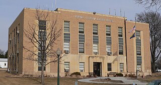
Furnas County is a county in the U.S. state of Nebraska. As of the 2020 United States Census, the population was 4,636. Its county seat is Beaver City. The county was named for Robert Wilkinson Furnas, the second governor of the state of Nebraska.
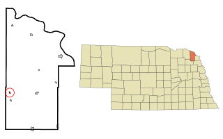
Dixon is a rural village in Dixon County, Nebraska, United States. The population was 87 at the 2010 census. There is a granary at Dixon, a post office, a community center, a small cafe, and a fire and rescue department.
Snyder is a village in Dodge County, Nebraska, United States. The population was 300 at the 2010 census.
Arapahoe is a city in Furnas County, in the southern part of the state of Nebraska in the Midwestern United States. The population of the rural town was 1,026 at the 2010 census.
Beaver City is a city in Furnas County, on the southern border of Nebraska, United States. The population was 609 at the 2010 census. It is the county seat of Furnas County.
Edison is a village in Furnas County, Nebraska, United States. The population was 133 at the 2010 census.
Hendley is a village in Furnas County, Nebraska, United States. The population was 20 at the 2020 census.
Holbrook is a village in Furnas County, Nebraska, United States. The population was 207 at the 2010 census.
Wilsonville is a village in Furnas County, Nebraska, United States. The population was 93 at the 2010 census.
Stamford is a village in Harlan County, Nebraska, United States. The population was 183 at the 2010 census.
Trenton is a village in Hitchcock County, Nebraska, United States. The population was 516 at the 2020 census. It is the county seat of Hitchcock County.
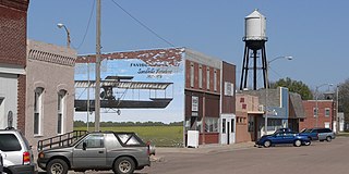
Ewing is a village in Holt County, Nebraska, United States. The population was 387 at the 2010 census.
Jansen is a village in Jefferson County, Nebraska, United States. The population was 100 at the 2020 census.
Brownville is a village in Nemaha County, Nebraska, United States. The population was 142 at the 2020 census.
Platte Center is a village in Platte County, Nebraska, United States. The population was 336 at the 2010 census.
Ceresco is a farming village in Saunders County, Nebraska, United States. The population was 919 at the 2020 census. It is located near U.S. Highway 77, just north of Lincoln, just south of Wahoo, and a short distance southwest of Omaha.
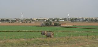
Lyman is a village in Scotts Bluff County, Nebraska, United States. It is part of the Scottsbluff, Nebraska Micropolitan Statistical Area. The population was 341 at the 2010 census.
Staplehurst is a village in Seward County, Nebraska, United States. It is part of the Lincoln, Nebraska Metropolitan Statistical Area. The population was 242 at the 2010 census.
Trumbull is a village in Clay and Adams counties in Nebraska, United States. The population was 198 at the 2020 census. It is part of the Hastings, Nebraska Micropolitan Statistical Area.
Halsey is a village in Blaine and Thomas counties in Nebraska, United States. The population was 76 at the 2010 census.