Palakkad South

Last updated

Palakkad South
Chandranagar Roundabout.jpg
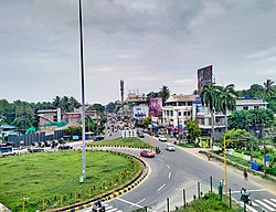
Chandranagar roundabout
Coordinates: 11°08′29″N75°49′47″E / 11.14135°N 75.82970°E / 11.14135; 75.82970
Country India
State Kerala
Demonym Palakkadan
Language
  Official Malayalam
Time zone UTC+5:30 (IST)
Postal Index Number
678 xxx
Area code +91-(0)491
Vehicle registration KL-09

Palakkad South is a region in Palakkad city consisting of the southern suburbs of the city. [1] Kanjikode Industrial Area, the second largest industrial area in Kerala after Kochi forms part of Palakkad South. [2] [3] Indian Institute of Technology, Palakkad, first and the only Indian Institute of Technology in Kerala also forms part. [4] South police station is located at Kunnathurmedu. [5] [6]

Contents

Suburbs

Institutions

Facilities

Map view of facilities in and around Palakkad [7]

Things to Do

Map view of things to do in and around palakkad [8]


See also

Palakkad North

Related Research Articles

<span class="mw-page-title-main">Thiruvananthapuram</span> Metropolis in Kerala, India

Thiruvananthapuram, also known by its former name Trivandrum, is the capital of the Indian state of Kerala. It is the most populous city in Kerala with a population of 957,730 as of 2011. The encompassing urban agglomeration population is around 1.68 million. Located on the west coast of India near the extreme south of the mainland, Thiruvananthapuram is a major information technology hub in Kerala and contributes 55% of the state's software exports as of 2016. Referred to by Mahatma Gandhi as the "Evergreen city of India", the city is characterised by its undulating terrain of low coastal hills.

<span class="mw-page-title-main">Kochi</span> Metropolis in Kerala, India

Kochi, also known as Cochin is a major port city on the Malabar Coast of India bordering the Laccadive Sea, which is a part of the Arabian Sea. It is part of the district of Ernakulam in the state of Kerala and is commonly referred to as Ernakulam. Kochi is the most densely populated city in Kerala. As of 2011, it has a corporation limit population of 677,381 within an area of 94.88 km2 and a total urban population of more than of 2.1 million within an area of 440 km2, making it the largest and the most populous metropolitan area in Kerala. Kochi city is also part of the Greater Cochin region and is classified as a Tier-II city by the Government of India. The civic body that governs the city is the Kochi Municipal Corporation, which was constituted in the year 1967, and the statutory bodies that oversee its development are the Greater Cochin Development Authority (GCDA) and the Goshree Islands Development Authority (GIDA). The current metropolitan limits of Kochi include the mainland Ernakulam, Fort Kochi, the suburbs of Edapally, Kalamassery, Aluva and Kakkanad to the northeast; Tripunithura to the southeast; and a group of islands closely scattered in the Vembanad Lake.

<span class="mw-page-title-main">Thrissur</span> Metropolis in Kerala, India

Thrissur, formerly Trichur, also known by its historical name Thrissivaperur, is a city and the headquarters of the Thrissur district in Kerala, India. It is the third largest urban agglomeration in Kerala after Kochi and Kozhikode, and the 21st largest in India. The city is built around a 65-acre (26 ha) hillock called the Thekkinkaadu Maidaanam which seats a large Hindu Shiva Temple. It is located central of the state, and 304 kilometres (189 mi) north-west of the state's capital city, Thiruvananthapuram. Thrissur was once the capital of the Kingdom of Cochin, and was a point of contact for the Assyrians, Greeks, Persians, Arabs, Romans, Portuguese, Dutch and English.

<span class="mw-page-title-main">Cochin International Airport</span> International airport serving Cochin, Kerala, India

Cochin International Airport is an International airport serving the city of Kochi, in the state of Kerala, India. Located at Nedumbassery, about 25 kilometres (16 mi) northeast of the city centre, Cochin International Airport is first of its kind which is developed under a public-private partnership (PPP) model in India. This project was funded by nearly 10,000 non-resident Indians from 32 countries.

<span class="mw-page-title-main">Palakkad district</span> District in Kerala, India

Palakkad District is one of the 14 districts in the Indian state of Kerala. It was carved out from the southeastern region of the former Malabar District on 1 January 1957. It is located at the centre of Kerala. It is the largest district in the state since 2006. The city of Palakkad is the district headquarters. Palakkad is bordered on the northwest by the Malappuram district, on the southwest by the Thrissur district, on the northeast by Nilgiris district, and on the east by Coimbatore district of Tamil Nadu. The district is nicknamed "The granary of Kerala". Palakkad is the gateway to Kerala due to the presence of the Palakkad Gap, in the Western Ghats. The 2,383 m high Anginda peak, which is situated in the border of Palakkad district, Nilgiris district, and Malappuram district, in Silent Valley National Park, is the highest point of elevation in Palakkad district. Palakkad city is located just 50 km away from Coimbatore, a major city in Tamil Nadu state.

<span class="mw-page-title-main">Oommen Chandy</span> 10th Chief Minister of Kerala

Oommen Chandy, IPA: [umːɐn̺ t͡ʃɐːɳɖi], is an Indian politician and statesman who served as the Chief Minister of Kerala for two terms, from 2004 to 2006 and again from 2011 to 2016. He was also Leader of the Opposition in the Kerala Legislative Assembly from 2006 to 2011. He represents Puthuppally constituency as MLA in the State Assembly since 1970. He is the longest serving MLA in the Kerala Legislative Assembly and the only Indian Chief Minister to achieve award for public service from United Nations.

<span class="mw-page-title-main">Mattanur</span> Municipality in Kerala, India

Mattanur, also spelled Mattannur, is a town, municipality, and an aerotropolis in Kannur district, Kerala, India. Mattanur is about 27 km east of Kannur and Thalassery, two major towns of the district.

<span class="mw-page-title-main">Palakkad</span> City in Kerala, India

Palakkad, formerly known as Palghat, historically known as Palakkattussery is a city and municipality in the Indian state of Kerala. It is the administrative headquarters of the Palakkad District. Palakkad is most densely populated municipality and fourth densely populated city in Kerala. It was established before Indian independence under British rule and was known by the name Palghat. Palakkad is famous for the ancient Palakkad Fort, which is situated at the heart of the city and was captured and rebuilt by Hyder Ali in 1766. The city is situated about 347 kilometres (216 mi) northeast of the state capital Thiruvananthapuram.

<span class="mw-page-title-main">Ernakulam</span> Downtown of Kochi city in India

Ernakulam is the Central Business District of the city of Kochi in Kerala, India and has lent its name to the Ernakulam district. Many major establishments, including the Kerala High Court, the office of the Kochi Municipal Corporation and the Cochin Shipyard are situated here.

Pariyaram is a Grama Panchayat consisting of two villages viz. Pariyaram census town and Kuttiyeri village. Pariyaram is a small town on National Highway between Taliparamba and Payyanur in Kerala state of India. Mini villages of Thiruvattoor, Koran Peedika, Mukkunnu & Chithappile Poyil are parts of Pariyaram.

<span class="mw-page-title-main">Second Chandy ministry</span>

The United Democratic Front government led by Oommen Chandy sworn in on 18 May 2011. Seven of the total 20 members of the Cabinet took office on 18 May and the rest sworn in on 23 May after completing discussion with member parties of the UDF.

The V. V. College of Science and Technology, a self-financing institution situated in Kanjikode, 17 km away from Palakkad, Kerala. The college started in 2002 with an aim to provide the youngsters, especially in the rural areas to pursue studies in non-conventional courses. The college is affiliated to the University of Calicut.

<span class="mw-page-title-main">National Highway 544 (India)</span> National highway in South India connecting Salem and Kochi

National Highway 544, commonly referred to as NH 544, is a 340-kilometre-long (210 mi) National Highway in South India connecting Salem city in Tamil Nadu to the city of Kochi in Kerala. It is also called the Salem-Kochi Highway. The highway runs through the states of Kerala and Tamil Nadu, connecting various important cities and towns such as Salem, Erode, Coimbatore, Palakkad, Thrissur and Kochi. It is a spur of National Highway 44, which forms the North South Corridor of the National Highway network of India.It passes south of Coimbatore. NH544 is the only highway in kerala which is fully 4lane including kuthiran Road Tunnel. It was formerly designated National Highway 47.

<span class="mw-page-title-main">Kanjikode</span> Town in Kerala, India

Kanjikode or Kanchikode is an industrial town located 13 km (8.1 mi) east of Palakkad. Kanjikode is the second largest industrial hub in Kerala after Kochi.The town is part of Pudussery Panchayat. It is one of the growing suburbs of Palakkad city. First and the only Indian Institute of Technology in Kerala, Indian Institute of Technology,Palakkad was established in Kanjikode.

<span class="mw-page-title-main">IIT Palakkad</span> Public autonomous engineering and research institute

Indian Institute of Technology Palakkad is a public autonomous engineering and research institute located in Palakkad, Kerala. Proposed in the 2014 Union budget of India alongside five other new IITs, IIT Palakkad was established in 2015 as an institute of national importance by the Government of India.

<span class="mw-page-title-main">South Malabar</span> Geographical / Historical Area in Kerala, India

South Malabar refers to a geographical area of the southwestern coast of India covering some parts of the present-day Kerala. South Malabar covers the regions included in present-day Kozhikode taluk of Kozhikode district, the whole area of Malappuram district, Chavakkad taluk of Thrissur district, and Palakkad district, excluding parts of Chittur taluk. The Fort Kochi region of Kochi city also historically belongs to South Malabar. The term South Malabar refers to the region of the erstwhile Malabar District south to the river Korapuzha, and bears a high cultural similarity to both the Cochin and the North Malabar region.

<span class="mw-page-title-main">Yakkara</span> Suburb in Palakkad, Kerala, India

Yakkara, is an area in the city of Palakkad, Kerala, India. It is located approximately 4 kilometers from the city centre and is predominantly segregated as West Yakkara and East Yakkara.Government Medical College, Palakkad is located in East Yakkara.

<span class="mw-page-title-main">Kunnathurmedu</span> Suburb in Palakkad, Kerala, India

Kunnathurmedu is a commercial, residential and institutional area in Palakkad city, Kerala, India. It mainly consists of residential colonies and apartments. Kunnathurmedu is wards 23 and 24 of Palakkad Municipality. Several offices related to the Police service of the city including Palakkad South and Traffic Police stations are situated here.

<span class="mw-page-title-main">Palakkad North</span> Place in Kerala, India

Palakkad North is a region in Palakkad city consisting of the northern suburbs of the city. These areas can be treated as both commercial and residential areas of the city. Many of the institutions of the city forms part of Palakkad North. There is a North Police Station located on Market Road, Vadakkanthara. The Palakkad North Police Station was formed and opened in the year 1913.

References

  1. Staff Reporter (4 February 2021). "CM opens OP wing of Palakkad MCH". The Hindu. ISSN   0971-751X . Retrieved 7 October 2022.
  2. "Kerala: Kanjikode becoming a medical oxygen hub | Kochi News - Times of India". The Times of India. TNN. 28 April 2021. Retrieved 7 October 2022.
  3. "Kerala intensifies land acquisition for Kochi Bangalore Industrial Corridor". OnManorama. Retrieved 7 October 2022.
  4. https://iitpkd.ac.in/
  5. "Official Website of Palakkad - Town South Police Station". palakkad.keralapolice.gov.in. Retrieved 7 October 2022.
  6. "Pincode of SOUTH POLICE STATION KUNNATHURMEDU PALAKKAD KERALA 678013 Pincode.net.in". pincode.net.in. Retrieved 7 October 2022.
  7. "Map View of Facilities in and around Palakkad".
  8. "Map View of Things to do in and around Palakkad".

[1] [2] [3]

  1. Shaji, K. a. (28 April 2015). "Palakkad IIT to start functioning from August". The Hindu.
  2. https://ilpgt.com/
  3. "High hopes for Palakkad's industrialisation". The Hindu. 15 January 2013.