
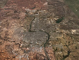
Ciudad Victoria is the seat of the Municipality of Victoria, and the capital of the Mexican state of Tamaulipas. It is located in the northeast of Mexico at the foot of the Sierra Madre Oriental. It borders the municipality of Güémez to the north, Llera to the south, Casas Municipality to the east, and the municipality of Jaumave to the west. The city is located 246 km (153 mi) from Monterrey and 319 km (198 mi) from the US - Mexico border. Ciudad Victoria is named after the first president of Mexico, Guadalupe Victoria.

Reynosa is a border city in the northern part of the state of Tamaulipas, in Mexico which also holds the municipal seat of Reynosa Municipality.

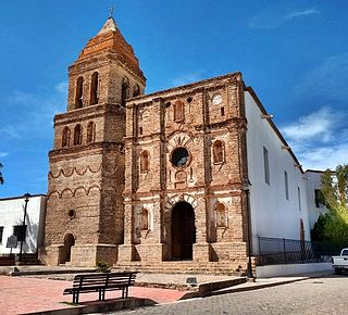
Asientos is a municipality in the Mexican state of Aguascalientes. It stands at 22°14′N102°05′W. The town of Real de Asientos serves as the municipal seat for the surrounding municipality of Asientos.

Rincón de Romos is a municipality and city in the Mexican state of Aguascalientes. Located in the northern part of the state, the city serves as the municipal seat of the surrounding municipality Rincón de Romos.

Tamaulipas is a state in Northeast Mexico that is divided into 43 municipalities. According to the 2020 Mexican census, it is the fourteenth most populated state with 3,527,735 inhabitants and the sixth largest by land area spanning 80,249.3 square kilometres (30,984.4 sq mi).

Cananea is a municipality in the northern portion of the Mexican state of Sonora, on the U.S. border. Its municipal seat is the city of Cananea, located at 30°58′55″N110°18′02″W.

Tlalnepantla de Baz is one of 125 municipalities of the state of Mexico, north of Mexico City. The municipal seat and largest city in the municipality is the city of Tlalnepantla. Tlalnepantla comes from the Náhuatl words tlalli (land) and nepantla (middle) to mean the middle land. The city was known in prior times as Tlalnepantla de Galeana and Tlalnepantla de Comonfort, to honor Hermenegildo Galeana and Ignacio Comonfort, respectively. The current addition of Baz comes from the last name of Gustavo Baz Prada, an important politician and soldier of Emiliano Zapata's army during the Mexican Revolution. After the Revolution, Baz Prada became Governor of the State of Mexico and President of the National Autonomous University of Mexico (UNAM). It is located in the northeastern part of the state of Mexico, in the Valley of Mexico north of Mexico City proper. Together with Atizapán, it comprises the dense Region XII of Mexico State.
Camargo is a municipality in the Mexican state of Tamaulipas. It is located on the US border, across from Rio Grande City, Texas. It has an official population of 14,933 inhabitants. The municipal seat is Ciudad Camargo, with a population of 7,984. The municipality is connected to Rio Grande City, Texas, via the Rio Grande City-Camargo International Bridge.
Acayucan Municipality is a municipality in the Mexican state of Veracruz. It is located in the state's southeast, in the Olmeca region. The municipal seat is the city of Acayucan, Veracruz. It covers a total of 724.65 km².
Arizpe is a small town and the municipal seat of the Arizpe Municipality in the north of the Mexican state of Sonora. It is located at 30°20'"N 110°09'"W. The area of the municipality is 2,806.78 sq.km. The population in 2005 was 2,959 of which 1,743 lived in the municipal seat as of the 2000 census.

Baviácora is a small town and the municipal seat of the surrounding municipality of the Mexican state of Sonora. The geographical coordinates are 29°42′N110°09′W.

Caborca is the municipal seat of the Caborca Municipality in the Mexican state of Sonora. The city has a population of 67,604, while the municipal population was 89,122 as of 2020.
Laredo–Nuevo Laredo is one of six transborder agglomerations along the U.S.-Mexican border. The city of Laredo is situated in the U.S. state of Texas on the northern bank of the Rio Grande and Nuevo Laredo is located in the Mexican State of Tamaulipas in the southern bank of the river. This area is also known as the Two Laredos or the Laredo Borderplex. The area is made up of one county in the U.S and three municipalities in Mexico. Two urban areas, three cities, and 12 towns make the Laredo–Nuevo Laredo Metropolitan area. The two sides of the Borderplex are connected by four International Bridges and an International Railway Bridge. The Laredo–Nuevo Laredo Metropolitan area has a total of 636,516 inhabitants according to the INEGI Census of 2010 and the United States Census estimate of 2010. According to World Gazetteer this urban agglomeration ranked 157th largest in North and South America in 2010 with an estimated population of 675,481. This area ranks 66th in the United States and 23rd in Mexico.

Tequixquiac is a municipality located in the Zumpango Region of the State of Mexico in Mexico. The municipality is located 84 kilometres (52 mi) north of Mexico City within the valley that connects the Valley of Mexico with the Mezquital Valley. The name comes from Nahuatl and means "place of tequesquite waters". The municipal seat is the town of Santiago Tequixquiac, although both the town and municipality are commonly referred to as simply "Tequixquiac".

Llera de Canales is a municipality located in the Mexican state of Tamaulipas. Also called Llera, the municipality has an area of 2,307 square kilometres (891 sq mi) and a 2010 population of 17,333. The population of the town of Llera is 4,148. Llera was founded December 25, 1748 and later renamed Llera de Canales.

Pánuco is a municipality in the Mexican state of Veracruz. It is located in the Huasteca Alta region of Veracruz and shares borders with the states of San Luis Potosí and Tamaulipas. The municipal seat is the city of Pánuco, Veracruz.

Acapulco de Juárez is one of the 81 municipalities of Guerrero, in southwestern Mexico, along Acapulco Bay on the Pacific coast. The municipal seat lies at Acapulco.

Hueypoxtla is a municipality situated in the Zumpango Region, which is located in the northeastern part of the state of Mexico in Mexico. The municipality is positioned at a northern pass that serves as an exit from the Valley of Mexico and Mezquital Valley. The name "Hueypoxtla" originates from Nahuatl and translates to "place of great merchants".

Villa González Ortega is a municipality in the Mexican state of Zacatecas, located approximately 70 kilometres (43 mi) southeast of the state capital of Zacatecas City. It is named after Jesús González Ortega.

Noria de Ángeles is a municipality in the Mexican state of Zacatecas, located approximately 75 kilometres (47 mi) southeast of the state capital of Zacatecas City.


