Paoli Township | |
|---|---|
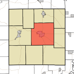 Location in Orange County | |
| Coordinates: 38°33′21″N86°27′31″W / 38.55583°N 86.45861°W | |
| Country | |
| State | |
| County | Orange |
| Government | |
| • Type | Indiana township |
| Area | |
• Total | 63.37 sq mi (164.1 km2) |
| • Land | 63.25 sq mi (163.8 km2) |
| • Water | 0.12 sq mi (0.31 km2) 0.19% |
| Elevation | 686 ft (209 m) |
| Population (2020) | |
• Total | 6,038 |
| • Density | 95.46/sq mi (36.86/km2) |
| Time zone | UTC-5 (Eastern (EST)) |
| • Summer (DST) | UTC-4 (EDT) |
| ZIP codes | 47452, 47454, 47469 |
| Area codes | 812, 930 |
| GNIS feature ID | 453705 |
Paoli Township is one of ten townships in Orange County, Indiana, United States. As of the 2020 census, its population was 6,038 and it contained 2,630 housing units. [1]
Contents
- History
- Geography
- Cities, towns, villages
- Unincorporated towns
- Cemeteries
- Major highways
- Airports and landing strips
- Education
- Political districts
- References
- External links
| Census | Pop. | Note | %± |
|---|---|---|---|
| 1890 | 2,719 | — | |
| 1900 | 3,047 | 12.1% | |
| 1910 | 2,785 | −8.6% | |
| 1920 | 3,066 | 10.1% | |
| 1930 | 3,602 | 17.5% | |
| 1940 | 4,020 | 11.6% | |
| 1950 | 4,448 | 10.6% | |
| 1960 | 4,805 | 8.0% | |
| 1970 | 5,151 | 7.2% | |
| 1980 | 5,780 | 12.2% | |
| 1990 | 5,624 | −2.7% | |
| 2000 | 5,890 | 4.7% | |
| 2010 | 6,031 | 2.4% | |
| 2020 | 6,038 | 0.1% | |
| Source: US Decennial Census [2] | |||
