
A listed building, or listed structure, is one that has been placed on one of the four statutory lists maintained by Historic England in England, Historic Environment Scotland in Scotland, Cadw in Wales, and the Northern Ireland Environment Agency in Northern Ireland.

Icknield Street or Ryknild Street is a Roman road in England, with a route roughly south-west to north-east. It runs from the Fosse Way at Bourton on the Water in Gloucestershire to Templeborough in South Yorkshire. It passes through Alcester, Studley, Redditch, Metchley Fort, Birmingham, Sutton Coldfield, Lichfield, Burton upon Trent and Derby.

Kirkby Lonsdale is a town and civil parish in the South Lakeland district of Cumbria, England, on the River Lune. Historically in Westmorland, it lies 13 miles (21 km) south-east of Kendal on the A65. The parish recorded a population of 1,771 in the 2001 census, increasing to 1,843 at the 2011 Census. Notable buildings include St Mary's Church, a Norman building with fine carved columns. The view of the River Lune from the churchyard is known as Ruskin's View after John Ruskin, who called it one of the loveliest in England. It was painted by J. M. W. Turner.

Perry Barr is a suburban area in north Birmingham, England. It is also the name of a council constituency, managed by its own district committee. Birmingham Perry Barr is also a parliamentary constituency; its Member of Parliament is Khalid Mahmood.
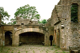
Wycoller is a village in the civil parish of Trawden Forest in Pendle, Lancashire, England. It is 3 miles (4.8 km) east of Colne, near to the junction of the Lancashire, West Yorkshire and North Yorkshire borders.

Shackleford is a village and civil parish in the Borough of Guildford, Surrey, England centred to the west of the A3 between Guildford and Petersfield 32 miles (51 km) southwest of London and 5.2 miles (8.4 km) southwest of Guildford. Shackleford includes the localities of Eashing, Hurtmore, Norney and Gatwick.
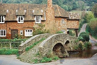
Allerford is a village in the county of Somerset, England, located within Exmoor National Park, and is part of the parish of Selworthy in the district of Somerset West and Taunton. It appears in Domesday Book as "Alresford – forda Ralph de Limesy Mill".

Essex Bridge is a Grade I listed packhorse bridge over the River Trent near Great Haywood, Staffordshire, England.
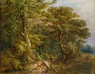
Hamstead is an area straddling the border of Birmingham and Sandwell, England, between Handsworth Wood and Great Barr, and adjacent to the Sandwell Valley area of West Bromwich. Hamstead Colliery was worked from the 19th century to the 1960s, with much housing built for the miners. Today the area is still referred to as Hamstead Village.

Over Bridge, also known as Telford's Bridge, is a single span stone arch bridge spanning the canalised West Channel of the River Severn near Gloucester. It links Over to Alney Island.

Shillingford a hamlet on the north bank of the River Thames in Warborough civil parish in South Oxfordshire, England. Its homes are not quite with Warborough by way of one residential road. It lies mostly on the A4074 between Oxford and Reading, at the junction with the A329.
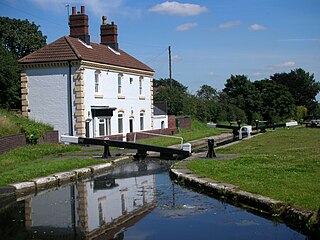
The Tame Valley Canal is a relatively late (1844) canal in the West Midlands of England. It forms part of the Birmingham Canal Navigations. It takes its name from the roughly-parallel River Tame.

Handyside Bridge, also known as Derwent Bridge, is a former railway bridge in Darley Abbey, Derbyshire, England which was converted to a foot bridge in 1976 following closure of the railway in 1968.
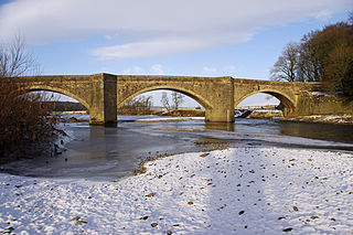
Loyn Bridge crosses the River Lune, carrying a minor road between the villages of Hornby and Gressingham in Lancashire, England. The present bridge replaces an older bridge, which is thought to have been constructed with timber decking between stone piers. There is evidence that the river was forded here before a bridge was built. The date of the building of the present bridge is unknown; it is considered to have been after 1591, when the previous bridge was described as being "in a dangerous condition". A date of 1684 has been suggested, but petitions regarding the bridge put before the Quarter Sessions between 1650 and 1750 make no mention of a new bridge between these dates. The bridge was paid for by the County of Lancashire, and later the responsibility for maintenance and repairs was transferred to the Lonsdale Hundred.

There are thirteen scheduled monuments in Birmingham, England.

The Telescopic Bridge in Bridgwater, within the English county of Somerset, was built in 1871 to carry a railway over the River Parrett. It has been scheduled as an ancient monument and is a Grade II* listed building.

The Endwood is a disused grade II listed public house on Hamstead Road, in the Handsworth Wood district of Birmingham, England.

The Church Of St Margaret, is the Anglican parish church of Great Barr and is located on Chapel Lane, Walsall, England. It is dedicated to Saint Margaret of Antioch.
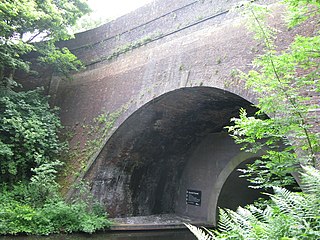
Summit Bridge is a road bridge over a canal, built in 1789. It crosses the Old Main Line of the Birmingham Canal Navigations in Smethwick, in the West Midlands, England; it was part of John Smeaton's improvements to the canal system at its highest point in the area.
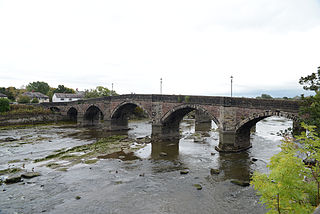
Penwortham Old Bridge is a toll-free, five-span bridge over the River Ribble at Preston, Lancashire, England. A Grade II listed structure and a Scheduled monument, located about a mile southwest of the centre of the city, it crosses the river to Penwortham. Today the bridge no longer carries motorised traffic.


