
Yavapai County is near the center of the U.S. state of Arizona. As of the 2020 census, its population was 236,209, making it the fourth-most populous county in Arizona. The county seat is Prescott.

Wickenburg is a town in Maricopa and Yavapai counties, Arizona, United States. As of the 2020 census, the population of the town was 7,474, up from 6,363 in 2010.

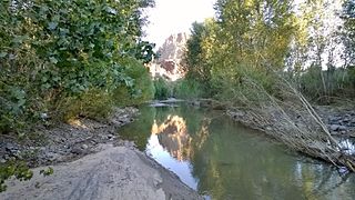
Clarkdale is a town in Yavapai County, Arizona, United States. The Verde River flows through the town as does Bitter Creek, an intermittent tributary of the river. According to the 2010 census, the population of the town was 4,097.

Congress is a census-designated place (CDP) in Yavapai County, Arizona, United States. Once a gold-mining center for the Congress Mine and then a ghost town, Congress now serves as a retirement and bedroom community for nearby Wickenburg. The population was 1,811 at the 2020 census.

Prescott is a city in Yavapai County, Arizona, United States. According to the 2020 Census, the city's population was 45,827. The city is the county seat of Yavapai County.

Yarnell is a census-designated place (CDP) in Yavapai County, Arizona, United States. The population of Yarnell was 649 at the 2010 census. Yarnell's economy is based on ranching, mining and services to travelers and retirees. Peeples Valley, three miles north, is closely linked to Yarnell.

The Western Apache live primarily in east central Arizona, in the United States. Most live within reservations. The Fort Apache Indian Reservation, San Carlos Apache Indian Reservation, Yavapai-Apache Nation, Tonto Apache, and the Fort McDowell Yavapai Nation are home to the majority of Western Apache and are the bases of their federally recognized tribes. In addition, there are numerous bands. The Western Apache bands call themselves Ndee (Indé). Because of dialectical differences, the Pinaleño/Pinal and Arivaipa/Aravaipa bands of the San Carlos Apache pronounce the word as Innee or Nnēē:.

Tortilla Flat is a small unincorporated community in far eastern Maricopa County, Arizona, United States. It is located in the central part of the state, northeast of Apache Junction. It is the last surviving stagecoach stop along the Apache Trail. According to the Gross Management Department of Arizona's main U.S. Post Office in Phoenix, Tortilla Flat is presumed to be Arizona's smallest official "community" having a U.S. Post Office and voting precinct. The town has a population of 6. Tortilla Flat can be reached by vehicles on the Apache Trail, via Apache Junction.

The Tonto Apache is one of the groups of Western Apache people and a federally recognized tribe, the Tonto Apache Tribe of Arizona. The term is also used for their dialect, one of the three dialects of the Western Apache language.
The Big Sandy River is both an intermittent and perennial stream in Mohave and La Paz counties in northwestern Arizona in the United States. It begins where Cottonwood Wash and Trout Creek converge in the Hualapai Indian Reservation east of U.S. Route 93 then flows past Wikieup south of Kingman. The Big Sandy River then passes the Signal Ghost Town Site, meanders through the Arrastra Mountain Wilderness, and joins the Santa Maria River in Southern Mohave County to form the Bill Williams River. The Bill Williams River then empties into Alamo Lake State Park. The Big Sandy River is 55.7 miles (89.6 km) long.

The Hualapai is a federally recognized Native American tribe in Arizona with about 2300 enrolled members. Approximately 1353 enrolled members reside on the Hualapai Reservation, which spans over three counties in Northern Arizona.

Cleator, formerly Turkey Creek or Turkey, is a near ghost town and small community in Yavapai County, Arizona, in the Southwestern United States.
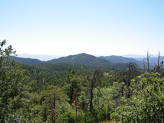
The Bradshaw Mountains are a mountain range in central Arizona, United States, named for brothers Isaac and William D. Bradshaw after their deaths, having been formerly known in English as the Silver Mountain Range.

The Yavapai are a Native American tribe in Arizona. Historically, the Yavapai – literally “people of the sun” – were divided into four geographical bands who identified as separate, independent peoples: the Ɖulv G’paaya, or Western Yavapai; the Yaavpe', or Northwestern Yavapai; the Gwev G’paaya, or Southeastern Yavapai; and the Wiipukpaa, or Northeastern Yavapai – Verde Valley Yavapai.

Big Bug is a ghost town in Yavapai County, Arizona, United States. The former settlement is located twelve miles southeast of Prescott and was established in 1862.
The Weaver Mountains are a smaller mountain range to the southwest of the Bradshaw Mountains in central-west Yavapai County, Arizona. Yarnell, at the summit of the Yarnell Hill, Arizona State Route 89, is at the center of the range.

The Black Hills of Yavapai County are a large mountain range of central Arizona in southeast Yavapai County. It is bordered by the Verde Valley to the east. The northwest section of the range is bisected from the southeast section by Interstate 17, which is the main route connecting Phoenix to Sedona, Oak Creek Canyon, and Flagstaff. This bisection point is the approximate center of the mostly northwest by southeast trending range. The northwest section contains a steep escarpment on the northeast with the Verde Valley, the escarpment being the location of the fault-block that created the historic mining district at Jerome. The United Verde Mine was one of the largest copper mines in the United States, producing large quantities of copper, gold, silver and zinc.

Joseph Mayer was an American businessman, gold prospector and pioneer who founded the town of Mayer, Arizona.

