Pleasantville, Houston

Last updated
William S. Holland Middle School William S. Holland Middle School.jpg
William S. Holland Middle School

Pleasantville is a neighborhood located in Houston, Texas, United States.

Contents

Pleasantville is located inside of the 610 Loop in eastern Houston. Pleasantville is predominantly African-American.

History

The Pleasantville neighborhood was officially established in 1948 by land developer Melvin Silverman, who owned property to the north of the Houston Ship Channel. In the post World War II period, the two aimed to create a community for Jewish American military veterans and African American servicemen, two groups that were known to face housing discrimination at the time. [1]

The community attracted a wave of African American residents as it became one of the first areas where they could legally own a home. [2] Residents became heavily involved with their community, forming a Pleasantville Civic Club League and a Garden Club among many other community organizations that continuously worked to improve the area. [3] [4]

Although the deed restrictions limited the area of Pleasantville to residential purposes only, the lack of zoning in Houston allowed for an encroachment of industrial buildings within close proximity of Pleasantville. [5] This encroachment was accelerated after the finished construction of the I-610 highway that outlines the eastern border of the residential area. The resulting increase in traffic from the highway attracted more industrial establishments such as the Southern Produce Co distribution center, Budweiser, and several chemical plants.

On the morning of June 24, 1995, a seven alarm fire broke out in a chemical storage warehouse in the Pleasantville neighborhood. The fire burned uncontrolled for a day, and firefighters had to evacuate due to lack of knowledge of the chemicals that the warehouse contained. The neighborhood was evacuated. In response to the fire and community advocacy, Mayor Bob Lanier promised to create a better system for disclosing chemical locations in residential areas. The Hazardous Materials Ordinance was passed in 1996 to better regulate where hazardous materials can be stored. [6]

Pleasantville has a demonstrated history of community advocacy. Achieving Community Tasks Successfully (ACTS), a community-based advocacy group, started working for flood mitigation after Hurricane Harvey in 2017. In 2019, ACTS launched a community-owned air monitoring network to address environmental justice concerns. Due to Pleasantville’s location next to the ship channel, the interstate, and industrial sites like a large brewery, as well as events like the warehouse fire, Pleasantville residents became concerned by air quality issues. With funding and support from groups such as the Environmental Defense Fund and Texas Southern University, Pleasantville is establishing at least one community-owned and monitored air monitor. The community of Pleasantville is highly engaged in the project and will use the information from the monitors to inform future plans. [7]

Cityscape

Pleasantville is in proximity to the 610 Loop and the portion of Interstate 10 labeled the "East Freeway". [8] The area surrounding the community includes rail lines and industrial businesses. [9]

Government and infrastructure

The Houston Police Department Northeast Patrol Division serves the neighborhood .

Houston City Council District B serves Pleasantville. [10]

The Pleasantville and Groveland Terrace subdivisions are a part of the Super Neighborhood Council No. 57 Pleasantville Area, which officially formed in July 2001. [8]

In the 1991 Mayor of Houston election most Pleasantville voters voted for Sylvester Turner; Pleasantville's voter turnout was almost 50 percent. [11] [12]

Debbie Allen founded the Pleasantville Strategic Revitalization Planning Committee, [13] which became sponsored by the city government. The Texas Southern University (TSU) School of Public Affairs and several community-based organizations are a part of the committee. [14] Allen became the committee's president. [15]

Harris Health System (formerly Harris County Hospital District) designated Ripley Health Center in the East End for ZIP code 77029. [16] In 2000 Ripley was replaced by the Gulfgate Health Center. [17] The designated public hospital is Ben Taub General Hospital in the Texas Medical Center. [16]

Crime and environment

In 2005 there was a door-to-door survey conducted by the Strategic Planning Committee and TSU. Residents stated in the survey that their major concerns were gang activity, drug trafficking, a lack of presence of police, drive-by shootings, and prostitution. In addition residents mentioned issues with noise pollution originating from railroad tracks, abandoned and vacant buildings, and the overall quality of the environment. On Saturday June 10, 2005, residents attended a meeting at the Judson Robinson Sr. Community Center to discuss the survey. [14]

By 2008 Allen had, as part of the METRO Adopt-a-Stop/Shelter program, adopted 28 bus stops in Pleasantville, and she stated that she did this in order to stop criminal activity from occurring at the bus stops. [15]

Education

Furr High School FurrHighSchoolHouston.JPG
Furr High School

Pleasantville is served by the Houston Independent School District. Zoned schools include Pleasantville Elementary School, Holland Middle School, and Furr High School. [18] [19] [20]

The Pleasantville Neighborhood Library of the Houston Public Library is in the community. [21]

Parks and recreation

The Robinson Sr. Community Center is located in Pleasantville.

It was named after Judson W. Robinson Sr., a precinct chairperson in Pleasantville, the founder of real estate company Judson W. Robinson & Sons, Inc., a director of the Riverside General Hospital, and a member of the board of commissioners of the Housing Authority of the city of Houston. He was born in Crockett, Texas and he died on Sunday May 11, 1986. The Houston Chronicle stated that he was "a notable leader in the city's black community". [22] His son, Judson W. Robinson Jr., served as a member of Houston City Council. [22]

Related Research Articles

<span class="mw-page-title-main">Jacinto City, Texas</span> City in Texas, United States

Jacinto City is a city in Harris County, Texas, United States, east of the intersection of Interstate 10 and the East Loop of Interstate 610. Jacinto City is part of the Houston–Sugar Land–Baytown metropolitan area and is bordered by the cities of Houston and Galena Park. The population was 9,613 at the 2020 census.

Harrisburg is a community that is now located within the city of Houston, Texas, United States.

<span class="mw-page-title-main">Second Ward, Houston</span>

Second Ward is a historical political district ward in the East End community in Houston, Texas. It was one of the four original wards of the city in the nineteenth century. The community known as the Second Ward today is roughly bounded by Buffalo Bayou to the north, Lockwood Avenue to the east, and railroad tracks to the south and west, although the City of Houston's "Super Neighborhood" program includes a section east of Lockwood.

<span class="mw-page-title-main">Meyerland, Houston</span> Community in Houston, Texas

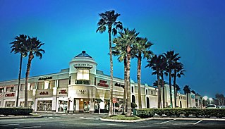
Meyerland is a community in southwest Houston, Texas, outside of the 610 Loop and inside Beltway 8. The neighborhood is named after the Meyer family, who bought and owned 6,000 acres (24 km²) of land in southwest Houston.

<span class="mw-page-title-main">Acres Homes, Houston</span>

Acres Homes is a neighborhood located in northwest Houston, Texas. The 9-square-mile (23 km2) mile area is loosely bounded by the city limits and West Gulf Bank Road to the north; Pinemont Drive to the south; North Shepherd Drive to the east; and Alabonson Drive to the west. Historically, it has been predominantly African American. Unincorporated for decades, it was annexed to Houston in 1967.

Southgate is a neighborhood in Houston, Texas, United States.

<span class="mw-page-title-main">Sunnyside, Houston</span>

Sunnyside is a community in southern Houston, Texas, United States, south of Downtown Houston.

<span class="mw-page-title-main">Briargrove, Houston</span>

Briargrove is a neighborhood in Houston, Texas, United States, near Uptown Houston.

Eastwood is a historic neighborhood in the East End area of Houston, Texas, United States. Eastwood maintains Houston’s largest intact collection of Craftsman, Arts & Crafts, Foursquare and Mission style architecture.

Pecan Park is a neighborhood in Houston, Texas.

Independence Heights is a community in Houston, Texas, bordered by 40th Street east of N. Main and 40th Street west of N. Main to the north, Yale Street to the west, the 610 Loop to the south, and Airline Drive to the east. The Super Neighborhood boundary created by the City of Houston is bordered by Tidwell to the north, Shepherd Drive to the west, the 610 Loop to the south, and Interstate 45 to the east.

<span class="mw-page-title-main">Furr High School</span> Public school in Houston, Texas, United States

Ebbert L. Furr High School is a secondary school located in Houston, Texas, United States. Furr, which serves grades 9 through 12, is a part of the Houston Independent School District.

<span class="mw-page-title-main">Clinton Park, Houston</span>

Clinton Park is a neighborhood located in Houston, Texas. Clinton Park is located outside the 610 Loop in eastern Houston. Clinton Park is predominantly African-American. Carolyn Campbell of KHOU-TV described Clinton Park, close to the Port of Houston, as "small" and "isolated."

<span class="mw-page-title-main">Magnolia Park, Houston</span>

Magnolia Park is an area of the East End, Houston, Texas, located near the Houston Ship Channel. One of the oldest Hispanic neighborhoods in the City of Houston, Magnolia Park was formerly incorporated as the City of Magnolia Park in eastern Harris County.

<span class="mw-page-title-main">East End, Houston</span> District in Houston, Texas, United States

East End Houston, managed by the East End District (EED), is a district in eastern Houston, Texas, United States, located between the eastern edge of downtown to the Port of Houston and South to Hobby Airport. The District is home to Houston's early history and industry and is the site of Harrisburg, the seat of government for the Republic of Texas in 1836. East End Houston consists of many different ethnic groups, including Hispanic, Asian, White, and African American. Latinos make up more than half of the 100,512 residents, The area includes two of Houston's oldest Hispanic neighborhoods, Magnolia Park and Second Ward.

The Harris Health System, previously the Harris County Hospital District (HCHD), is a governmental entity with taxing authority that owns and operates three hospitals and numerous clinics throughout Harris County, Texas, United States, including the city of Houston. The entity's administrative offices are in Bellaire, Texas.

Sunset Terrace and Montclair Place are two Inner Loop neighborhoods of Harris County, Texas, United States. The two subdivisions are served by the Sunset Terrace/Montclair Civic Association.

Port Houston is a neighborhood located on the East Side of Houston, Texas, United States.

Kashmere Gardens is a historically African-American neighborhood in the northern 610 Loop area in Houston, Texas, United States. A group of single-family houses, many of which have large lots, Kashmere Gardens is between an industrial area and a rail corridor.

<span class="mw-page-title-main">Westmoreland, Houston</span> Subdivision in Houston, Texas, United States

The Westmoreland Historic District is a neighborhood in Neartown Houston, Texas. It is west of Spur 527, between Westheimer Road and West Alabama Street.

References

  1. “Urban Research and Resource Center, Inc. Annual Report”. Texas Southern University Urban Research and Resource Center. p. 12 of 21. Retrieved on December, 17, 2020.
  2. “Housing Amendments of 1953”. United States Congress House Committee on Banking and Currency. p. 201 of 209. Retrieved on December, 17, 2020.
  3. “Pleasantville Civic League”. Neighborhood Link National Network. Retrieved on December 17, 2020.
  4. “Pleasantville Garden Club”. Retrieved on December 17, 2020.
  5. “Deed Restrictions for Pleasantville”. Pleasantville Civic League, Inc. Neighborhood Link National Network. Retrieved on December 17, 2020.
  6. Trevizo, Perla. "Worried about the air quality, Pleasantville residents came up with a one-of-a-kind solution". Houston Chronicle. Retrieved 2020-03-25.
  7. Moore, Katie. "Here’s how a Houston neighborhood is taking action after decades of environment injustice". Environmental Defense Fund. Retrieved 2020-03-25.
  8. 1 2 Crowe, Robert. "Houston grants council to Pleasantville." Houston Chronicle . October 18, 2001. Retrieved on May 17, 2014.
  9. Olson, Bradley. "Smelly mounds of Ike debris tower over Pleasantville." Houston Chronicle . January 13, 2009. Retrieved on May 17, 2014.
  10. City of Houston, Council District Maps, District B Archived 2012-06-25 at the Wayback Machine ." City of Houston. Retrieved on November 5, 2011.
  11. Rodriguez, Lori. "Saying goodbye, with no regrets." Houston Chronicle . Saturday November 9, 1991. A31.
  12. Bernstein, Alan and Jim Simmon. "Black vote went solidly for Turner/Whitmire failed to produce split." Houston Chronicle . Thursday November 7, 1991. A21.
  13. "Problem: Lane restriping on hold until construction on Pleasantville wraps up -- Day 3." Houston Chronicle . June 27, 2005. Retrieved on May 17, 2014.
  14. 1 2 Jaitapker, Nabeel. "Pleasantville homeowners hear results of survey." Houston Chronicle . June 16, 2005. Pasadena News. Retrieved on May 17, 2014.
  15. 1 2 "Pleasantville residents help in fight against crime." Houston Chronicle . June 3, 2008. Retrieved on May 17, 2014.
  16. 1 2 "Clinic/Emergency/Registration Center Directory By ZIP Code". Harris County Hospital District. 2001-11-19. Archived from the original on 2001-11-19. Retrieved 2021-04-08. - See ZIP code 77029. See this map for relevant ZIP code.
  17. "Gulfgate Health Center" (Archive). Harris County Hospital District. Accessed October 17, 2008.
  18. "Pleasantville Elementary School Attendance Boundary Archived 2006-05-16 at the Wayback Machine ." Houston Independent School District . Retrieved October 12, 2008.
  19. "Holland Middle School Attendance Boundary Archived 2008-04-11 at the Wayback Machine ." Houston Independent School District . Retrieved October 12, 2008.
  20. "Furr High School Attendance Boundary Archived 2011-07-26 at the Wayback Machine ." Houston Independent School District . Retrieved October 12, 2008.
  21. "Pleasantville Neighborhood Library." Houston Public Library. Retrieved on March 17, 2014.
  22. 1 2 Staff. "Services set today for Judson W. Robinson Sr." Houston Chronicle . Tuesday, May 13, 1986. Section 3, p. 8. NewsBank Record Number: HSC0513238425. Available at the Houston Public Library website with a library card.

Coordinates: 29°45′48″N95°16′42″W / 29.7632°N 95.2783°W / 29.7632; -95.2783