Port of Port Hedland | |
---|---|
Location | |
Country | Australia |
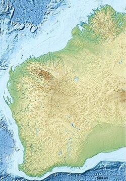
Location | Port Hedland, Western Australia |
Coordinates | 20°19.0′S118°34.5′E / 20.3167°S 118.5750°E |
UN/LOCODE | AUPHE [1] |
Details | |
Opened | 1896 |
Operated by | Pilbara Ports Authority |
Type of harbour | Seaport |
No. of berths | 19 |
Draft depth | 19.8 m |
Statistics | |
Vessel arrivals | 3,281 (2021/22) |
Annual cargo tonnage | 561 million tonnes (2021/22) |
Website Pilbara Ports Authority |
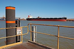
Port Hedland is one of the largest iron ore loading ports in the world and the largest in Australia. In 2022, it had the largest bulk cargo throughput in Australia. With the neighboring ports of Port Walcott and Dampier, Port Hedland is one of three major iron ore exporting ports in the Pilbara region of Western Australia. [2]
Named after Captain Hedland, the Master of a ship that anchored there in 1863, Port Hedland was first developed in order to service the needs of the local pastoral industry in East Pilbara. The first jetty was built in 1896, this was extended in 1908 after the discovery of gold in the Marble Bar area. [3]
Until the 1930s the port was predominantly used to import goods and stores for the local industries and to export pearl, shell, wool, livestock, gold, tin and copper. With the end of World War II, the port began exporting significant amounts of manganese. [3]
The 1960s saw the development of the port by the iron ore and salt industries. Mount Goldsworthy Mining Associates, a company later absorbed by BHP, dredged an approach channel and turning basin for 65,000 DWT ships. Meanwhile, the Leslie Salt Company, from August 2001 Dampier Salt (part of Rio Tinto), built a land backed wharf and facilities to aid salt exports and fuel imports. [3] [4]
Further dredging was performed after the Mount Newman Mining Company, a subsidiary of BHP, chose Port Hedland as its export port. The new works allowed for ships up to 120,000 DWT. [3]
Between the 1960s and today and extensive dredging and building has taken Port Hedland from a convenient anchorage to 15 berths capable of loading various ores and goods onto ships ranging from 25,000 DWT to 320,000 DWT. [3]
In 2005/06 Port Hedland became the first Australian port to export in excess of 100 million tonnes annually. In 2010/11 the port exported a record 199 million tonnes, making it the largest port by cargo tonnage in Australia. [3]
In 2021/22, 561 million tonnes of cargo passed through the port. [5]
Port Hedland's harbour is managed by the Pilbara Port Authority, a Government of Western Australia instrumentality. The port authority's headquarters, control tower and heliport are at Mangrove Point, just to the west of The Esplanade at the western end of Port Hedland.
The tugboat pen, customs office and public jetty are at nearby Laurentius Point. The harbour's wharves are located on both sides of the harbour – Finucane Island to the west and Port Hedland to the east.
The points are key references to the port and its composition. Mangrove and Laurentius points are already mentioned, Utah Point, and Anderson Point are located in the inner part of the harbour and exist within the complex of current berths.
Allocation of berths includes a commercial in confidence agreement between the PPA and BHP [6] [7] known as the Harriet Point agreement [8]
Access by oceangoing vessels into and out of the harbour is via a narrow curved channel. The following series of images depicts a 225 m (246.1 yd) long bulk carrier, Darya Shanthi, using the channel to enter the harbour. Visible in the foreground of each image is part of the harbour's system of mangroves.
2012 | 2011 | 2010 | 2009 | 2008 | 2007 | |
---|---|---|---|---|---|---|
Total cargo (tonnes) | 246,672,060 | 199,002,079 | 178,625,449 | 159,390,660 | 130,707,208 | 111,809,432 |
Imports | ||||||
Sulphuric acid | 10,003 | 6,011 | – | 73,577 | 69,649 | 145,336 |
Bitumen | – | – | – | 3,185 | 1,284 | 3,825 |
Caustic soda | – | 4,166 | – | 7,433 | 7,032 | – |
Ammonium nitrate | 16,100 | – | – | – | 389 | – |
Cement | 186,870 | 98,573 | 163,604 | 82,803 | 25,148 | – |
Fuel oils | 1,216,044 | 988,990 | 822,794 | 713,226 | 619,957 | 527,256 |
General & containerised cargo | 227,186 | 172,285 | 167,796 | 128,642 | 70,487 | 136,022 |
Total imports (tonnes) | 1,656,203 | 1,270,025 | 1,154,194 | 1,008,866 | 793,946 | 812,439 |
Exports | ||||||
Iron ore | 238,932,735 | 192,548,683 | 173,957,507 | 153,895,882 | 125,267,292 | 106,616,567 |
Hot briquetted iron | – | – | – | – | – | – |
Hot briquetted iron fines | – | – | 44,576 | 324,389 | 321,702 | – |
Manganese | 1,958,419 | 1,881,708 | 1,645,950 | 920,216 | 1,217,026 | 1,184,927 |
Chromite | 411,647 | 173,236 | 143,421 | 180,128 | 209,792 | 219,337 |
Copper | 433,904 | 461,383 | 479,545 | 423,050 | 417,075 | 249,824 |
Feldspar | – | – | – | – | – | – |
Salt | 3,197,203 | 2,623,412 | 1,165,401 | 2,609,954 | 2,409,527 | 2,669,441 |
Scrap | 70,245 | 39,002 | 25,150 | 20,008 | 39,051 | – |
Livestock | – | – | 7,817 | 5,825 | 7,951 | 6,335 |
General & containerised cargo | 11,703 | 4,630 | 1,888 | 2,342 | 23,846 | 50,562 |
Total exports (tonnes) | 245,015,856 | 197,732,054 | 177,471,255 | 158,381,794 | 129,913,262 | 110,996,993 |
Shipping | ||||||
Gross registered tonnage | 145,056,987 | 112,081,735 | 100,040,087 | 74,012,123 | 63,614,547 | 62,370,169 |
Deadweight tonnage | 277,313,992 | 216,454,152 | 193,442,785 | 142,870,875 | 122,810,231 | 120,119,965 |
No. of vessels | 1,843 | 1,474 | 1,303 | 1,027 | 888 | 925 |
Dampier is a major industrial port in the Pilbara region in the northwest of Western Australia. It is located near the city of Karratha and Port Walcott.
The Pilbara is a large, dry, thinly populated region in the north of Western Australia. It is known for its Aboriginal peoples; its ancient landscapes; the red earth; and its vast mineral deposits, in particular iron ore. It is also a global biodiversity hotspot for subterranean fauna.
Port Hedland is the second largest town in the Pilbara region of Western Australia, with an urban population of 15,298 as of the 2021 census, including the satellite town of South Hedland, 18 kilometres (11 mi) away. It is also the site of the highest tonnage port in Australia.
The Port of Port Talbot is located on the River Afan estuary next to Port Talbot Steelworks in the industrial town of Port Talbot, South Wales. The whole basin complex covers about 500 acres (2.0 km2), consisting of: an inner set of floating docks, developed from 1834 onwards; and an outer tidal basin, completed in 1970. Owned and operated by Associated British Ports, the tidal basin has the deepest berthing facilities in the Severn estuary and is one of only a few harbours in the UK capable of handling Capesize vessels of up to 170,000 tonnes deadweight (DWT), mostly for the import of iron ore and coal for use by nearby Port Talbot Steelworks.
The Port of Albany is located within Princess Royal Harbour in King George Sound on the south coast of Western Australia, in the Great Southern region.
The Hamersley & Robe River railway, majority-owned by Rio Tinto, and operated by its subsidiary Pilbara Iron, is a private rail network in the Pilbara region of Western Australia for the purpose of carrying iron ore. The network is larger than any other Australian heavy freight rail network in private ownership. The total length of its track is about 1,700 km (1,056 mi).
The Goldsworthy railway, owned and operated by BHP, is a private rail network in the Pilbara region of Western Australia built to carry iron ore. It is one of two railway lines BHP operates in the Pilbara, the other being the Mount Newman railway.
Cape Lambert is a port facility operated by Rio Tinto Iron Ore in the Pilbara region of Western Australia. It is located 40 kilometres north-east of Karratha.
The Mount Whaleback mine, officially the Newman West operation, is an iron ore mine located in the Pilbara region of Western Australia, six kilometres west of Newman.
Iron ore mining in Western Australia, in the 2018–19 financial year, accounted for 54 percent of the total value of the state's resource production, with a value of A$78.2 billion. The overall value of the minerals and petroleum industry in Western Australia was A$145 billion in 2018–19, a 26 percent increase on the previous financial year.
The Area C mine is an iron ore mine located in the Pilbara region of Western Australia, 92 kilometres west-north-west of Newman.
The Jimblebar mine is an iron ore mine located in the Pilbara region of Western Australia, 41 kilometres east of Newman.
The Yarrie mine is an iron ore mine located in the Pilbara region of Western Australia, 90 kilometres north-east of Marble Bar.
The Yandi mine is an iron ore mine located in the Pilbara region of Western Australia, 90 kilometres north-west of Newman. It should not be confused with Rio Tinto's nearby Yandicoogina mine, which is also sometimes shortened to Yandi.
The Orebodies 18, 23 and 25 mine, part of BHP's Eastern Ridge hub and officially referred to as the Newman East operation, is an iron ore mine located in the Pilbara region of Western Australia, 8 kilometres east of Newman. The mine is majority-owned and operated by BHP, and is one of seven iron ore mines the company operates in the Pilbara. The company also operates two port facilities at Port Hedland, Nelson Point and Finucane Island, and over 1,000 kilometres of rail in the Pilbara.
The Roy Hill mine is an iron ore mine in the Chichester Range in the Pilbara region of Western Australia, located 115 kilometres (71 mi) north of Newman and 277 kilometres (172 mi) south of Port Hedland. With indicated and inferred reserves of more than 2.4 billion tonnes, it is expected to become one of the largest mining projects in Australia. Mining operations will produce 55 million tonnes of iron ore per annum with an operating life of more than 20 years.
Port Walcott, formerly known as Tien Tsin Harbour, is a large open water harbour located on the northwest coast of Western Australia, located near the town of Point Samson.
The Railways in the Pilbara are a collection of railways in the Pilbara region of north-west Western Australia.
The Pilbara Coast is the coastline of Western Australia's Pilbara region. It is often referred to as the North West Coast of Western Australia.
East Intercourse Island is an uninhabited island in the Dampier Archipelago, in the Pilbara, Western Australia. It is around 250 hectares in size.