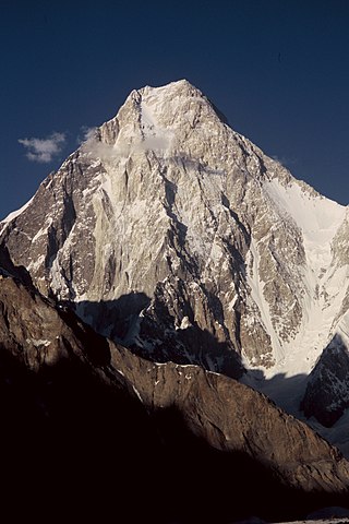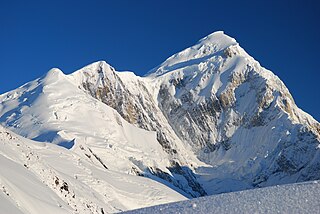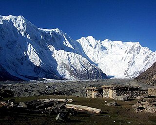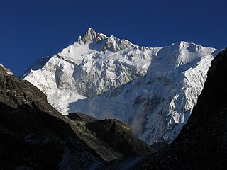
K2, at 8,611 metres (28,251 ft) above sea level, is the second-highest mountain on Earth, after Mount Everest at 8,849 metres (29,032 ft). It lies in the Karakoram range, partially in the Gilgit-Baltistan region of Pakistan-administered Kashmir and partially in the China-administered Trans-Karakoram Tract in the Taxkorgan Tajik Autonomous County of Xinjiang.

The eight-thousanders are the 14 mountains recognized by the International Mountaineering and Climbing Federation (UIAA) as being more than 8,000 metres (26,247 ft) in height above sea level, and sufficiently independent of neighbouring peaks. There is no precise definition of the criteria used to assess independence, and at times, the UIAA has considered whether the list should be expanded to 20 mountain peaks by including the major satellite peaks of eight-thousanders. All of the eight-thousanders are located in the Himalayan and Karakoram mountain ranges in Asia, and their summits lie in an altitude known as the death zone.

Gasherbrum II ; surveyed as K4, is the 13th highest mountain in the world at 8,035 metres (26,362 ft) above sea level. It is the third-highest peak of the Gasherbrum massif, and is located in the Karakoram, on the border between Gilgit–Baltistan, Pakistan and Xinjiang, China. The mountain was first climbed on July 7, 1956, by an Austrian expedition which included Fritz Moravec, Josef Larch, and Hans Willenpart.

Saser Kangri is a mountain in India. It is the highest peak in the Saser Muztagh, the easternmost subrange of the Karakoram range. Sasir Kangri is located within Ladakh.

Gasherbrum IV, surveyed as K3, is the 17th highest mountain on Earth and the 6th highest in Pakistan, as well as the highest independent mountain under eight thousand meters in Pakistan.
The Rimo massif lies in the northern part of the remote Rimo Muztagh, a subrange of the Karakoram range. It is located about 20 km northeast of the snout of the Siachen Glacier and its main summit, Rimo I is the world's 71st highest mountain with an elevation of 7,385 metres (24,229 ft). The massif heads the large Central Rimo Glacier and South Rimo Glacier, as well as the smaller North Terong Glacier.
Pumari Chhish, is a group of peaks in the Shimshal Valley, a village of the Karakoram range. The central peak,(or Pumarikish, Peak 11) rises to 7,492m. It lies about 4 km east of Khunyang Chhish, in the heart of the Hispar, north of the Hispar Glacier.

Spantik, or Golden Peak, is a mountain situated in the subrange within the Karakoram range. It is located in the Arandu Valley, Shigar District, within the Gilgit-Baltistan region of Pakistan. The northwest face of Spantik is dominated by a pronounced pillar of creamy yellow marble which reaches up its north face to 300 m below the summit. Its distinctive appearance has given the peak its Buruskaski name, "Ganesh Chish" or Golden Peak. This outcropping is renowned for its exceptionally challenging climbing route, famously referred to as the "Golden Pillar."

The Hindu Raj is a mountain range in northern Pakistan, between the Hindu Kush and the Karakoram ranges. The peaks in the Hindu Raj mountains average between 5,000 to 6,000 metres in height. Its highest peak is Koyo Zom, 6,872 m (22,546 ft).

The Latok group is a cluster of large and dramatic rock peaks in the Panmah Muztagh, part of the central Karakoram mountain range in Pakistan. They lie just to the east of the Ogre group, dominated by Baintha Brakk. To the immediate south of the Latok group lies the Baintha Lukpar Glacier, a small tributary of the Biafo Glacier, one of the main glaciers of the Karakoram. On the north side, lies the Choktoi Glacier.
Kazuya Hiraide was a Japanese ski mountaineer, Alpine climber, and professional mountain cameraman. Hiraide has won the Piolet d'Or mountaineering award on three occasions.
Sarwali Peak, also known as Dabbar Peak, Toshe Ri, and Toshain-I, is a mountain peak located at an altitude of 6,326 metres (20,755 ft) in Neelum District of the Pakistan-administered Azad Kashmir, in the disputed Kashmir region. It is located at the junction of the Neelam and Shounter valleys on Toshain/Rupal Glacier towering in Rupal Valley of Nanga Parbat. It is the highest point in Azad Jammu and Kashmir.

Muchu Chhish is a mountain in the Batura Muztagh sub-range of the Karakoram in Hunza Valley, in northern areas of Pakistan. Located in a very remote and inaccessible region, only a handful of attempts have been made to reach the summit. Muchu Chhish was one of the tallest unclimbed mountains on Earth, until its successful summit in 2024. The peak has a modest prominence however, rising only 263 m (863 ft) above the nearest col or pass. The Batura Glacier, one of the longest outside the polar regions, flanks Muchu Chhish to the north.
Richard Frank "Rick" Allen was a Scottish mountaineer. Allen summitted six eight-thousanders and was the first British climber atop some of Tajikistan's biggest mountains. He had over 40 years experience climbing in the Himalayas at the time of his death.

Marija "Mariča" Sabolek Frantar (1956-1991), was a Slovenian alpinist who was one of Slovenia's most successful mountaineers, and the second Slovene woman to summit an eight-thousander. In 1990, she received the Stanko Bloudek award, Slovenia's highest state award for sport for her achievements in mountaineering.

Kanchenjunga South Peak is a 8,476 m high subsidiary peak of Kangchenjunga, the third highest mountain in the world.
Nancy Joanne Hansen is a Canadian sport climber and mountaineer. She is an ambassador for the Alpine Club of Canada and has been a professional alpinist for nearly thirty years.

The Urdok ridge is a 7426 m high mountain ridge follows the continuation of the southwest ridge of Gasherbrum I.
Takeo "Kenro" Nakajima was a Japanese elite alpinist and cameraman. In 2018, Nakajima and his climbing partner Kazuya Hiraide received the 26th Piolet d'Or for their ascent of the unclimbed northeast face of Shispare, which they climbed in 2017. In 2020, the pair won their second Piolet d'Or for their ascent of Rakaposhi. Nakajima summitted six of the Seven Summits and three eight-thousanders: Cho Oyu, Manaslu, and Mount Everest. He was known for making first ascents on other remote peaks across the Himalayas and the Karokoram.


