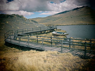
Paquni is a 4,838-metre-high (15,873 ft) mountain in the Potosí Department of Bolivia. It is located in the Antonio Quijarro Province, Tomave Municipality, northeast of the Jatun Mundo Quri Warani volcano.

San Juan de Tarucani District is one of 29 districts of the province Arequipa in Peru.

Arque Municipality is the first municipal section of the Arque Province in the Cochabamba Department, Bolivia. Its seat is Arque. At the time of census 2001 the municipality had 11,806 inhabitants. It has the lowest HDI of Bolivia with 0.311.

Mizque Municipality is the first municipal section of the Mizque Province in the Cochabamba Department, Bolivia. Its seat is Mizque.

Vila Vila or Wila Wila (Aymara) is the second municipal section of the Mizque Province in the Cochabamba Department, Bolivia. Its seat is Vila Vila.

Wila Qullu, also Cerro Laguna, is a 4,948-metre-high (16,234 ft) mountain in the Andes located on the border of Bolivia and Chile in the Cordillera Occidental. Wila Qullu lies between the Salar de Huasco in the Tarapacá Region of Chile and the Salar de Uyuni in Bolivia. On the Bolivian side it is situated in the Potosí Department, Daniel Campos Province, Llica Municipality, Canquella Canton, north of the village of Pampa Anta.

Wila Qullu is a mountain in the Andes of Bolivia which reaches a height of approximately 4,140 m (13,580 ft). It is located in the Potosí Department, on the border of the Quijarro Province, Uyuni Municipality, and the Sud Chichas Province, Atocha Municipality. Wila Qullu lies at the Wila Wila river (Vila Vila) south of the village of Wila Wila.

Laram Quta is a lake in the Cordillera Real in the Andes of Bolivia. It is situated in the La Paz Department, Pedro Domingo Murillo Province, La Paz Municipality, La Paz Canton. It lies south-west of the lake Pata Larama. The wetlands of this area are also known as Pampa Larama (Pampalarama, Pamparalama). This is where the Qaluyu River (Kaluyo) originates which downstream is called Achachi Qala and Choqueyapu River.

Q'ulini is a 4,968-metre-high (16,299 ft) mountain in the Cordillera Real in the Bolivian Andes. It is located in the La Paz Department, Murillo Province, La Paz Municipality. Q'ulini is situated southeast of the mountain Qala Uyu (Khala Huyo). It lies northeast of the lake Laram Quta at the wetlands known as Pampa Larama (Pampalarama, Pamparalama).

P'isaqa is a mountain east of the Apolobamba mountain range in the Andes of Bolivia, about 4,640 metres (15,223 ft) high. It is located in the La Paz Department, Franz Tamayo Province, Pelechuco Municipality. P'isaqa lies north of the little town of Pelechuco, southeast of Rit'i Apachita and east of Puka Puka.

Yapu Qullu is a dome in the Cordillera Occidental of Bolivia southeast of the summit of the Chullkani volcano. It is located in the Oruro Department, Sajama Province, Turco Municipality, east of the Sajama River and southwest of a plain named Titi Pampa. The peak of Yapu Qullu reaches a height of 4,148 m (13,609 ft).
The Ch'alla Jawira which upstream successively is named Chilla Jawira, Pichini Jawira, Janq'u Quta and Siwinqa is a river in the La Paz Department in Bolivia. It is a left tributary of the Desaguadero River.
The Llallawa Jawira which upstream successively is named Patu Uma, Ch'alla Jawira, Jach'a Qura, Lupipi and Chuqi Phuju is a river in the La Paz Department in Bolivia. It is a left tributary of the Desaguadero River.

Chuqi Sillani is a 4,812-metre-high (15,787 ft) mountain in the Bolivian Andes. It is located in the La Paz Department, Loayza Province, Luribay Municipality. Chuqi Sillani lies southeast of Qillwan Quta and east of a plain named Qillwan Quta Pampa.

Qillwan Quta is a 4,826-metre-high (15,833 ft) mountain in the Bolivian Andes. It is located in the La Paz Department, Loayza Province, Luribay Municipality. Qillwan Quta lies northwest of Chuqi Sillani at a plain named Qillwan Quta Pampa.

Liqiliqini is a 3,928-metre-high (12,887 ft) mountain in the Bolivian Andes. It is located in the La Paz Department, Loayza Province, Cairoma Municipality, southwest of the village of Wila Pampa. Liqiliqini lies northwest of Wayra Willk'i, Wanuni and Uyuyuni.

Inka P'iqi is a 4,110-metre-high (13,480 ft) mountain in the Bolivian Andes. It is located in the Cochabamba Department, on the border of the Arani Province, Vacas Municipality, and the Mizque Province, Alalay Municipality. Inka P'iqi lies southwest of Jatun Llallawa and south of Juch'uy Llallawa.

Apachita is a 4,061-metre-high (13,323 ft) mountain in the Bolivian Andes. It is located in the Potosí Department, Chayanta Province, Ravelo Municipality. It lies northeast of the village of Wari Pampa (Huari Pampa).

Wanaku is a 3,844-metre-high (12,612 ft) mountain in the Bolivian Andes. It is located in the Chuquisaca Department, Azurduy Province, Tarvita Municipality. Wanaku lies south of Wanaku Kimray, northwest of the village of Panti Pampa.

Q'illu Apachita is a mountain in the Bolivian Andes which reaches a height of approximately 4,440 m (14,570 ft). It is located in the Chuquisaca Department, Nor Cinti Province, San Lucas Municipality. It lies northeast of Llaqta Pampa.


