Yale is an incorporated town in Beadle County, South Dakota, United States. The population was 112 at the 2020 census.

Stratford is a town in southern Brown County, South Dakota, United States. The population was 57 at the 2020 census.

Westport is a town in western Brown County, South Dakota, United States. The population was 88 at the 2020 census.

Mound City is a town in and the county seat of Campbell County, South Dakota, United States. The population was 69 at the 2020 census.

Bradley is a town in Clark County, South Dakota, United States. The population was 65 at the 2020 census.

Garden City is a town in Clark County, South Dakota, United States. The population was 33 at the 2020 census.

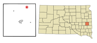
Florence is a town in northwestern Codington County, South Dakota, United States. It is part of the Watertown, South Dakota Micropolitan Statistical Area. The population was 337 at the 2020 census.

Morristown is a town in Corson County, South Dakota, United States. The population was 67 at the 2010 census.

Fairburn is a town in Custer County, South Dakota, United States. The population was 60 at the 2020 census.

Onaka is a town in Faulk County, South Dakota, United States. The population was 13 at the 2020 census.

Orient is a town in Faulk County, South Dakota, United States. The population was 51 at the 2020 census.

Revillo is a town in southeastern Grant County, South Dakota, United States. The population was 99 at the 2020 census.

Stockholm is a town in Grant County, South Dakota, United States. The population was 102 at the 2020 census.
Nunda is a village in Lake County, South Dakota, United States. The population was 46 at the 2020 census. Located there are a post office, grainery, bar and grill, and an American Legion post.

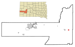
Hudson is a town in Lincoln County, South Dakota, United States. The population was 311 at the 2020 census. It is the easternmost community in South Dakota.

Long Lake is a town in McPherson County, South Dakota, United States. The population was 27 at the 2020 census.

Crooks is a city in Minnehaha County, South Dakota, United States and is a suburb of Sioux Falls. The population was 1,362 at the 2020 census. Crooks was named New Hope until 1904. The town's present name honors W. A. Crooks, a local politician.

Sherman is a town in Minnehaha County, South Dakota, United States. The population was 81 at the 2020 census.

Ortley is a town in Roberts County, South Dakota, United States. The population was 50 according to the 2020 census.

New Witten is a town in Tripp County, South Dakota, United States. The population was 54 at the 2020 census.