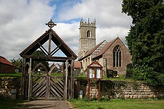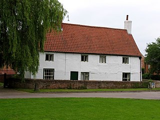
Askham is a village and civil parish in the Bassetlaw district of Nottinghamshire, England, about six miles south-east of East Retford. According to the 2001 census it had a population of 183. It decreased slightly to 181 at the 2011 Census, but has increased to 189 residents during the 2021 Census.
Bothamsall is a village and civil parish in the Bassetlaw district of Nottinghamshire, England.

Papplewick is a village and civil parish in Nottinghamshire, England, 7.5 miles (12 km) north of Nottingham and 6 miles (10 km) south of Mansfield. It had a population of 756 at the 2011 census. In the Middle Ages, the village marked the southern gateway to Sherwood Forest.

Hockerton is a village and civil parish in Nottinghamshire. It is 2 miles from the town of Southwell on the A617 between Newark and Mansfield. Fewer than 60 houses are situated around the church, the Spread Eagle pub and village hall. The population at the 2011 Census was 146. The local properties range from the carbon neutral housing of the Hockerton Housing Project to converted barns, 1960s and 1970s housing together with much older houses and a 19th-century Rectory. The parish church of St Nicholas is Norman with an aisleless nave and a 14th-century chancel.

Walesby is a village and civil parish in Nottinghamshire, England. At the time of the 2001 census it had a population of 1,255 people, increasing slightly to 1,266 at the 2011 census. It is located 16 miles (26 km) north of Newark. The parish church of St Edmund is Perpendicular in style.
Halam is a village and civil parish in the Newark and Sherwood district of Nottinghamshire, England, with a population of 372 in 2001, increasing to 426 at the 2011 Census. It is located to the west of Southwell.

Thrumpton is a village and civil parish in Nottinghamshire, England. At the time of the 2001 census it had a population of 152, increasing to 165 at the 2011 census. It is located on the A453 road 6 miles (9.7 km) south-west of West Bridgford. The 13th century Church of All Saints is Grade II* listed and was restored in 1871. Many of the gabled brick houses in the village were built between 1700 and 1745 by John Emerton of Thrumpton Hall.
Dunham-on-Trent is a village and civil parish in Nottinghamshire, England. It is located on the A57 road, about 0.5 miles (0.8 km) west of Dunham Bridge, a toll bridge crossing the River Trent.
Darlton is a small village and civil parish in Nottinghamshire, England. It is on the A57 road about 5 kilometres (3.1 mi) north-east of Tuxford.

East Drayton is a village in Nottinghamshire, England. According to the 2001 census it had a population of 212, increasing to 252 at the 2011 Census, and 266 in 2021. It is located 3 miles west of Dunham-on-Trent. The parish church of St Peter and St Paul is 13th or 14th century in date. Nicholas Hawksmoor the architect was born here.

Eaton is a village and civil parish in Nottinghamshire, England. According to the 2001 census it had a population of 105, increasing to 233 at the 2011 Census. and 111 in 2021. It is located 2 miles south of Retford, on the A638 road.

Shelton is an English village and civil parish in the Rushcliffe borough of Nottinghamshire. According to the 2001 census, Shelton had a population of 107,. At the 2011 census, the statistics for Shelton included Sibthorpe, and the population was 307. The village lies 8 miles (13 km) south of Newark-on-Trent, on the north side of the River Smite, near where it joins the River Devon. It has no parish council, only a parish meeting.
Girton is a village and civil parish in Nottinghamshire, England. According to the 2001 census it had a population of 143, reducing slightly to 140 at the 2011 Census. It is located 17 miles west of Lincoln.

Maplebeck is a village in Nottinghamshire, England. It is located 6 miles north of Southwell, and is part of the civil parish of Winkburn. It is in the civil parish of Caunton. It is one of only five villages in England to have a church dedicated to St Radegund and it is also one of only 51 Thankful Villages in England and Wales – those rare places that were spared fatalities in the Great War of 1914 to 1918. The parish church of St Radegund was extensively restored in 1898.

Morton is a village and former civil parish, now in the parish of Fiskerton cum Morton, in the Newark and Sherwood district, in the county of Nottinghamshire, England. It is located 1 mile west of Fiskerton. The parish church of St Denis was built in 1756.

Kirton is a village in Nottinghamshire, England. It is located 3 miles (4.8 km) east of Ollerton. According to the United Kingdom Census 2001 it had a population of 273, reducing to 261 at the 2011 census. The parish church of Holy Trinity is 13th century church, restored in 1865 in the Victorian era. Hall Farm was built c. 1630 by William Clarkson. It is an early example of brick facing on walls of rough skerry.
Weston is a village in Nottinghamshire, England. It is located 10 miles south of Retford. According to the 2001 census it had a population of 312, increasing to 393 at the 2011 Census. The parish church of All Saints is 13th century. At the south-east end of the village are three 16th century tenements built with cruck trusses.

Hayton is a village in Nottinghamshire, England. It is located 4 miles north-east of Retford. According to the 2001 census it had a population of 386, decreasing marginally to 385 in the 2011 Census, but markedly more so in 2021 to 361. The parish church of St Peter is Norman, with 14th century windows.

Normanton on Trent is a village in Nottinghamshire, England. It is nine miles south-east of Retford.

Woodborough is a village and civil parish in the Gedling district, in the county of Nottinghamshire, England. It is located 7 miles north-east of Nottingham. According to the 2001 census it had a population of 1,872. rising slightly to 1,872 at the 2011 census.


