Resurs-DK No.1

Last updated

Resurs-DK No.1
Resurs-DK.gif
NamesResurs-DK1
Mission type Earth observation
Operator NTs OMZ
COSPAR ID 2006-021A OOjs UI icon edit-ltr-progressive.svg
SATCAT no. 29228
Website eng.ntsomz.ru/ks_dzz/satellites/resurs_dk1
Mission duration3 years (planned) [1]
9 years, 7 months, 22 days (achieved) [2]
Spacecraft properties
Bus Yantar [3]
Manufacturer TsSKB-Progress
Launch mass6,570 kg (14,480 lb) [1]
Payload mass1,200 kg (2,600 lb)
Dimensions7.93 × 2.72 m (26.0 × 8.9 ft)
Start of mission
Launch date15 June 2006, 08:00:00 UTC [4]
Rocket Soyuz-U
Launch site Baikonur, Site 1/5 [5]
Contractor TsSKV-Progress
End of mission
DisposalDecommissioned
Deactivated7 February 2016 [2]
Orbital parameters
Reference system Geocentric orbit [6]
Regime Low Earth orbit
Perigee altitude 555.74 km (345.32 mi)
Apogee altitude 566.46 km (351.98 mi)
Inclination 69.94°
Period 95.88 minutes
Instruments
Geoton-1
PAMELA
ARINA
Russian Earth observation
 

Resurs-DK No.1, [7] also called Resurs-DK1, was a commercial Earth observation satellite capable of transmitting high-resolution imagery (up to 0.9 m) to the ground stations as it passed overhead. The spacecraft was operated by NTs OMZ, the Russian Research Center for Earth Operative Monitoring.

Contents

The satellite was designed for multi-spectral remote sensing of the Earth's surface aimed at acquiring high-quality visible images in near real-time as well as on-line data delivery via radio link and providing a wide range of consumers with value-added processed data.

The Russian space tracking service, ASPOS OKP, reported that the spacecraft's onboard systems and attitude control had been terminated in February 2016. Tracking of the satellite was discontinued on 1 March 2016. [2]

Spacecraft

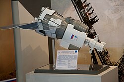
The Resurs-DK spacecraft was built by the Russian space company TsSKB-Progress in Samara, Russia. It was a modified version of the military reconnaissance satellite Yantar-4KS1 (Terilen). [8] The spacecraft was three-axis stabilized. The design lifetime was no less than three years, with an expected lifetime of five years. Ground location accuracy was 100 m (330 ft). Onboard storage was 768 gigabits. Data link speed to the ground station was 300 Mbit/s. Maximum daily productivity was 1,000,000 km2 (390,000 sq mi).

Resurs is Russian for "Resource". The letters DK are the initials of Dmitry Kozlov, chief designer of the first satellite of the Yantar-2K class.

Optical subsystem

Made by Vavilov State Optical Institute, Russia Archived 3 March 2016 at the Wayback Machine .

Spectral Resolution

It was not possible to represent an image in true-color because there was no blue band (0.4 - 0.5 μm). However, it was possible to combine red, green and near infrared in such way that the appearance of the displayed image resembles a visible colour photograph, i.e. vegetation in green, water in blue, soil in brown. This was not always possible because two similarly coloured objects can have completely different reactions to near IR light.

Green, red and near IR are typically combined to make a traditional false color composite where the near IR is displayed in red, the red is displayed in green, and the green is displayed in blue. This combination is favoured by scientists because near IR is useful for detection of numerous vegetation types. Vegetation appear as redtones, the brighter the red, the healthier the vegetation. Soils with no or sparse vegetation range from white (sand, salt) to greens or browns depending on moisture and organic matter content. Water appears blue, clear water is dark blue to black while shallow waters or waters with high sediment concentrations are lighter blue. Urban areas will appear blue towards gray. Clouds and snow are white.

Focal Plane Unit

Resurs DK-1 Model at MAKS-2009.jpg

Unit featured 4 TDI (Time Delay and Integration) sensor arrays, one panchromatic and three multispectral. Each sensor array was composed of 36 "Kruiz" CCD chips. Effective length of the single array was about 36000 pixels. Arrays were grouped in 3 separated lines:

This separation was causing a time delay of the colour images combined from green, red and near infrared, so fast-moving objects were shown in triplets. Moving object speed and direction could be calculated. All 4 arrays could work simultaneously, so it was possible to combine panchromatic and 3 multispectral images in one pansharpened color composite.

The system used 10-bit analog-to-digital converters.

Focal Plane Unit was made by NPO Opteks, Russia .

CCD

The CCD "Kruiz" was a 1024 pixel x 128 line, high speed TDI sensor. The active imaging area was organized as 1024 vertical columns and 128 horizontal TDI rows. [ permanent dead link ]

Designed jointly by NPO Opteks and ELECTRON-OPTRONIC.
Produced by ELECTRON-OPTRONIC (now is ELAR )

Spatial resolution

Panchromatic

At the altitude of 360 km:

At the altitude of 604 km:

Multispectral

1.5–2.0 m

Temporal resolution

The revisit rate was 5 to 7 days off-nadir.

Swath

Swath width at the altitude of 350 km:

ARINA

Russian research hardware for detection of high-energy electrons and protons, their identification, detection of high-energy particle bursts – earthquake signs.

PAMELA

PAMELA, Payload for Antimatter Matter Exploration and Light-nuclei Astrophysics was an attached module built by Italian researchers with international partners. Its purpose was basic physics research of primary cosmic rays.

Major tasks

Major orbit change

The satellite was initially placed in a 355 km × 573 km (221 mi × 356 mi) orbit in 2006. On 10 September 2010, its orbit was circularised to 567 km × 573 km (352 mi × 356 mi), with an inclination of 69.9°.

See also

Related Research Articles

<span class="mw-page-title-main">Satellite imagery</span> Images taken from an artificial satellite

Satellite images are images of Earth collected by imaging satellites operated by governments and businesses around the world. Satellite imaging companies sell images by licensing them to governments and businesses such as Apple Maps and Google Maps.

IKONOS was a commercial Earth observation satellite, and was the first to collect publicly available high-resolution imagery at 1- and 4-meter resolution. It collected multispectral (MS) and panchromatic (PAN) imagery. The capability to observe Earth via space-based telescope has been called "one of the most significant developments in the history of the space age", and IKONOS brought imagery rivaling that of military spy satellites to the commercial market. IKONOS imagery began being sold on 1 January 2000, and the spacecraft was retired in 2015.

QuickBird was a high-resolution commercial Earth observation satellite, owned by DigitalGlobe, launched in 2001 and reentered after orbit decay in 2015. QuickBird used Ball Aerospace's Global Imaging System 2000. The satellite collected panchromatic imagery at 61 centimeter resolution and multispectral imagery at 2.44- to 1.63-meter resolution, as orbit altitude is lowered during the end of mission life.

<span class="mw-page-title-main">Multispectral imaging</span> Capturing image data across multiple electromagnetic spectrum ranges

Multispectral imaging captures image data within specific wavelength ranges across the electromagnetic spectrum. The wavelengths may be separated by filters or detected with the use of instruments that are sensitive to particular wavelengths, including light from frequencies beyond the visible light range, i.e. infrared and ultra-violet. It can allow extraction of additional information the human eye fails to capture with its visible receptors for red, green and blue. It was originally developed for military target identification and reconnaissance. Early space-based imaging platforms incorporated multispectral imaging technology to map details of the Earth related to coastal boundaries, vegetation, and landforms. Multispectral imaging has also found use in document and painting analysis.

<span class="mw-page-title-main">NOAA-17</span>

NOAA-17, also known as NOAA-M before launch, was an operational, polar orbiting, weather satellite series operated by the National Environmental Satellite Service (NESS) of the National Oceanic and Atmospheric Administration (NOAA). NOAA-17 also continued the series of Advanced TIROS-N (ATN) spacecraft begun with the launch of NOAA-8 (NOAA-E) in 1983 but with additional new and improved instrumentation over the NOAA A-L series and a new launch vehicle.

<span class="mw-page-title-main">NOAA-16</span>

NOAA-16, also known as NOAA-L before launch, was an operational, polar orbiting, weather satellite series operated by the National Environmental Satellite Service (NESS) of the National Oceanic and Atmospheric Administration (NOAA). NOAA-16 continued the series of Advanced TIROS-N (ATN) spacecraft that began with the launch of NOAA-8 (NOAA-E) in 1983; but it had additional new and improved instrumentation over the NOAA A-K series and a new launch vehicle. It was launched on 21 September 2000 and, following an unknown anomaly, it was decommissioned on 9 June 2014. In November of 2015 it broke up in orbit, creating more than 200 pieces of debris.

<span class="mw-page-title-main">NOAA-18</span>

NOAA-18, also known as NOAA-N before launch, is an operational, polar orbiting, weather satellite series operated by the National Environmental Satellite Service (NESS) of the National Oceanic and Atmospheric Administration (NOAA). NOAA-18 also continued the series of Advanced TIROS-N (ATN) spacecraft begun with the launch of NOAA-8 (NOAA-E) in 1983 but with additional new and improved instrumentation over the NOAA A-M series and a new launch vehicle. NOAA-18 is in an afternoon equator-crossing orbit and replaced NOAA-17 as the prime afternoon spacecraft.

<span class="mw-page-title-main">NOAA-15</span>

NOAA-15, also known as NOAA-K before launch, is an operational, polar-orbiting of the NASA-provided Television Infrared Observation Satellite (TIROS) series of weather forecasting satellite operated by National Oceanic and Atmospheric Administration (NOAA). NOAA-15 was the latest in the Advanced TIROS-N (ATN) series. It provided support to environmental monitoring by complementing the NOAA/NESS Geostationary Operational Environmental Satellite program (GOES).

<span class="mw-page-title-main">China–Brazil Earth Resources Satellite program</span> Satellite cooperation program between China and Brazil

The China–Brazil Earth Resources Satellite program (CBERS) is a technological cooperation program between Brazil and China which develops and operates Earth observation satellites.

<span class="mw-page-title-main">Persona (satellite)</span>

Persona is a class of Russian reconnaissance satellites, derived from the Resurs DK class of remote sensing satellite, in turn derived from the Soviet Yantar reconnaissance satellites. The satellites are built by TsSKB-Progress, and the optics by LOMO and the Vavilov State Optical Institute.

NOAA-13, also known as NOAA-I before launch, was an American weather satellite operated by the National Oceanic and Atmospheric Administration (NOAA). NOAA-I continued the operational, polar orbiting, meteorological satellite series operated by the National Environmental Satellite System (NESS) of the National Oceanic and Atmospheric Administration (NOAA). NOAA-I continued the series (fifth) of Advanced TIROS-N (ATN) spacecraft begun with the launch of NOAA-8 (NOAA-E) in 1983. NOAA-I was in an afternoon equator-crossing orbit and was intended to replace the NOAA-11 (NOAA-H) as the prime afternoon (14:00) spacecraft.

<span class="mw-page-title-main">NOAA-7</span>

NOAA-7, known as NOAA-C before launch, was an American operational weather satellite for use in the National Operational Environmental Satellite System (NOESS) and for the support of the Global Atmospheric Research Program (GARP) during 1978-1984. The satellite design provided an economical and stable Sun-synchronous platform for advanced operational instruments to measure the atmosphere of Earth, its surface and cloud cover, and the near-space environment. An earlier launch, NOAA-B, was scheduled to become NOAA-7, however NOAA-B failed to reach its required orbit.

NOAA-6, known as NOAA-A before launch, was an American operational weather satellite for use in the National Operational Environmental Satellite System (NOESS) and for the support of the Global Atmospheric Research Program (GARP) during 1978-1984. The satellite design provided an economical and stable Sun-synchronous platform for advanced operational instruments to measure the atmosphere of Earth, its surface and cloud cover, and the near-space environment.

<span class="mw-page-title-main">ADEOS I</span> Japanese Earth observation satellite

ADEOS I was an Earth observation satellite launched by NASDA in 1996. The mission's Japanese name, Midori means "green". The mission ended in July 1997 after the satellite sustained structural damage to the solar panel. Its successor, ADEOS II, was launched in 2002. Like the first mission, it ended after less than a year, also following solar panel malfunctions.

<span class="mw-page-title-main">Resurs-P</span> Series of Russian commercial Earth observation satellites

Resurs-P is a series of Russian commercial Earth observation satellites capable of acquiring high-resolution hyperspectral (HSI), wide-field multispectral (MSI), and panchromatic imagery. These spacecraft cost over 5 billion rubles and are operated by Roscosmos replacing the Resurs-DK No.1 satellite.

<span class="mw-page-title-main">NOAA-8</span> Weather satellite

NOAA-8, known as NOAA-E before launch, was an American weather satellite operated by the National Oceanic and Atmospheric Administration (NOAA) for use in the National Environmental Satellite Data and Information Service (NESDIS). It was first of the Advanced TIROS-N series of satellites. The satellite design provided an economical and stable Sun-synchronous platform for advanced operational instruments to measure the atmosphere of Earth, its surface and cloud cover, and the near-space environment.

NOAA-10, known as NOAA-G before launch, was an American weather satellite operated by the National Oceanic and Atmospheric Administration (NOAA) for use in the National Environmental Satellite Data and Information Service (NESDIS). It was the third of the Advanced TIROS-N series of satellites. The satellite design provided an economical and stable Sun-synchronous platform for advanced operational instruments to measure the atmosphere of Earth, its surface and cloud cover, and the near-space environment.

NOAA-11, known as NOAA-H before launch, was an American weather satellite operated by the National Oceanic and Atmospheric Administration (NOAA) for use in the National Operational Environmental Satellite System (NOESS) and for support of the Global Atmospheric Research Program (GARP) during 1978–1984. It was the fourth of the Advanced TIROS-N series of satellites. The satellite design provided an economical and stable Sun-synchronous platform for advanced operational instruments to measure the atmosphere of Earth, its surface and cloud cover, and the near-space environment.

NOAA-12, also known as NOAA-D before launch, was an American weather satellite operated by National Oceanic and Atmospheric Administration (NOAA), an operational meteorological satellite for use in the National Environmental Satellite, Data, and Information Service (NESDIS). The satellite design provided an economical and stable Sun-synchronous platform for advanced operational instruments to measure the atmosphere of Earth, its surface and cloud cover, and the near-space environment.

NOAA-14, also known as NOAA-J before launch, was an American weather satellite operated by the National Oceanic and Atmospheric Administration (NOAA). NOAA-14 continued the third-generation operational, Polar Orbiting Environmental Satellite (POES) series operated by the National Environmental Satellite Service (NESS) of the National Oceanic and Atmospheric Administration (NOAA). NOAA-14 continued the series of Advanced TIROS-N (ATN) spacecraft begun with the launch of NOAA-8 (NOAA-E) in 1983.

References

  1. 1 2 "RESURS-DK1 Spacecraft". Ntsomz.ru. Russian Federal Space Agency. 18 November 2008. Retrieved 12 August 2011.
  2. 1 2 3 "Resurs-DK1 completes a decade-long mission". russianspaceweb.com. March 2016. Retrieved 1 April 2016.
  3. "Yantar-4KS1". Encyclopedia Astronautica. Archived from the original on 11 October 2011. Retrieved 12 August 2011.
  4. "Resurs DK-1 satellite details". N2YO. Retrieved 12 August 2011.
  5. "Resurs-DK1 (Resurs - High Resolution 1)". events.eoportal.org. Archived from the original on 26 February 2010. Retrieved 12 August 2011.
  6. "Resurs DK-1 - Orbit". Heavens Above. 27 April 2016. Retrieved 27 April 2016.
  7. McDowell, Jonathan (17 June 2006). "Issue 565". Jonathan's Space Report. Archived from the original on 4 March 2016. Retrieved 29 June 2013.
  8. "Yantar-4KS1". Astronautix. Archived from the original on 11 October 2011. Retrieved 12 August 2011.