A spacecraft is a vehicle that is designed to fly in outer space and operate there. Spacecraft are used for a variety of purposes, including communications, Earth observation, meteorology, navigation, space colonization, planetary exploration, and transportation of humans and cargo. All spacecraft except single-stage-to-orbit vehicles cannot get into space on their own, and require a launch vehicle.

The Pioneer Venus project was part of the Pioneer program consisting of two spacecraft, the Pioneer Venus Orbiter and the Pioneer Venus Multiprobe, launched to Venus in 1978. The program was managed by NASA's Ames Research Center.

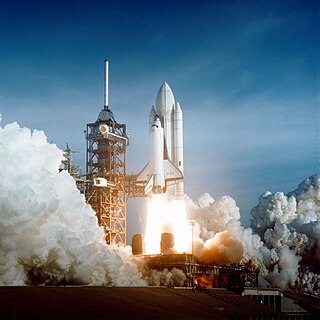
Spaceflight is an application of astronautics to fly objects, usually spacecraft, into or through outer space, either with or without humans on board. Most spaceflight is uncrewed and conducted mainly with spacecraft such as satellites in orbit around Earth, but also includes space probes for flights beyond Earth orbit. Such spaceflight operate either by telerobotic or autonomous control. The more complex human spaceflight has been pursued soon after the first orbital satellites and has reached the Moon and permanent human presence in space around Earth, particularly with the use of space stations. Human spaceflight programs include the Soyuz, Shenzhou, the past Apollo Moon landing and the Space Shuttle programs. Other current spaceflight are conducted to the International Space Station and to China's Tiangong Space Station.

Space weather is a branch of space physics and aeronomy, or heliophysics, concerned with the varying conditions within the Solar System and its heliosphere. This includes the effects of the solar wind, especially in the Earth's magnetosphere, ionosphere, thermosphere, and exosphere. Though physically distinct, space weather is analogous to the terrestrial weather of Earth's atmosphere. The term "space weather" was first used in the 1950s and popularized in the 1990s. Later, it prompted research into "space climate", the large-scale and long-term patterns of space weather.

Cascade, Smallsat and Ionospheric Polar Explorer (CASSIOPE), is a Canadian Space Agency (CSA) multi-mission satellite operated by the University of Calgary. The mission development and operations from launch to February 2018 was funded through CSA and the Technology Partnerships Canada program. In February, 2018 CASSIOPE became part of the European Space Agency's Swarm constellation through the Third Party Mission Program, known as Swarm Echo, or Swarm-E. It was launched September 29, 2013, on the first flight of the SpaceX Falcon 9 v1.1 launch vehicle. CASSIOPE is the first Canadian hybrid satellite to carry a dual mission in the fields of telecommunications and scientific research. The main objectives are to gather information to better understand the science of space weather, while verifying high-speed communications concepts through the use of advanced space technologies.

TOPEX/Poseidon was a joint satellite altimeter mission between NASA, the U.S. space agency; and CNES, the French space agency, to map ocean surface topography. Launched on August 10, 1992, it was the first major oceanographic research satellite. TOPEX/Poseidon helped revolutionize oceanography by providing data previously impossible to obtain. Oceanographer Walter Munk described TOPEX/Poseidon as "the most successful ocean experiment of all time." A malfunction ended normal satellite operations in January 2006.
Taiwan Space Agency, formerly the National Space Organization (NSPO), is the national civilian space agency of the Republic of China (Taiwan), under the auspices of the National Science and Technology Council. TASA is involved in the development of space technologies and related research.
Formosat-1 was an Earth observation satellite operated by the National Space Program Office of the Republic of China (Taiwan) to conduct observations of the ionosphere and oceans. The spacecraft and its instrumentation were developed jointly by NSPO and TRW using TRW's Lightsat bus, and was launched from Cape Canaveral Air Force Station, US, by Lockheed Martin on January 27, 1999. FormoSat-1 provided 5½ years of operational service. The spacecraft ended its mission on June 17, 2004 and was decommissioned on July 16, 2004.

FalconSAT is the United States Air Force Academy's (USAFA) small satellite engineering program. Satellites are designed, built, tested, and operated by Academy cadets. The project is administered by the USAFA Space Systems Research Center under the direction of the Department of Astronautics. Most of the cadets who work on the project are pursuing a bachelor of science degree in astronautical engineering, although students from other disciplines join the project.

Challenging Minisatellite Payload (CHAMP) was a German satellite launched July 15, 2000 from Plesetsk, Russia and was used for atmospheric and ionospheric research, as well as other geoscientific applications, such as GPS radio occultation, gravity field determination, and studying the Earth's magnetic field.
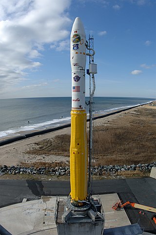
The Minotaur I, or just Minotaur is an American expendable launch system derived from the Minuteman II missile. It is used to launch small satellites for the US Government, and is a member of the Minotaur family of rockets produced by Orbital Sciences Corporation.
The Space Test Program (STP) is the primary provider of spaceflight for the United States Department of Defense (DoD) space science and technology community. STP is managed by a group within the Advanced Systems and Development Directorate, a directorate of the Space and Missile Systems Center of the United States Space Force. STP provides spaceflight via the International Space Station (ISS), piggybacks, secondary payloads and dedicated launch services.

Radio occultation (RO) is a remote sensing technique used for measuring the physical properties of a planetary atmosphere or ring system. Other satellite carriers onboard GNSS-Radio occultation include CHAMP (satellite), GRACE and GRACE-FO, MetOp and the recently launched COSMIC-2.
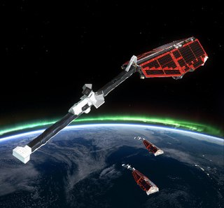
Swarm is a European Space Agency (ESA) mission to study the Earth's magnetic field. High-precision and high-resolution measurements of the strength, direction and variations of the Earth's magnetic field, complemented by precise navigation, accelerometer and electric field measurements, will provide data for modelling the geomagnetic field and its interaction with other physical aspects of the Earth system. The results offer a view of the inside of the Earth from space, enabling the composition and processes of the interior to be studied in detail and increase our knowledge of atmospheric processes and ocean circulation patterns that affect climate and weather.

Fast, Affordable, Science and Technology Satellite-Huntsville 01 or FASTSAT-Huntsville 01 of the NASA. FASTSAT-HSV 01 was flying on the STP-S26 mission - a joint activity between NASA and the U.S. Department of Defense Space Test Program, or DoD STP. FASTSAT and all of its six experiments flying on the STP-S26 multi-spacecraft/payload mission have been approved by the Department of Defense Space and Experiments Review Board (USA-220).
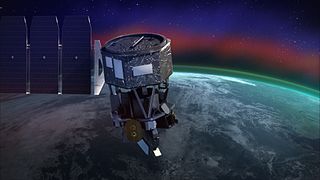
Ionospheric Connection Explorer (ICON) is a satellite designed to investigate changes in the ionosphere of Earth, the dynamic region high in our atmosphere where terrestrial weather from below meets space weather from above. ICON studies the interaction between Earth's weather systems and space weather driven by the Sun, and how this interaction drives turbulence in the upper atmosphere. It is hoped that a better understanding of this dynamic will mitigate its effects on communications, GPS signals, and technology in general. It is part of NASA's Explorer program and is operated by University of California, Berkeley's Space Sciences Laboratory.
USA-221, also known as FalconSat-5, is an American military minisatellite, which was launched in 2010. The fifth FalconSat spacecraft to be launched, it carries four technology development and ionospheric research experiments. The satellite was constructed and is operated by the United States Air Force Academy.

COSMIC-2 also known as FORMOSAT-7, is the constellation of satellites for meteorology, ionosphere, climatology, and space weather research. FORMOSAT-7 is a joint US-Taiwanese project including National Space Organization (NSPO) on the Taiwanese side and the National Oceanic and Atmospheric Administration (NOAA) and the United States Air Force (USAF) on the US side. FORMOSAT-7 is the successor of FORMOSAT-3 The six satellites of the constellation were launched 25 June 2019 on a Falcon Heavy rocket. They reached their designated mission orbits in February 2021, after eighteen months of gradual orbital adjustments. Full operational capability was achieved in October 2021.

Liu Chao-han is a radio engineer/scientist and an international leader in solar terrestrial physics and remote sensing research. He served as Vice President of the Academia Sinica from 2006 to 2011 after serving as President of National Central University for 12 years and as Chancellor of the University System of Taiwan for 4 years. He is a Fellow of the Institute of Electrical and Electronics Engineers, an Academician of the Academia Sinica and a member of the National Academy of Engineering.

Formosat-5 is the first Earth observation satellite manufactured and operated solely by the National Space Organization, the national civilian space agency of Taiwan. The satellite was launched from a Falcon 9 rocket on 24 August 2017, and placed into a Sun-synchronous orbit at an altitude of about 720 km. Formosat-5 can capture color and more detailed monochrome images, along with measuring the ionosphere plasma's properties.

