Rhossili

Last updated • 4 min readFrom Wikipedia, The Free Encyclopedia

Rhossili
Rhosilli village from the air.jpg
Swansea UK location map.svg
Red pog.svg
Rhossili
Location within Swansea
Population278 
Community
  • Rhossili
Principal area
Country Wales
Sovereign state United Kingdom
Post town Swansea
Postcode district SA3
Police South Wales
Fire Mid and West Wales
Ambulance Welsh
UK Parliament
Senedd Cymru – Welsh Parliament
List of places
UK
Wales
Swansea
51°34′07″N4°17′13″W / 51.56856°N 4.28690°W / 51.56856; -4.28690

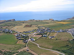
Rhossili (Welsh : Rhosili; Welsh pronunciation ) is both a small village and a community on the southwestern tip of the Gower Peninsula [1] in Wales. It is within the first Area of Outstanding Natural Beauty in the United Kingdom. The village has a community council and is part of the Gower parliamentary constituency, and the Gower electoral ward. At the 2011 census, the population was 278. The community includes the hamlet of Middleton.

Contents

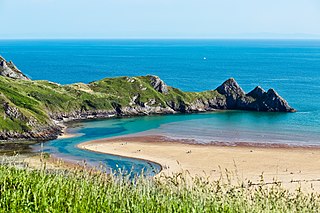
The name derives from the Welsh word rhos meaning a moor and the personal name Sulein, hence "Sulein's moorland promontory".[ clarification needed ] [2] Rhossili is a popular tourist destination: the views from the headland and the Down are panoramic; several pleasant walks begin, end, or pass through the village; Iron Age remains are found on Rhossili Down. The 2.8-mile (4.5 km) wide sandy beach is backed with sand dunes and attracts surfers at the Llangennith end as well as along the entire stretch of beach.

Church

The present Norman church is dedicated to St Mary the Virgin. Inside there is a memorial to Edgar Evans, who was the first to perish on the Terra Nova Expedition with Captain Scott on the return from the South Pole.

Rhossili Bay

Rhossili Bay curves along an arc running northwards from the village. The 2.8-mile (4.5 km) wide sandy beach is backed with sand dunes. Some locals refer to the beach as Llangennith Sands. Behind the beach just north of the village is Rhossili Down with the highest point on the Gower Peninsula, the Beacon (193 metres), and a number of prehistoric remains. It is between Rhossili Down and the beach that the Warren is found. In some of the fields on "The Vile" in Rhossili, the National Trust plant every year around 400,000 sunflowers. This is an extremely popular attraction for visitors to take selfies at during late July and early August, however there have been issues with some visitors picking the flowers. [3] [4]

At the southern end of the Bay is Worm's Head, consisting of two tidal islands: Outer Head184 feet (56 m) and Inner Head154 feet (47 m). At the north is Burry Holms. These islands are accessible only at low tide.

Rhossili Bay featured in the Opening Ceremony of the London 2012 Olympic Games, a youth choir began a cappella performances of "Bread of Heaven" live on the beach which was broadcast at the Olympic Stadium. [5] The bay has been used as the setting of New Earth in the sci-fi show Doctor Who and the bay including the Old Rectory was used in Torchwood: Miracle Day . In 2014, it was voted the UK's number one beach, third best in Europe, and 9th best in the world, by TripAdvisor users. [6] [7]

Fall Bay

Fall Bay is one of the most remote and hardest to reach beaches on Gower. The beach is never crowded due to its remoteness. There is no beach visible at high tide. The beach is very popular with surfers. At very low tide, it is possible to walk over from the beach to Mewslade Bay. The beach is reachable via a path which passes Rhossili village hall. It continues over fields and many stiles and has a steep final descent. The cliff path leads east to Mewslade Bay [8] or westwards towards the Worm's Head and Rhossili Bay.[ citation needed ]

Notable residents

National Trust

The National Trust owns and protects much land on the Gower Peninsula. The Trust operates a visitor centre in Rhossili near the Warren, Rhossili Down, Worm's Head, Rhossili beach and coastal cliffs. Scenes from Torchwood: Miracle Day were filmed at the National Trust's Old Rectory cottage in Rhossili Bay. [11] [12]

Skinny dipping

On 19 June 2011, almost four hundred people attempted to break the world record for the largest number of people skinny dipping at one time in the sea at Rhossili. [13]

Further reading

See also

Related Research Articles

<span class="mw-page-title-main">Swansea</span> City and county in Wales

Swansea is a coastal city and the second-largest city of Wales. It forms a principal area, officially known as the City and County of Swansea.

<span class="mw-page-title-main">Glamorgan</span> Historic county of Wales

Until 1974, Glamorgan, or sometimes Glamorganshire, was an administrative county in the south of Wales, and later classed as one of the thirteen historic counties of Wales. Originally an early medieval petty kingdom of varying boundaries known in Welsh as Morgannwg, which was then invaded and taken over by the Normans as the Lordship of Glamorgan. The area that became known as Glamorgan was both a rural, pastoral area, and a conflict point between the Norman lords and the Welsh princes. It was defined by a large concentration of castles.

<span class="mw-page-title-main">Gower Peninsula</span> Peninsula in Wales

Gower or the Gower Peninsula is in South West Wales and is the most westerly part of the historic county of Glamorgan, Wales. It projects towards the Bristol Channel. In 1956, the majority of Gower became the first area in the United Kingdom to be designated an Area of Outstanding Natural Beauty.

<span class="mw-page-title-main">Gower (electoral ward)</span> Human settlement in Wales

Gower electoral ward is an electoral ward in Britain. It is a ward of the City and County of Swansea, and comprises the western part of the Gower Peninsula. It lies within the UK Parliamentary constituency of Gower.

<span class="mw-page-title-main">Bristol Channel</span> Large inlet to the river Severn in southwest Great Britain

The Bristol Channel is a major inlet in the island of Great Britain, separating South Wales and South West England. It extends from the smaller Severn Estuary of the River Severn to the North Atlantic Ocean. It takes its name from the English city and port of Bristol.

<span class="mw-page-title-main">Burry Holms</span> Small tidal island at the northern end of the Gower Peninsula, Wales

Burry Holms, a tidal island with the height of is at the northern end of Rhossili Bay in the Gower Peninsula, Wales. During spring and summer, Burry Holms is covered by flowers such as thrift and sea campion.

Llangennith is a village in the City and County of Swansea, South Wales. It is located in the Gower. Moor Lane leads westwards to a caravan park near Rhossili Bay and Burrows Lane leads northwards to a caravan park overlooking Broughton Bay. The village has a scattering of houses, centred on St Cenydd's church, and the King's Head pub.

<span class="mw-page-title-main">Bishopston, Swansea</span> Human settlement in Wales

Bishopston is a large village and community situated on the Gower Peninsula, 6 miles (9.7 km) west south west of the centre of Swansea in South Wales.

<span class="mw-page-title-main">Port Eynon</span> Human settlement in Wales

Port Eynon is a village and community within the City and County of Swansea, Wales, on the far south tip of the Gower Peninsula within the designated Area of Outstanding Natural Beauty. The A4118 from Swansea city centre terminates here.

<span class="mw-page-title-main">Cenydd</span> 6th-century Welsh saint

Saint Cenydd, sometimes anglicised as Saint Kenneth, was a Christian hermit on the Gower Peninsula in Wales, where he is credited with the foundation of the church at Llangennith.

<span class="mw-page-title-main">Gower Explorer</span> Bus service in Wales, United Kingdom

The Gower Explorer is a bus service, previously operated by Veolia Transport Cymru and now First Cymru, which provides services to Gowerton, Horton, Llangennith, Llanmadoc, Llanrhidian, Oxwich, Penclawdd, Port Eynon, Reynoldston and Rhossili.

<span class="mw-page-title-main">Mewslade Bay</span>

Mewslade Bay is a small sandy beach facing SSW in the west of the Gower Peninsula, Wales. It lies south of Middleton and southwest of Pitton, from which footpaths lead to the beach.

<span class="mw-page-title-main">Blue Pool Bay</span> Cove on the coast of Wales

Blue Pool Bay is a small cove near the village of Llangennith in Gower, Wales. The cove is bordered by cliffs, and is accessible via a clifftop path and a steep, unstable path down to the beach. The beach is covered fully at high tide and takes its name from a large, natural rockpool. Rhossili Bay is nearby.

<span class="mw-page-title-main">Worm's Head</span> Headland in Rhossili, Wales

Worm's Head is a headland, at Rhossili, part of the City and County of Swansea, Wales. It is the furthest westerly point of the Gower Peninsula. The name Worm's Head is derived from an Old English word 'wyrm' for 'sea serpent'. The headland of carboniferous limestone comprises three islands: the Inner Head, the Middle Head which features a collapsed sea cave which is known as the Devil's Bridge, and the Outer Head. In total, it is approximately one mile long. The Inner Head is up to 200 yards wide. Worm's Head is only accessible on foot for 2+12 hours either side of low tide, fatal to attempt to wade or swim to when the causeway from the mainland is flooded.

<span class="mw-page-title-main">Cuisine of Gower</span> Welsh regional cuisine

The cuisine of Gower, a peninsula in south Wales, is based on ingredients grown, raised or collected on or around the peninsula. The cuisine is based on fresh ingredients with recipes based around a fish or meat dish. Until the twentieth century, the peninsula was virtually cut off from other markets due to poor roads, and no rail connection. The result was that Gower became self-sufficient in food.

<span class="mw-page-title-main">Gower and Swansea Bay Coast Path</span> A section of the Wales Coast Path

The Gower and Swansea Bay Coast Path (Welsh: Llwybr arfordir Penrhyn Gŵyr a Bae Abertawe is part of the Wales Coast Path, an 1,400-kilometre long-distance walking route around the whole coast of Wales that opened in 2012. The Gower and Swansea Bay stretch is 156 kilometres in length, running along the coast of the Gower Peninsula from Loughor, Swansea to Kenfig Dunes near Port Talbot, South Wales. The number of people using the Wales Coast Path in the Swansea local authority area was 349,333.

The geology of the Gower Peninsula in South Wales is central to the area's character and to its appeal to visitors. The peninsula is formed almost entirely from a faulted and folded sequence of Carboniferous rocks though both the earlier Old Red Sandstone and later New Red Sandstone are also present. Gower lay on the southern margin of the last ice sheet and has been a focus of interest for researchers and students in that respect too. Cave development and the use of some for early human occupation is a further significant aspect of the peninsula's scientific and cultural interest.
<span class="mw-page-title-main">Coastline of Wales</span> Sea-bounded areas of Wales

The coastline of Wales extends from the English border at Chepstow westwards to Pembrokeshire then north to Anglesey and back eastwards to the English border once again near Flint. Its character is determined by multiple factors, including the local geology and geological processes active during and subsequent to the last ice age, its relative exposure to or shelter from waves, tidal variation and the history of human settlement and development which varies considerably from one place to another. The majority of the coast east of Cardiff in the south, and of Llandudno in the north, is flat whilst that to the west is more typically backed by cliffs. The cliffs are a mix of sandstones, shales and limestones, the erosion of which provides material for beach deposits. Of the twenty-two principal areas which deliver local government in Wales, sixteen have a coastline, though that of Powys consists only of a short section of tidal river some distance from the open sea. Its length has been estimated at 1,680 miles (2,700 km).
References

  1. A Guide to Gower, published by the Gower Society, ISBN   0-902767-23-2
  2. Owen, Hywel Wyn; Morgan, Richard (2007). Dictionary of the Place-names of Wales (First ed.). Llandysul, Ceredigion: Gomer. p. 415. ISBN   9781843239017.
  3. Williams, Nino (29 July 2019). "The sunflowers are back at Rhossili and they are looking stunning". walesonline. Retrieved 26 August 2019.
  4. "Call for people to stop picking beauty spot flowers". 4 August 2019. Retrieved 26 August 2019.
  5. "London 2012 Olympic Opening Ceremony live". National Post. 27 July 2012. Archived from the original on 9 December 2012. Retrieved 24 June 2020.
  6. "Wales beats Hawaii and Caribbean in beach poll". Travelmole.com. 18 March 2014. Retrieved 19 June 2013.
  7. "BBC News - Rhossili Bay, Gower, third best in Europe says TripAdvisor survey". Bbc.co.uk. 18 March 2014. Retrieved 18 March 2014.
  8. "Rhossili to Mewslade Bay". Wales Coast Path. Retrieved 28 August 2016.
  9. Evans Collection
  10. Rhossili Parish Church and the old Church in the Warren by Robert Lucas, published by Rhossili Parochial Church Council, 2000.
  11. Wright, Ben. "Swansea-born Torchwood writer 'can't wait' to show off hometown in new BBC series". This Is South Wales. Retrieved 26 January 2011.
  12. Foster, Chuck. "Torchwood: Week Three Filming". The Doctor Who News Page. Retrieved 31 January 2011.
  13. "Rhossili midsummer skinny dip organisers claim record". BBC News. 19 June 2011.

Commons-logo.svg Media related to Rhossili at Wikimedia Commons